
Seller's Agent in 2025
Chad Grabham
RETHINK Real Estate
(602) 491-1525
1 in this area
61 Total Sales
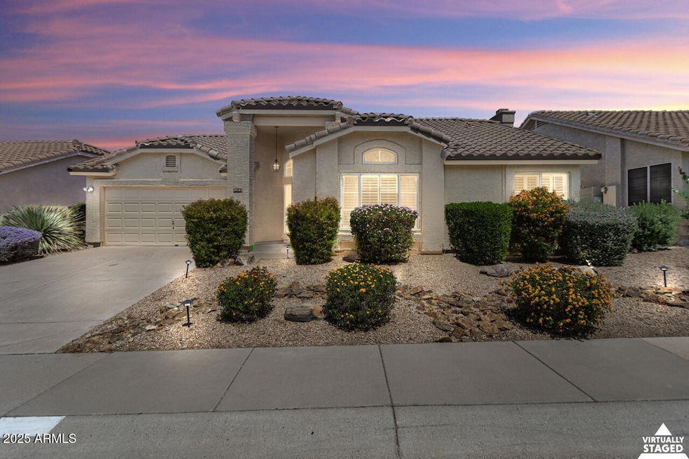
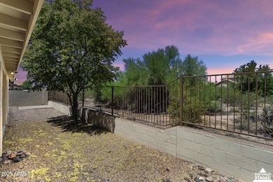
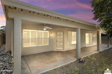
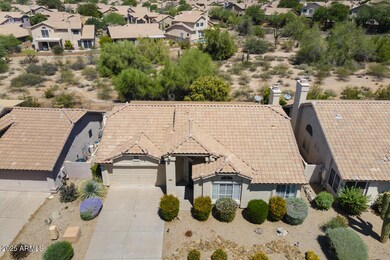
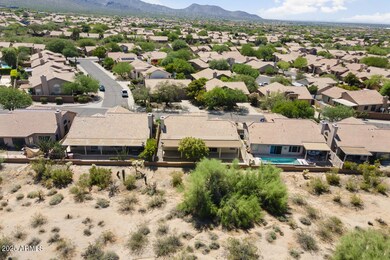
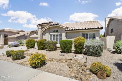
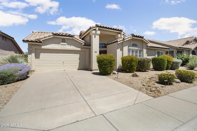
***PRICED 40K BELOW APPRAISAL and COMPS*** Welcome home to this beautiful 3 bed 2 bath gem located in the highly desirable neighborhood of Ironwood Village, nestled in the foothills of the McDowell Mountains! This well-maintained home; in 2017 the roof underlayment was replaced, and in 2020 the A/C was replaced. Ideal split floor plan with the spacious primary bedroom located on its own side for privacy. Enjoy the low maintenance backyard with an extended length covered patio that opens to a desert area. Prime location minutes from the 101 Freeway, Scottsdale Health Care, Mayo Clinic, hiking at Gateway Trailhead, Ironwood Park and Market Street. Live the lifestyle you deserve here in this quiet neighborhood close to everything that North Scottsdale has to offer.
Last Agent to Sell the Property
RETHINK Real Estate License #BR544160000 Listed on: 06/20/2025
| Date | Type | Sale Price | Title Company |
|---|---|---|---|
| Warranty Deed | $625,000 | Wfg National Title Insurance C | |
| Interfamily Deed Transfer | -- | Chicago Title Agency Inc | |
| Interfamily Deed Transfer | -- | None Available | |
| Warranty Deed | $157,000 | Old Republic Title Agency |
| Date | Status | Loan Amount | Loan Type |
|---|---|---|---|
| Previous Owner | $532,500 | Reverse Mortgage Home Equity Conversion Mortgage | |
| Previous Owner | $80,000 | New Conventional |
| Date | Event | Price | List to Sale | Price per Sq Ft |
|---|---|---|---|---|
| 08/22/2025 08/22/25 | Sold | $625,000 | -5.3% | $399 / Sq Ft |
| 08/06/2025 08/06/25 | Pending | -- | -- | -- |
| 07/10/2025 07/10/25 | Price Changed | $659,900 | -2.2% | $421 / Sq Ft |
| 06/20/2025 06/20/25 | For Sale | $675,000 | -- | $430 / Sq Ft |
| Year | Tax Paid | Tax Assessment Tax Assessment Total Assessment is a certain percentage of the fair market value that is determined by local assessors to be the total taxable value of land and additions on the property. | Land | Improvement |
|---|---|---|---|---|
| 2025 | $2,049 | $34,463 | -- | -- |
| 2024 | $1,923 | $32,822 | -- | -- |
| 2023 | $1,923 | $47,520 | $9,500 | $38,020 |
| 2022 | $1,831 | $35,460 | $7,090 | $28,370 |
| 2021 | $1,986 | $32,120 | $6,420 | $25,700 |
| 2020 | $1,968 | $30,130 | $6,020 | $24,110 |
| 2019 | $1,908 | $28,550 | $5,710 | $22,840 |
| 2018 | $1,865 | $28,120 | $5,620 | $22,500 |
| 2017 | $1,759 | $28,070 | $5,610 | $22,460 |
| 2016 | $1,713 | $27,910 | $5,580 | $22,330 |
| 2015 | $1,657 | $24,130 | $4,820 | $19,310 |
Seller's Agent in 2025
Chad Grabham
RETHINK Real Estate
(602) 491-1525
1 in this area
61 Total Sales
Seller Co-Listing Agent in 2025
Patti Goldman
RETHINK Real Estate
(480) 220-4148
1 in this area
12 Total Sales
Source: Arizona Regional Multiple Listing Service (ARMLS)
MLS Number: 6882909
APN: 217-12-470
Disclaimer: Certain information contained herein is derived from information provided by parties other than Homes.com. All information provided is deemed reliable, but is not guaranteed to be accurate and should be independently verified.
![]() All information should be verified by the recipient and none is guaranteed as accurate by ARMLS
All information should be verified by the recipient and none is guaranteed as accurate by ARMLS
Listing Information presented by local MLS brokerage: Ten-X, local REALTOR®- Arlene Richardson - (888)-952-6393