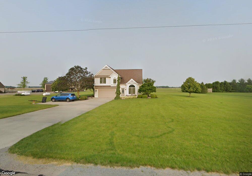
19102 Road 23q Delphos, OH 45833
Estimated Value: $198,000 - $455,000
4
Beds
3
Baths
2,587
Sq Ft
$122/Sq Ft
Est. Value
About This Home
This home is located at 19102 Road 23q, Delphos, OH 45833 and is currently estimated at $315,878, approximately $122 per square foot. 19102 Road 23q is a home located in Putnam County with nearby schools including Fort Jennings Elementary School, Fort Jennings High School, and Delphos St. John's High School.
Ownership History
Date
Name
Owned For
Owner Type
Purchase Details
Closed on
May 18, 2009
Sold by
Kleman Jeffrey James
Bought by
Kleman Jeffrey James and Kleman Vickie S
Current Estimated Value
Home Financials for this Owner
Home Financials are based on the most recent Mortgage that was taken out on this home.
Original Mortgage
$100,800
Interest Rate
4.9%
Mortgage Type
New Conventional
Create a Home Valuation Report for This Property
The Home Valuation Report is an in-depth analysis detailing your home's value as well as a comparison with similar homes in the area
Home Values in the Area
Average Home Value in this Area
Purchase History
| Date | Buyer | Sale Price | Title Company |
|---|---|---|---|
| Kleman Jeffrey James | -- | None Available |
Source: Public Records
Mortgage History
| Date | Status | Borrower | Loan Amount |
|---|---|---|---|
| Closed | Kleman Jeffrey James | $100,800 |
Source: Public Records
Tax History Compared to Growth
Tax History
| Year | Tax Paid | Tax Assessment Tax Assessment Total Assessment is a certain percentage of the fair market value that is determined by local assessors to be the total taxable value of land and additions on the property. | Land | Improvement |
|---|---|---|---|---|
| 2024 | $2,700 | $91,060 | $5,830 | $85,230 |
| 2023 | $2,771 | $72,850 | $4,490 | $68,360 |
| 2022 | $2,459 | $72,850 | $4,491 | $68,359 |
| 2021 | $2,467 | $72,770 | $4,490 | $68,280 |
| 2020 | $2,468 | $54,070 | $3,780 | $50,290 |
| 2019 | $2,142 | $62,790 | $4,490 | $58,300 |
| 2018 | $2,062 | $62,790 | $4,490 | $58,300 |
| 2017 | $1,788 | $62,790 | $4,490 | $58,300 |
| 2016 | $1,788 | $54,070 | $3,780 | $50,290 |
| 2015 | $1,963 | $54,070 | $3,780 | $50,290 |
| 2014 | $1,984 | $54,070 | $3,780 | $50,290 |
| 2013 | $2,024 | $54,070 | $3,780 | $50,290 |
Source: Public Records
Map
Nearby Homes
- 7510 State Route 66
- 0 Road 24-Q
- 0 Heritage Cir Unit 6112034
- 0 Heritage Cir Unit 303239
- 320 Auglaize St
- 8951 Brickner Rd
- 1220 Rose Anna Dr
- 1303 Carolyn Dr
- 17736 Road 20p
- 810 N Franklin St
- 704 N Franklin St
- 628 N Pierce St
- 650 E 6th St
- 610 N Washington St
- 604 W 6th St
- 503 W 6th St
- 405 N Franklin St
- 616 W 5th St
- 903 E 3rd St
- 821 E 3rd St
- 19134 Road 23q
- 19125 Road 23q
- 19054 Road 23q
- 19049 Road 23q
- 19030 Road 23q
- 19190 Road 23q
- 19190 Road 23-Q
- 19019 Road 23-Q
- 19019 Road 23q
- 19235 Road 23q
- 19255 Road 23q
- 19281 Road 23q
- 18881 Road 23q
- 19346 Road 23q
- 18812 Road 23q
- 18714 Road 23q
- 18660 Road 23q
- 18622 Road 23q
- 18622 Road 23-Q
- 19409 Road 23q