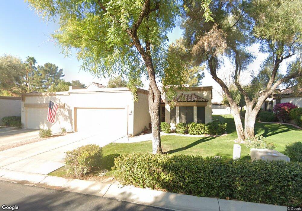
19104 N 91st Ln Unit 98 Peoria, AZ 85382
Estimated Value: $347,877 - $386,000
2
Beds
2
Baths
1,457
Sq Ft
$250/Sq Ft
Est. Value
About This Home
This home is located at 19104 N 91st Ln Unit 98, Peoria, AZ 85382 and is currently estimated at $363,719, approximately $249 per square foot. 19104 N 91st Ln Unit 98 is a home located in Maricopa County with nearby schools including Apache Elementary School, Sunrise Mountain High School, and Sonoran Science Academy-Peoria.
Ownership History
Date
Name
Owned For
Owner Type
Purchase Details
Closed on
Dec 28, 2016
Sold by
Capano Frank and Capano Frank
Bought by
Capano Frank X and Capano Billie
Current Estimated Value
Purchase Details
Closed on
Jan 30, 2009
Sold by
Dodd Danna C
Bought by
Capano Frank and Capano Frank
Purchase Details
Closed on
Jun 11, 2002
Sold by
Geoffroy Thomas P
Bought by
Dodd Danna C and The Danna C Dodd Trust
Purchase Details
Closed on
Aug 21, 1995
Sold by
Vansant Rosemarie
Bought by
Geoffroy Thomas P
Create a Home Valuation Report for This Property
The Home Valuation Report is an in-depth analysis detailing your home's value as well as a comparison with similar homes in the area
Home Values in the Area
Average Home Value in this Area
Purchase History
| Date | Buyer | Sale Price | Title Company |
|---|---|---|---|
| Capano Frank X | -- | None Available | |
| Capano Frank | $152,000 | Great American Title Agency | |
| Dodd Danna C | $124,900 | Capital Title Agency Inc | |
| Geoffroy Thomas P | $105,000 | Nations Title Insurance |
Source: Public Records
Tax History Compared to Growth
Tax History
| Year | Tax Paid | Tax Assessment Tax Assessment Total Assessment is a certain percentage of the fair market value that is determined by local assessors to be the total taxable value of land and additions on the property. | Land | Improvement |
|---|---|---|---|---|
| 2025 | $1,792 | $19,724 | -- | -- |
| 2024 | $1,808 | $18,785 | -- | -- |
| 2023 | $1,808 | $25,870 | $5,170 | $20,700 |
| 2022 | $1,773 | $20,800 | $4,160 | $16,640 |
| 2021 | $1,856 | $20,620 | $4,120 | $16,500 |
| 2020 | $1,868 | $18,850 | $3,770 | $15,080 |
| 2019 | $1,812 | $15,780 | $3,150 | $12,630 |
| 2018 | $1,758 | $15,360 | $3,070 | $12,290 |
| 2017 | $1,753 | $13,350 | $2,670 | $10,680 |
| 2016 | $1,767 | $14,300 | $2,860 | $11,440 |
| 2015 | $1,644 | $14,220 | $2,840 | $11,380 |
Source: Public Records
Map
Nearby Homes
- 9120 W Wescott Dr
- 9238 W Taro Ln
- 9115 W Kimberly Way
- 9130 W Utopia Rd
- 9039 W Wescott Dr
- 9152 W Oraibi Dr
- 9031 W Taro Ln
- 9270 W Morrow Dr
- 18650 N 91st Ave Unit 4001
- 18650 N 91st Ave Unit 1401
- 18650 N 91st Ave Unit 1501
- 18725 N 92nd Dr Unit 104
- 9322 W Topeka Dr Unit 71
- 19249 N 93rd Dr Unit 52
- 8958 W Rosemonte Dr
- 9273 W Jason Dr Unit 73
- 18778 N 94th Ave
- 8942 W Sequoia Dr
- 19420 N Westbrook Pkwy Unit 502
- 19400 N Westbrook Pkwy Unit 241
- 19102 N 91st Ln Unit 99
- 19106 N 91st Ln Unit 97
- 19018 N 91st Ln Unit 100
- 19108 N 91st Ln
- 19016 N 91st Ln Unit 101
- 9124 W Taro Ln
- 19110 N 91st Ln
- 9125 W Taro Ln Unit 71
- 9122 W Taro Ln Unit 73
- 19012 N 91st Ln
- 19145 N 92nd Ave
- 9123 W Taro Ln Unit 70
- 19201 N 92nd Ave
- 9123 W Topeka Dr Unit 84
- 19135 N 92nd Ave
- 9120 W Taro Ln
- 19010 N 91st Ln Unit 103
- 9121 W Taro Ln
- 9118 W Taro Ln Unit 75
- 19211 N 92nd Ave