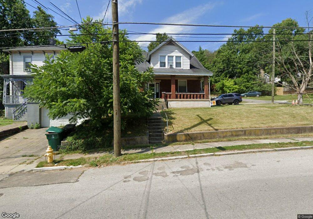
1911 Baltimore Ave Cincinnati, OH 45225
North Fairmount NeighborhoodEstimated Value: $66,000 - $173,000
4
Beds
2
Baths
2,150
Sq Ft
$50/Sq Ft
Est. Value
About This Home
This home is located at 1911 Baltimore Ave, Cincinnati, OH 45225 and is currently estimated at $106,778, approximately $49 per square foot. 1911 Baltimore Ave is a home located in Hamilton County with nearby schools including Ethel M. Taylor Academy, Robert A. Taft Information Technology High School, and Western Hills High School.
Ownership History
Date
Name
Owned For
Owner Type
Purchase Details
Closed on
Aug 5, 2013
Sold by
A D P Of Greater Cincinnati Llc
Bought by
Echidna Holdings Llc
Current Estimated Value
Purchase Details
Closed on
Sep 28, 2011
Sold by
Fels George W
Bought by
Adp Of Greater Cincinnati Llc
Purchase Details
Closed on
Dec 26, 2007
Sold by
Wells Fargo Bank Na
Bought by
Ndb Development Llc
Purchase Details
Closed on
Sep 13, 2007
Sold by
Barnes Maceo and Barnes Margie
Bought by
Wells Fargo Bank Na
Create a Home Valuation Report for This Property
The Home Valuation Report is an in-depth analysis detailing your home's value as well as a comparison with similar homes in the area
Home Values in the Area
Average Home Value in this Area
Purchase History
| Date | Buyer | Sale Price | Title Company |
|---|---|---|---|
| Echidna Holdings Llc | $1,000 | Attorney | |
| Adp Of Greater Cincinnati Llc | $15,000 | Attorney | |
| Ndb Development Llc | -- | Sovereign Title Agency Llc | |
| Wells Fargo Bank Na | $44,000 | None Available |
Source: Public Records
Tax History
| Year | Tax Paid | Tax Assessment Tax Assessment Total Assessment is a certain percentage of the fair market value that is determined by local assessors to be the total taxable value of land and additions on the property. | Land | Improvement |
|---|---|---|---|---|
| 2025 | $1,200 | $17,819 | $2,601 | $15,218 |
| 2023 | $1,200 | $17,819 | $2,601 | $15,218 |
| 2022 | $934 | $12,254 | $2,594 | $9,660 |
| 2021 | $897 | $12,254 | $2,594 | $9,660 |
| 2020 | $899 | $12,254 | $2,594 | $9,660 |
| 2019 | $897 | $11,141 | $2,359 | $8,782 |
| 2018 | $898 | $11,141 | $2,359 | $8,782 |
| 2017 | $862 | $11,141 | $2,359 | $8,782 |
| 2016 | $439 | $5,250 | $2,919 | $2,331 |
| 2015 | $397 | $5,250 | $2,919 | $2,331 |
| 2014 | $399 | $5,250 | $2,919 | $2,331 |
| 2013 | $403 | $5,250 | $2,919 | $2,331 |
Source: Public Records
Map
Nearby Homes
- 1965 Baltimore Ave
- 1859 Baltimore Ave
- 1808 Carll St
- 1797 Denham St
- 1793 Baltimore Ave
- 1781 Baltimore Ave
- 2594 Seegar Ave
- 2043 E Teralta Cir
- 1955 Fairmount Ave
- 2060 Bickel Ave
- 2568 Trevor Place
- 2114 Saint Leo Place
- 2085 N Teralta Cir
- 1854 Knox St
- 1642 Sutter Ave
- 1646 Pulte St
- 1674 Baltimore Ave
- 2109 Harrison Ave
- 2911 Moosewood Ct
- 1879 Biegler St
- 1909 Baltimore Ave
- 1917 Baltimore Ave
- 1905 Baltimore Ave
- 2590 Brestel Rd
- 1903 Baltimore Ave
- 1921 Baltimore Ave
- 1895 Baltimore Ave
- 1919 Arthur Place
- 1925 Baltimore Ave
- 1918 Baltimore Ave
- 1924 Arthur Place
- 1891 Baltimore Ave
- 1920 Baltimore Ave
- 1914 Baltimore Ave
- 1912 Baltimore Ave
- 1932 Arthur Place
- 1910 Baltimore Ave
- 1906 Arthur Place
- 1929 Arthur Place
- 1889 Baltimore Ave
Your Personal Tour Guide
Ask me questions while you tour the home.