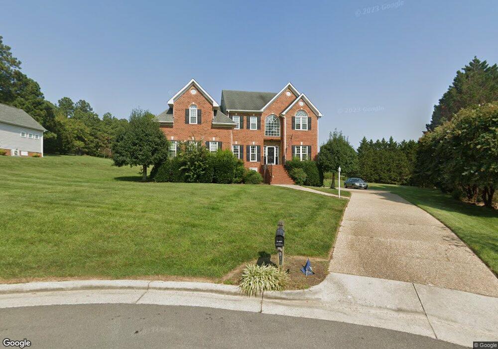
1911 Corner Rock Rd Midlothian, VA 23113
Roxshire NeighborhoodEstimated Value: $533,000 - $863,307
6
Beds
4
Baths
4,813
Sq Ft
$153/Sq Ft
Est. Value
About This Home
This home is located at 1911 Corner Rock Rd, Midlothian, VA 23113 and is currently estimated at $734,827, approximately $152 per square foot. 1911 Corner Rock Rd is a home located in Chesterfield County with nearby schools including Robious Elementary School, Robious Middle School, and James River High School.
Ownership History
Date
Name
Owned For
Owner Type
Purchase Details
Closed on
Aug 4, 2025
Sold by
Monts Stanley
Bought by
Monts Jason A
Current Estimated Value
Home Financials for this Owner
Home Financials are based on the most recent Mortgage that was taken out on this home.
Original Mortgage
$573,315
Outstanding Balance
$572,814
Interest Rate
6.67%
Mortgage Type
VA
Estimated Equity
$162,013
Purchase Details
Closed on
Sep 1, 2022
Sold by
Monts Stanley
Bought by
Monts Stanley and Stanley Monts Trust
Purchase Details
Closed on
Jul 18, 1997
Sold by
Mclellan Construction Company
Bought by
Monts Stanley and Monts Cheryl M
Home Financials for this Owner
Home Financials are based on the most recent Mortgage that was taken out on this home.
Original Mortgage
$250,000
Interest Rate
7.79%
Mortgage Type
New Conventional
Purchase Details
Closed on
Feb 24, 1997
Sold by
Albermarle Land Corporation
Bought by
Mclellan Construction Co Inc
Home Financials for this Owner
Home Financials are based on the most recent Mortgage that was taken out on this home.
Original Mortgage
$253,250
Interest Rate
7.8%
Mortgage Type
New Conventional
Create a Home Valuation Report for This Property
The Home Valuation Report is an in-depth analysis detailing your home's value as well as a comparison with similar homes in the area
Home Values in the Area
Average Home Value in this Area
Purchase History
| Date | Buyer | Sale Price | Title Company |
|---|---|---|---|
| Monts Jason A | $535,000 | First American Title Insurance | |
| Monts Jason A | $535,000 | First American Title Insurance | |
| Monts Stanley | -- | None Listed On Document | |
| Monts Stanley | $354,500 | -- | |
| Mclellan Construction Co Inc | $55,000 | -- |
Source: Public Records
Mortgage History
| Date | Status | Borrower | Loan Amount |
|---|---|---|---|
| Open | Monts Jason A | $573,315 | |
| Closed | Monts Jason A | $573,315 | |
| Previous Owner | Mclellan Construction Co Inc | $250,000 | |
| Previous Owner | Mclellan Construction Co Inc | $253,250 |
Source: Public Records
Tax History Compared to Growth
Tax History
| Year | Tax Paid | Tax Assessment Tax Assessment Total Assessment is a certain percentage of the fair market value that is determined by local assessors to be the total taxable value of land and additions on the property. | Land | Improvement |
|---|---|---|---|---|
| 2025 | $7,569 | $847,600 | $145,000 | $702,600 |
| 2024 | $7,569 | $799,800 | $135,000 | $664,800 |
| 2023 | $6,171 | $678,100 | $125,000 | $553,100 |
| 2022 | $5,779 | $628,100 | $115,000 | $513,100 |
| 2021 | $5,446 | $566,300 | $104,000 | $462,300 |
| 2020 | $5,157 | $542,800 | $104,000 | $438,800 |
| 2019 | $5,128 | $539,800 | $101,000 | $438,800 |
| 2018 | $4,928 | $518,700 | $99,000 | $419,700 |
| 2017 | $4,960 | $516,700 | $97,000 | $419,700 |
| 2016 | $4,935 | $514,100 | $97,000 | $417,100 |
| 2015 | $4,884 | $506,100 | $89,000 | $417,100 |
| 2014 | $4,704 | $487,400 | $82,000 | $405,400 |
Source: Public Records
Map
Nearby Homes
- 11911 Kilrenny Rd
- 11814 N Briar Patch Dr
- 11815 N Briar Patch Dr
- 1101 Southwick Blvd
- 12801 Foxstone Rd
- 1331 Warminster Dr
- 1516 Sandgate Rd
- 2735 Swanhurst Dr
- 1709 Headwaters Rd
- 1100 Oldbury Rd
- 2303 Bream Dr
- 13706 Danbury Dr
- 3010 Middlewood Rd
- 2831 Earlswood Rd
- 2310 Oakengate Ln
- 2725 Stonegate Ct
- 627 Hazeltine Ct
- 12513 Carnoustie Ln Unit B
- 13289 Coalfield Station Ln
- 1480 Railroad Ave
- 1921 Corner Rock Rd
- 1901 Corner Rock Rd
- 1941 Corner Rock Rd
- 1910 Corner Rock Rd
- 1900 Corner Rock Rd
- 1920 Corner Rock Rd
- 2007 Corner Rock Rd
- 1830 Corner Rock Rd
- 1930 Corner Rock Rd
- 2011 Corner Rock Rd
- 1940 Corner Rock Rd
- 2100 Planters Row Dr
- 2000 Corner Rock Rd
- 2105 Planters Row Dr
- 1921 Normandstone Dr
- 1931 Normandstone Dr
- 1911 Normandstone Dr
- 1941 Normandstone Dr
- 2101 Planters Row Dr
- 2010 Corner Rock Rd