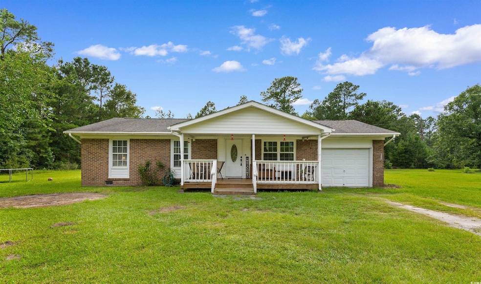
1911 Dirty Branch Rd Conway, SC 29527
Estimated payment $1,260/month
Highlights
- RV Access or Parking
- Laundry Room
- Bathroom on Main Level
- Ranch Style House
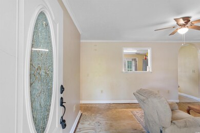
- Entrance Foyer
- Four Sided Brick Exterior Elevation
About This Home
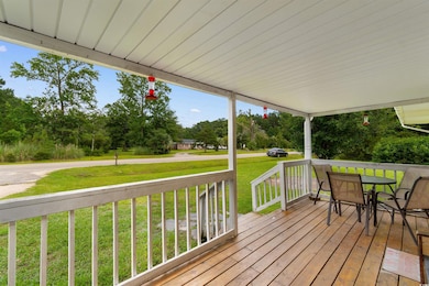
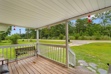
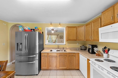
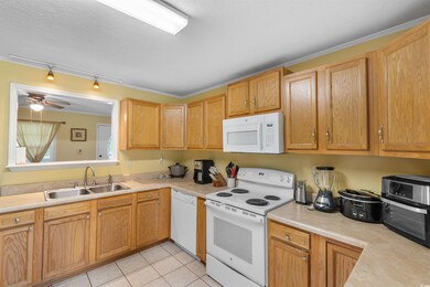
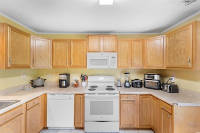
Welcome to your next home in the heart of Conway, SC! This delightful 3 bedroom, 2 bath residence sits on just under 1 ACRE of land, offering plenty of space to create your perfect outdoor retreat. Whether you're dreaming of a garden, workshop, pool, or simply wide-open space, this property delivers the flexibility to make it your own—with no HOA restrictions. Inside, you’ll find a thoughtfully designed floor plan featuring a spacious open kitchen with eat-in dining area, perfect for everyday meals or entertaining guests. The master suite includes its own private en suite bathroom, offering comfort and convenience. With two additional bedrooms and a full second bath, there’s room for family, guests, or a home office. Located just minutes from historic downtown Conway, you'll enjoy the charm of this picturesque town known for its quaint shops, delicious restaurants, and local entertainment. Plus, you're just a short drive to Myrtle Beach and all the Grand Strand has to offer. Don’t miss the opportunity to own a home with land, privacy, and potential—schedule your showing today!
Home Details
Home Type
- Single Family
Est. Annual Taxes
- $1,697
Year Built
- Built in 1969
Lot Details
- 0.96 Acre Lot
- Rectangular Lot
Parking
- 1 Car Attached Garage
- RV Access or Parking
Home Design
- Ranch Style House
- Four Sided Brick Exterior Elevation
- Lead Paint Disclosure
Interior Spaces
- 1,000 Sq Ft Home
- Ceiling Fan
- Entrance Foyer
- Combination Kitchen and Dining Room
Kitchen
- Range
- Microwave
- Dishwasher
Bedrooms and Bathrooms
- 3 Bedrooms
- Bathroom on Main Level
- 2 Full Bathrooms
Laundry
- Laundry Room
- Washer and Dryer
Location
- Outside City Limits
Schools
- Pee Dee Elementary School
- Whittemore Park Middle School
- Conway High School
Utilities
- Underground Utilities
- Water Heater
- Phone Available
- Cable TV Available
Map
Home Values in the Area
Average Home Value in this Area
Tax History
| Year | Tax Paid | Tax Assessment Tax Assessment Total Assessment is a certain percentage of the fair market value that is determined by local assessors to be the total taxable value of land and additions on the property. | Land | Improvement |
|---|---|---|---|---|
| 2024 | $1,697 | $5,801 | $3,485 | $2,316 |
| 2023 | $1,697 | $4,968 | $1,350 | $3,618 |
| 2021 | $1,147 | $4,968 | $1,350 | $3,618 |
| 2020 | $1,064 | $4,968 | $1,350 | $3,618 |
| 2019 | $332 | $3,312 | $900 | $2,412 |
| 2018 | $304 | $2,904 | $740 | $2,164 |
| 2017 | $289 | $2,904 | $740 | $2,164 |
| 2016 | -- | $2,904 | $740 | $2,164 |
| 2015 | $289 | $2,904 | $740 | $2,164 |
| 2014 | $268 | $2,904 | $740 | $2,164 |
Property History
| Date | Event | Price | List to Sale | Price per Sq Ft |
|---|---|---|---|---|
| 07/11/2025 07/11/25 | For Sale | $212,500 | -- | $213 / Sq Ft |
Purchase History
| Date | Type | Sale Price | Title Company |
|---|---|---|---|
| Warranty Deed | $117,000 | -- | |
| Deed | -- | -- | |
| Deed | $137,500 | None Available | |
| Deed | $40,000 | -- | |
| Quit Claim Deed | -- | -- | |
| Gift Deed | -- | -- |
Mortgage History
| Date | Status | Loan Amount | Loan Type |
|---|---|---|---|
| Open | $93,600 | New Conventional | |
| Previous Owner | $137,500 | Purchase Money Mortgage |
Source: Coastal Carolinas Association of REALTORS®
MLS Number: 2517065
APN: 36901040001
Disclaimer: Certain information contained herein is derived from information provided by parties other than Homes.com. All information provided is deemed reliable, but is not guaranteed to be accurate and should be independently verified.
![]() Provided courtesy of the Coastal Carolinas MLS. Copyright 2025 of the Coastal Carolinas MLS. All rights reserved. Information is provided exclusively for consumers' personal, non-commercial use, and may not be used for any purpose other than to identify prospective properties consumers may be interested in purchasing, and that the data is deemed reliable but is not guaranteed accurate by the Coastal Carolinas MLS.
Provided courtesy of the Coastal Carolinas MLS. Copyright 2025 of the Coastal Carolinas MLS. All rights reserved. Information is provided exclusively for consumers' personal, non-commercial use, and may not be used for any purpose other than to identify prospective properties consumers may be interested in purchasing, and that the data is deemed reliable but is not guaranteed accurate by the Coastal Carolinas MLS.
- 2812 Highway 378
- 0 Juniper Bay Rd
- 2626 Highway 378
- 3230 Merganser Dr
- 2706 Green Pond Cir
- 1036 MacAla Dr
- 1300 Ruddy Ct
- 3120 Merganser Dr
- 4005 Cosmos Ct Unit Dunlin- Lot 761
- 4004 Cosmos Ct Unit Ibis- Lot 759
- 3524 Merganser Dr
- 1416 Boker Rd
- 1301 Mandarin Dr
- 1349 Boker Rd
- 3689 Highway 378
- 3017 Spain Ln
- 2405 Capri Ct
- 494 Warren Springs Dr
- 1233 Dunraven Ct
- TBD New Rd
- 2839 Green Pond Cir
- 1801 Ernest Finney Ave
- 317 Bryant Park Ct
- 1301 American Shad St
- 1133 Blueback Herring Way
- 1703 Wright Blvd
- 3410 Longwood Ln
- 2407 James St Unit 302
- TBD 16th Ave Unit adjacent to United C
- 73 Cape Point Dr
- 1245 Pineridge St
- 1016 Moen Loop Unit Lot 5
- 1056 Moen Loop Unit Lot 15
- 1060 Moen Loop Unit Lot 16
- 1064 Moen Loop Unit Lot 17
- 1068 Moen Loop Unit Lot 18
- 1072 Moen Loop Unit Lot 19
- 1076 Moen Loop Unit Lot 20
- 105 Clover Walk Dr
- 293 Harvest Rdg Way
