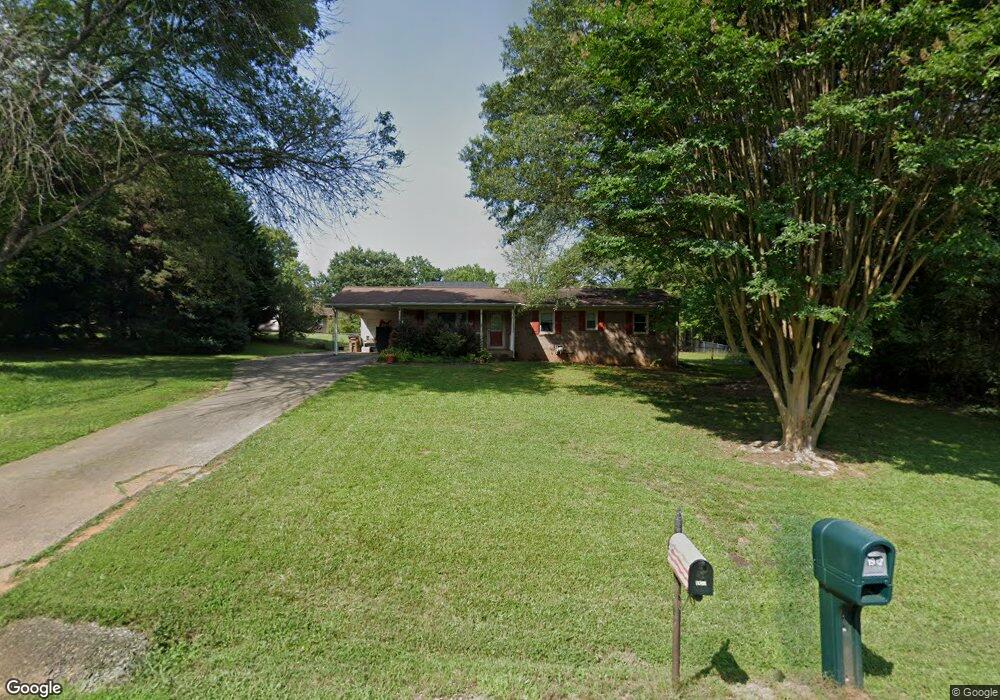
1911 Kendrick Cir Shelby, NC 28152
Estimated Value: $205,783 - $272,000
3
Beds
2
Baths
1,250
Sq Ft
$187/Sq Ft
Est. Value
About This Home
This home is located at 1911 Kendrick Cir, Shelby, NC 28152 and is currently estimated at $234,196, approximately $187 per square foot. 1911 Kendrick Cir is a home located in Cleveland County with nearby schools including Marion Intermediate School, Shelby Middle School, and Shelby High School.
Ownership History
Date
Name
Owned For
Owner Type
Purchase Details
Closed on
Jul 23, 2013
Sold by
Mauney Peter M and Mauney James P
Bought by
Williams Ann Mauney
Current Estimated Value
Purchase Details
Closed on
Aug 23, 2010
Sold by
Williams Ann M
Bought by
Williams Ann Mauney and Mauney Peter M
Purchase Details
Closed on
Jul 29, 2010
Sold by
Federal Home Loan Mortgage Corporation
Bought by
Williams Ann M
Purchase Details
Closed on
Apr 16, 2010
Sold by
Lail Larry D and Lail Angel M
Bought by
Federal Home Loan Mortgage Corporation
Purchase Details
Closed on
Jan 17, 2007
Sold by
Sides Kenneth Melvin and Sides Paula White
Bought by
Lail Larry D and Lail Angel M
Home Financials for this Owner
Home Financials are based on the most recent Mortgage that was taken out on this home.
Original Mortgage
$109,250
Interest Rate
6.05%
Mortgage Type
New Conventional
Create a Home Valuation Report for This Property
The Home Valuation Report is an in-depth analysis detailing your home's value as well as a comparison with similar homes in the area
Home Values in the Area
Average Home Value in this Area
Purchase History
| Date | Buyer | Sale Price | Title Company |
|---|---|---|---|
| Williams Ann Mauney | $40,000 | None Available | |
| Williams Ann Mauney | -- | None Available | |
| Williams Ann M | -- | None Available | |
| Federal Home Loan Mortgage Corporation | $111,950 | None Available | |
| Lail Larry D | $115,000 | None Available |
Source: Public Records
Mortgage History
| Date | Status | Borrower | Loan Amount |
|---|---|---|---|
| Previous Owner | Lail Larry D | $109,250 |
Source: Public Records
Tax History Compared to Growth
Tax History
| Year | Tax Paid | Tax Assessment Tax Assessment Total Assessment is a certain percentage of the fair market value that is determined by local assessors to be the total taxable value of land and additions on the property. | Land | Improvement |
|---|---|---|---|---|
| 2025 | $1,894 | $190,331 | $16,093 | $174,238 |
| 2024 | $1,194 | $96,998 | $12,875 | $84,123 |
| 2023 | $1,188 | $96,998 | $12,875 | $84,123 |
| 2022 | $1,188 | $96,998 | $12,875 | $84,123 |
| 2021 | $1,194 | $96,998 | $12,875 | $84,123 |
| 2020 | $885 | $69,426 | $12,875 | $56,551 |
| 2019 | $885 | $69,426 | $12,875 | $56,551 |
| 2018 | $883 | $69,426 | $12,875 | $56,551 |
| 2017 | $862 | $69,426 | $12,875 | $56,551 |
| 2016 | $864 | $69,426 | $12,875 | $56,551 |
| 2015 | $933 | $79,142 | $10,943 | $68,199 |
| 2014 | $933 | $79,142 | $10,943 | $68,199 |
Source: Public Records
Map
Nearby Homes
- 1900 E Dixon Blvd
- 114 Tanya Ln
- 124 Tanya Ln
- 0 Oates Dr
- 313 Kellom Dr
- 0 Pinecrest Dr
- 122 Pinecrest Dr
- 1108 Borders Rd
- 2111 Windermere Ln
- 123 Pinecrest Dr
- 329 Aniston Ln
- 1813 Isaac Place
- 1805 Isaac Place
- 2520 Wildwood Dr
- 2338 Hoey Church Rd
- 4022 Lynn Cir
- 2314 Marlowe Ave
- 2315 Marlowe Ave
- 2028 Kings Rd
- 2320 China Ave
- 1907 Kendrick Cir
- 1939 Kendrick Cir
- 1912 Kendrick Cir
- 1908 Kendrick Cir
- 1941 Kendrick Cir
- 1914 Kendrick Cir
- 1906 Kendrick Cir
- 300 Wilson Rd
- 1919 Kendrick Cir
- 1931 Kendrick Cir
- 304 Wilson Rd
- 208 Wilson Rd
- 1922 Kendrick Cir
- 1938 Kendrick Cir
- 1940 Kendrick Cir
- 1929 Kendrick Cir
- 1942 Kendrick Cir
- 1926 Kendrick Cir
- 206 Wilson Rd
- 215 Wilson Rd