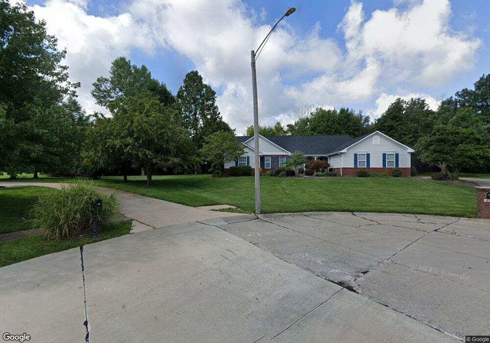
1911 Mapleview Ct Swansea, IL 62226
Estimated Value: $338,571 - $430,000
--
Bed
--
Bath
2,050
Sq Ft
$191/Sq Ft
Est. Value
About This Home
This home is located at 1911 Mapleview Ct, Swansea, IL 62226 and is currently estimated at $392,393, approximately $191 per square foot. 1911 Mapleview Ct is a home located in St. Clair County with nearby schools including Whiteside Elementary School, Whiteside Middle School, and St Teresa Catholic School.
Ownership History
Date
Name
Owned For
Owner Type
Purchase Details
Closed on
Jul 25, 2001
Sold by
Dichsen Andrew J and Dichsen Stacie L
Bought by
Vanhorn Jan and Vanhorn Rozanne
Current Estimated Value
Home Financials for this Owner
Home Financials are based on the most recent Mortgage that was taken out on this home.
Original Mortgage
$201,850
Outstanding Balance
$77,901
Interest Rate
7.16%
Mortgage Type
VA
Estimated Equity
$314,492
Create a Home Valuation Report for This Property
The Home Valuation Report is an in-depth analysis detailing your home's value as well as a comparison with similar homes in the area
Home Values in the Area
Average Home Value in this Area
Purchase History
| Date | Buyer | Sale Price | Title Company |
|---|---|---|---|
| Vanhorn Jan | $196,000 | -- |
Source: Public Records
Mortgage History
| Date | Status | Borrower | Loan Amount |
|---|---|---|---|
| Open | Vanhorn Jan | $201,850 |
Source: Public Records
Tax History Compared to Growth
Tax History
| Year | Tax Paid | Tax Assessment Tax Assessment Total Assessment is a certain percentage of the fair market value that is determined by local assessors to be the total taxable value of land and additions on the property. | Land | Improvement |
|---|---|---|---|---|
| 2024 | -- | $99,255 | $25,709 | $73,546 |
| 2023 | -- | $91,532 | $25,353 | $66,179 |
| 2022 | $4,458 | $83,362 | $23,090 | $60,272 |
| 2021 | $0 | $79,940 | $22,142 | $57,798 |
| 2020 | $4,458 | $74,447 | $20,621 | $53,826 |
| 2019 | $4,720 | $75,688 | $22,516 | $53,172 |
| 2018 | $4,615 | $73,755 | $21,941 | $51,814 |
| 2017 | $4,656 | $71,792 | $21,357 | $50,435 |
| 2016 | $4,634 | $69,318 | $20,621 | $48,697 |
| 2014 | $4,478 | $72,597 | $20,545 | $52,052 |
| 2013 | $5,690 | $72,597 | $20,545 | $52,052 |
Source: Public Records
Map
Nearby Homes
- 517 E Waters Edge Dr
- 4092 Redcastle Place
- 2024 Ravenel
- 4783 Katrina
- 1513 Pasteur Ln
- 21 Raven Oak Dr
- 1518 William Ln
- 1232 Carleton Ln
- 0 Hartman Ln
- 1214 Carleton Ln
- 1453 Winchester Grove Ct
- 1433 Victoria Square Ct
- 4167 Addiston Dr
- 4171 Addiston Dr
- 5025 Bristol Hill Dr
- 1278 Bainbridge Ct
- 980 Clemson Ave
- 2224 Cotswold Cir
- 2237 Glenfield Dr
- 313 Radcliff Rd
- 1913 Mapleview Ct
- 1914 Mapleview Ct
- 1920 Mapleview Ct
- 1917 Mapleview Ct
- 4130 Old Collinsville Rd
- 1921 Mapleview Ct
- 4191 Ashwood Ln
- 4187 Ashwood Ln
- 4195 Ashwood Ln
- 4140 Old Collinsville Rd
- 4183 Ashwood Ln
- 1929 Mapleview Ct
- 4179 Ashwood Ln
- 1915 Messinger Trail
- 1921 Messinger Trail
- 4188 Ashwood Ln
- 1909 Messinger Trail
- 4194 Ashwood Ln
- 1903 Messinger Trail
- 4184 Ashwood Ln