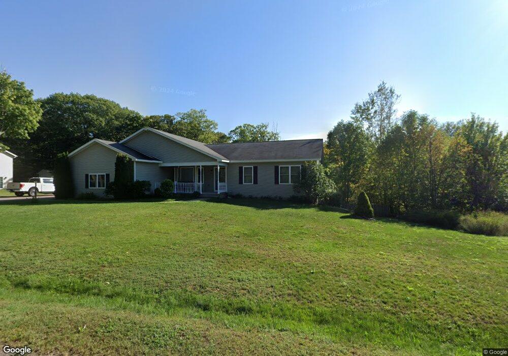
1911 Middle Pointe Ln Houghton, MI 49931
Estimated Value: $415,755 - $557,000
5
Beds
3
Baths
3,703
Sq Ft
$133/Sq Ft
Est. Value
About This Home
This home is located at 1911 Middle Pointe Ln, Houghton, MI 49931 and is currently estimated at $493,918, approximately $133 per square foot. 1911 Middle Pointe Ln is a home located in Houghton County with nearby schools including South Range Elementary School and Jeffers High School.
Ownership History
Date
Name
Owned For
Owner Type
Purchase Details
Closed on
Jul 15, 2021
Sold by
Choi Chang K
Bought by
Wosik Erik
Current Estimated Value
Home Financials for this Owner
Home Financials are based on the most recent Mortgage that was taken out on this home.
Original Mortgage
$341,000
Outstanding Balance
$309,262
Interest Rate
2.87%
Mortgage Type
Construction
Estimated Equity
$184,656
Purchase Details
Closed on
Jul 20, 2009
Sold by
Dwyer Dana L and Walz Jeff R
Bought by
Choi Chang K and Kim Kyoung M
Create a Home Valuation Report for This Property
The Home Valuation Report is an in-depth analysis detailing your home's value as well as a comparison with similar homes in the area
Home Values in the Area
Average Home Value in this Area
Purchase History
| Date | Buyer | Sale Price | Title Company |
|---|---|---|---|
| Wosik Erik | $391,000 | Keweenaw Title Agcy | |
| Choi Chang K | $282,200 | -- |
Source: Public Records
Mortgage History
| Date | Status | Borrower | Loan Amount |
|---|---|---|---|
| Open | Wosik Erik | $341,000 |
Source: Public Records
Tax History Compared to Growth
Tax History
| Year | Tax Paid | Tax Assessment Tax Assessment Total Assessment is a certain percentage of the fair market value that is determined by local assessors to be the total taxable value of land and additions on the property. | Land | Improvement |
|---|---|---|---|---|
| 2025 | $7,776 | $209,093 | $0 | $0 |
| 2024 | $5,998 | $200,992 | $0 | $0 |
| 2023 | $5,715 | $176,884 | $0 | $0 |
| 2022 | $7,070 | $154,013 | $0 | $0 |
| 2021 | $6,473 | $145,093 | $0 | $0 |
| 2020 | $6,383 | $141,853 | $0 | $0 |
| 2019 | $6,268 | $138,106 | $0 | $0 |
| 2018 | $6,107 | $139,204 | $0 | $0 |
| 2017 | $5,805 | $131,137 | $0 | $0 |
| 2016 | -- | $128,055 | $0 | $0 |
| 2015 | -- | $132,486 | $0 | $0 |
| 2014 | -- | $128,802 | $0 | $0 |
Source: Public Records
Map
Nearby Homes
- TBD-undeveloped Oak Ridge Ln
- 1906 White Oak Ln
- 2103 Balsam Ln
- 1905 Poplar Dr
- TBD32 Houghton Canal Rd
- 1506 Sugar Maple Ln
- 1504 Sugar Maple Ln
- TBD A B C Navy Stream
- 17970 Spring Brook Ln
- 47302 Janovosky Rd
- 52275 N Superior Rd
- 202 Scallon St
- TBD Razorback Dr Unit Part of Lot 22, Enti
- 624 Lake Ave
- 810 W Douglass Ave
- Unit 4 Greenway Dr Unit 4
- TBD Green Acres Rd
- TBD Off Cedar St
- Unit 6 Greenway Dr
- TBD A W Sharon Ave
- 1909 Middle Pointe Ln
- 1913 Middle Pointe Ln
- 1908 Middle Pointe Ln Unit Lot 42 Woodhaven
- 1908 Middle Pointe Ln
- 1907 Middle Pointe Ln
- 1910 Robindale Dr
- 1908 Robindale Dr
- 1912 Middle Pointe Ln
- 1912 Robindale Dr
- 1914 Middle Pointe Ln
- 1906 Robindale Dr
- 1905 Middle Pointe Ln
- 1904 Middle Pointe Ln
- 1914 Robindale Dr
- 1909 Crest View Dr
- 1909 Crest View Dr
- 1904 Robindale Dr
- 1907 Crest View Dr
- 1907 Crest View Dr
- 1911 Crest View Dr