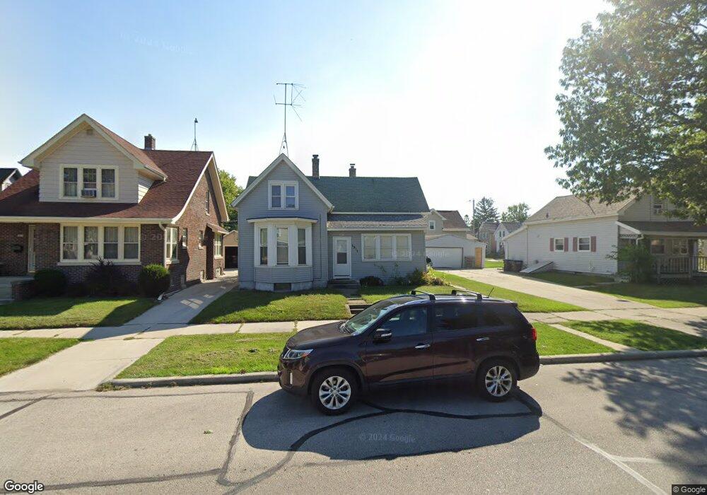
1911 N 10th St Sheboygan, WI 53081
Central Sheboygan NeighborhoodEstimated Value: $161,000 - $188,000
3
Beds
1
Bath
1,007
Sq Ft
$170/Sq Ft
Est. Value
About This Home
This home is located at 1911 N 10th St, Sheboygan, WI 53081 and is currently estimated at $171,299, approximately $170 per square foot. 1911 N 10th St is a home located in Sheboygan County with nearby schools including Grant Elementary School, Urban Middle School, and North High School.
Ownership History
Date
Name
Owned For
Owner Type
Purchase Details
Closed on
Jun 25, 2020
Sold by
Millstream Company Llc
Bought by
Coblyns Llc
Current Estimated Value
Home Financials for this Owner
Home Financials are based on the most recent Mortgage that was taken out on this home.
Original Mortgage
$55,000
Outstanding Balance
$48,661
Interest Rate
3.1%
Mortgage Type
New Conventional
Estimated Equity
$122,638
Purchase Details
Closed on
Jun 27, 2017
Sold by
Gries Crystal A and Gries Michael
Bought by
Millstream Company Llc
Create a Home Valuation Report for This Property
The Home Valuation Report is an in-depth analysis detailing your home's value as well as a comparison with similar homes in the area
Home Values in the Area
Average Home Value in this Area
Purchase History
| Date | Buyer | Sale Price | Title Company |
|---|---|---|---|
| Coblyns Llc | $52,500 | New Title Company Name | |
| Millstream Company Llc | -- | New Title Company Name | |
| Millstream Company Llc | $25,000 | Kaufman Kyle |
Source: Public Records
Mortgage History
| Date | Status | Borrower | Loan Amount |
|---|---|---|---|
| Open | Coblyns Llc | $55,000 |
Source: Public Records
Tax History Compared to Growth
Tax History
| Year | Tax Paid | Tax Assessment Tax Assessment Total Assessment is a certain percentage of the fair market value that is determined by local assessors to be the total taxable value of land and additions on the property. | Land | Improvement |
|---|---|---|---|---|
| 2024 | $1,768 | $108,600 | $17,900 | $90,700 |
| 2023 | $1,423 | $91,600 | $17,100 | $74,500 |
| 2022 | $1,440 | $77,800 | $17,100 | $60,700 |
| 2021 | $1,390 | $54,400 | $14,900 | $39,500 |
| 2020 | $1,395 | $54,400 | $14,900 | $39,500 |
| 2019 | $1,336 | $54,400 | $14,900 | $39,500 |
| 2018 | $1,318 | $54,400 | $14,900 | $39,500 |
| 2017 | $1,278 | $54,400 | $14,900 | $39,500 |
| 2016 | $1,286 | $54,400 | $14,900 | $39,500 |
| 2015 | $1,335 | $54,400 | $14,900 | $39,500 |
| 2014 | $1,389 | $54,400 | $14,900 | $39,500 |
Source: Public Records
Map
Nearby Homes
- 1915 N 10th St
- 924 Lincoln Ave
- 1903 N 10th St
- 1923 N 10th St
- 1919 N 10th St
- 918 Lincoln Ave
- 914 Lincoln Ave
- 1925 N 10th St
- 1827 N 10th St
- 1914 N 9th St
- 1908 N 10th St
- 917 Lincoln Ave
- 1902 N 10th St
- 1823 N 10th St Unit Upper
- 1823 N 10th St
- 1823 N 10th St Unit 1823A
- 1823 N 10th St
- 923 Lincoln Ave
- 1918 N 9th St
- 1910 N 9th St