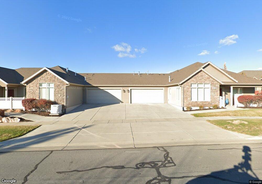
1911 S 910 W Unit D Syracuse, UT 84075
Estimated Value: $453,000 - $550,000
2
Beds
2
Baths
1,626
Sq Ft
$308/Sq Ft
Est. Value
About This Home
This home is located at 1911 S 910 W Unit D, Syracuse, UT 84075 and is currently estimated at $501,285, approximately $308 per square foot. 1911 S 910 W Unit D is a home located in Davis County with nearby schools including Bluff Ridge Elementary, Legacy Junior High School, and Clearfield High School.
Ownership History
Date
Name
Owned For
Owner Type
Purchase Details
Closed on
May 23, 2024
Sold by
Humphries Dale and Humphries Paulette
Bought by
Humphries Dale and Humphries Paulette
Current Estimated Value
Purchase Details
Closed on
May 8, 2024
Sold by
Diana G Sackett Family Trust and Sackett Diana G
Bought by
Humpheries Dale and Humpheries Paulette
Purchase Details
Closed on
Nov 11, 2022
Sold by
Sackett Diana G
Bought by
Diana G Sackett Family Trust
Purchase Details
Closed on
May 5, 2022
Sold by
Blair R Green And Judith Ann Green Trust
Bought by
Sackett Diana G
Purchase Details
Closed on
Sep 10, 2021
Sold by
Green Blair R
Bought by
Green Blair R and Green Judith Ann
Home Financials for this Owner
Home Financials are based on the most recent Mortgage that was taken out on this home.
Original Mortgage
$360,000
Interest Rate
2.8%
Mortgage Type
New Conventional
Purchase Details
Closed on
Jan 26, 2012
Sold by
Leisure Villas Inc
Bought by
Stolzenburg Lois K
Create a Home Valuation Report for This Property
The Home Valuation Report is an in-depth analysis detailing your home's value as well as a comparison with similar homes in the area
Home Values in the Area
Average Home Value in this Area
Purchase History
| Date | Buyer | Sale Price | Title Company |
|---|---|---|---|
| Humphries Dale | -- | Truly Title | |
| Humpheries Dale | -- | Truly Title | |
| Diana G Sackett Family Trust | -- | -- | |
| Sackett Diana G | -- | None Listed On Document | |
| Green Blair R | -- | Stewart Title Ins Ag | |
| Green Blair R | -- | Metro National Title | |
| Stolzenburg Lois K | -- | Metro National Title |
Source: Public Records
Mortgage History
| Date | Status | Borrower | Loan Amount |
|---|---|---|---|
| Previous Owner | Green Blair R | $360,000 |
Source: Public Records
Tax History
| Year | Tax Paid | Tax Assessment Tax Assessment Total Assessment is a certain percentage of the fair market value that is determined by local assessors to be the total taxable value of land and additions on the property. | Land | Improvement |
|---|---|---|---|---|
| 2025 | $2,622 | $253,000 | $76,450 | $176,550 |
| 2024 | $2,435 | $236,500 | $60,500 | $176,000 |
| 2023 | $2,384 | $422,000 | $113,000 | $309,000 |
| 2022 | $2,528 | $446,000 | $96,000 | $350,000 |
| 2021 | $2,297 | $345,000 | $79,000 | $266,000 |
| 2020 | $399 | $319,000 | $74,700 | $244,300 |
| 2019 | $367 | $296,000 | $75,000 | $221,000 |
| 2018 | $488 | $276,000 | $85,000 | $191,000 |
| 2016 | $1,732 | $129,415 | $33,000 | $96,415 |
| 2015 | $1,458 | $103,785 | $33,000 | $70,785 |
| 2014 | $1,767 | $128,124 | $18,333 | $109,791 |
| 2013 | -- | $110,693 | $21,175 | $89,518 |
Source: Public Records
Map
Nearby Homes
- 961 1910 S
- 929 W 1920 S Unit A
- 877 W 1920 S Unit C
- 1153 W 1875 S
- 711 W 2010 S
- 1876 S 1230 W
- 823 W 1600 S Unit 28
- Everglade Plan at Wilcox Farms
- Echo Plan at Wilcox Farms
- Granite Plan at Wilcox Farms
- 1154 W 1700 S
- 1553 S 900 W
- 1553 S 900 W Unit 139
- 1547 S 900 W
- 1913 S 525 W
- 794 W 2300 S
- 1137 2275 S
- 1116 W 2325 S
- 1156 W 2325 S
- 1196 W 2325 S
- 1911 S 910 W Unit B
- 1911 S 910 W Unit C
- 1911 S 910 W Unit A
- 1889 S 910 W Unit A
- 913 W 1920 S Unit B
- 913 W 1920 S Unit A
- 1912 S 910 W
- 1912 S 910 W
- 1912 S 910 W
- 1912 S 910 W
- 1912 S 910 W Unit A
- 1912 S 910 W Unit C
- 1912 S 910 W Unit D
- 891 W 1920 S Unit D
- 891 W 1920 S
- 877 W 1920 S Unit 4-D
- 877 W 1920 S Unit A
- 877 W 1920 S Unit 4C
- 1888 S 910 W Unit A
- 1888 S 910 W
Your Personal Tour Guide
Ask me questions while you tour the home.