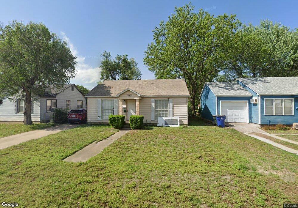
1911 W Oak Ave Duncan, OK 73533
Estimated Value: $56,000 - $83,000
2
Beds
2
Baths
896
Sq Ft
$77/Sq Ft
Est. Value
About This Home
This home is located at 1911 W Oak Ave, Duncan, OK 73533 and is currently estimated at $69,401, approximately $77 per square foot. 1911 W Oak Ave is a home located in Stephens County with nearby schools including Mark Twain Elementary School, Duncan Middle School, and Duncan High School.
Ownership History
Date
Name
Owned For
Owner Type
Purchase Details
Closed on
May 5, 2006
Sold by
Price Kord R
Bought by
Huckabaa Jennifer
Current Estimated Value
Home Financials for this Owner
Home Financials are based on the most recent Mortgage that was taken out on this home.
Original Mortgage
$35,000
Outstanding Balance
$20,271
Interest Rate
6.4%
Mortgage Type
New Conventional
Estimated Equity
$49,130
Purchase Details
Closed on
Sep 26, 2003
Sold by
Fuller George and Fuller Tanya
Purchase Details
Closed on
Jun 24, 1999
Sold by
Thompson Michael D
Purchase Details
Closed on
Sep 20, 1996
Sold by
Janssen Beatrice Rev Tr
Create a Home Valuation Report for This Property
The Home Valuation Report is an in-depth analysis detailing your home's value as well as a comparison with similar homes in the area
Home Values in the Area
Average Home Value in this Area
Purchase History
| Date | Buyer | Sale Price | Title Company |
|---|---|---|---|
| Huckabaa Jennifer | $35,000 | None Available | |
| -- | $25,000 | -- | |
| -- | $25,000 | -- | |
| -- | $25,000 | -- |
Source: Public Records
Mortgage History
| Date | Status | Borrower | Loan Amount |
|---|---|---|---|
| Open | Huckabaa Jennifer | $35,000 |
Source: Public Records
Tax History Compared to Growth
Tax History
| Year | Tax Paid | Tax Assessment Tax Assessment Total Assessment is a certain percentage of the fair market value that is determined by local assessors to be the total taxable value of land and additions on the property. | Land | Improvement |
|---|---|---|---|---|
| 2024 | $265 | $3,116 | $524 | $2,592 |
| 2023 | $265 | $2,968 | $524 | $2,444 |
| 2022 | $249 | $3,048 | $524 | $2,524 |
| 2021 | $237 | $2,791 | $524 | $2,267 |
| 2020 | $242 | $2,806 | $524 | $2,282 |
| 2019 | $264 | $3,055 | $524 | $2,531 |
| 2018 | $260 | $3,066 | $524 | $2,542 |
| 2017 | $239 | $2,781 | $524 | $2,257 |
| 2016 | $328 | $3,862 | $524 | $3,338 |
| 2015 | $351 | $3,862 | $524 | $3,338 |
| 2014 | $351 | $3,909 | $550 | $3,359 |
Source: Public Records
Map
Nearby Homes
- 174831 N 2844 Rd
- 2006 2006 W Oak Ave
- 2006 W Oak Ave
- 2011 2011 W Oak Ave
- 1812 W Walnut Ave
- 2108 Ave
- 210 N 22nd St
- 209 N 22nd St
- 2110 W Main St
- 1415 1415 W Walnut
- 27 27 N 14
- 106 Emery Rd
- 1309 W Beech Ave
- 1203 W Walnut Ave
- 2206 2206 W Spruce
- 2230 W Spruce St
- 1116 1116 W Chestnut
- 1099 1099 N 19th St
- 1309 W Pecan Ave
- 812 812 N 15th
- 1913 W Oak Ave
- 1909 W Oak Ave
- 1907 W Oak Ave
- 1915 W Oak Ave
- 1907 W Oak Ave
- 1905 W Oak Ave
- 1912 W Ash Ave
- 1906 W Ash Ave
- 1914 W Ash Ave
- 1910 W Oak Ave
- 1908 W Oak Ave
- 1906 W Oak Ave
- 1912 W Oak Ave
- 1904 W Ash Ave
- 1901 W Oak Ave
- 1904 W Oak Ave
- 2002 W Ash Ave
- 1902 W Ash Ave
- 2003 W Oak Ave
- 286500 Old Highway 7