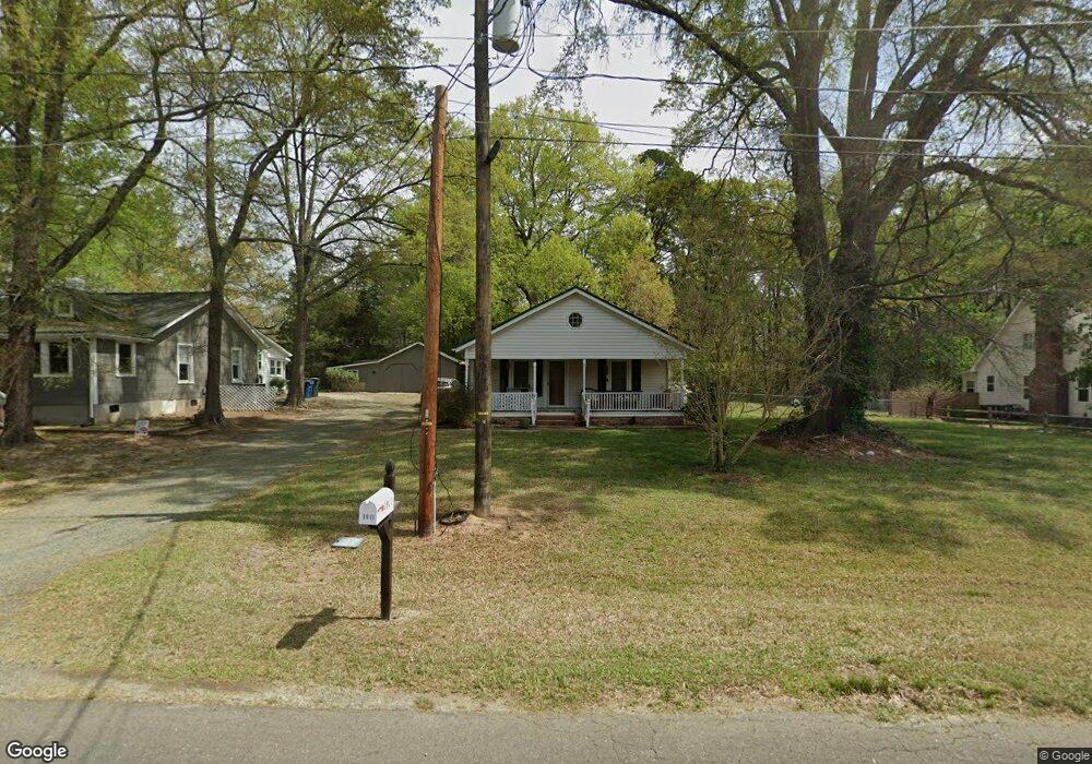
1911 Watson Rd Durham, NC 27704
Northeast Durham NeighborhoodEstimated Value: $215,000 - $244,000
2
Beds
1
Bath
972
Sq Ft
$235/Sq Ft
Est. Value
About This Home
This home is located at 1911 Watson Rd, Durham, NC 27704 and is currently estimated at $228,380, approximately $234 per square foot. 1911 Watson Rd is a home located in Durham County with nearby schools including Merrick-Moore Elementary School, John W Neal Middle School, and Southern School of Energy & Sustainability.
Ownership History
Date
Name
Owned For
Owner Type
Purchase Details
Closed on
Apr 12, 2019
Sold by
Rockriver Shane and Rockriver Sarah Resnik
Bought by
Rockriver Holdings Llc
Current Estimated Value
Purchase Details
Closed on
Apr 8, 2013
Sold by
Rockriver Shane
Bought by
Rockriver Shane and Rockriver Sarah Resnik
Purchase Details
Closed on
Feb 20, 2013
Sold by
Federal National Mortgage Association
Bought by
Rockdriver Shane
Purchase Details
Closed on
Jan 23, 2013
Sold by
Casey Dorothy Dalehite
Bought by
Federal National Mortgage Association and Fannie Mae
Create a Home Valuation Report for This Property
The Home Valuation Report is an in-depth analysis detailing your home's value as well as a comparison with similar homes in the area
Home Values in the Area
Average Home Value in this Area
Purchase History
| Date | Buyer | Sale Price | Title Company |
|---|---|---|---|
| Rockriver Holdings Llc | -- | None Available | |
| Rockriver Shane | -- | None Available | |
| Rockdriver Shane | -- | None Available | |
| Federal National Mortgage Association | -- | None Available |
Source: Public Records
Tax History
| Year | Tax Paid | Tax Assessment Tax Assessment Total Assessment is a certain percentage of the fair market value that is determined by local assessors to be the total taxable value of land and additions on the property. | Land | Improvement |
|---|---|---|---|---|
| 2025 | $2,015 | $203,310 | $91,875 | $111,435 |
| 2024 | $1,513 | $108,487 | $29,440 | $79,047 |
| 2023 | $1,421 | $108,487 | $29,440 | $79,047 |
| 2022 | $1,389 | $108,487 | $29,440 | $79,047 |
| 2021 | $1,382 | $108,487 | $29,440 | $79,047 |
| 2020 | $1,349 | $108,487 | $29,440 | $79,047 |
| 2019 | $1,349 | $136,043 | $29,440 | $106,603 |
| 2018 | $1,032 | $76,056 | $25,725 | $50,331 |
| 2017 | $1,024 | $76,056 | $25,725 | $50,331 |
| 2016 | $990 | $76,056 | $25,725 | $50,331 |
| 2015 | $1,058 | $76,426 | $28,069 | $48,357 |
| 2014 | -- | $76,426 | $28,069 | $48,357 |
Source: Public Records
Map
Nearby Homes
- 1832 E Geer St
- 1823 E Geer St
- 18 Syracuse Place
- 1905 Milan St
- 1811 E Geer St
- 2406 Winburn Ave
- 1515 Milan St
- 1113 Midland Terrace
- 2028 Buffalo Way
- 2027 Buffalo Way
- 2632 Melrose Ave
- 1615 Great Bend Dr
- 2113 Aiken Ave
- 1401 Milan St
- 2206 E Club Blvd
- 3019 Chrys St
- 3007 Chrys St
- 3017 Chrys St
- 3010 Chrys St
- 3008 Chrys St
- 1907 Watson Rd
- 1917 Watson Rd
- 1914 Watson Rd
- 1908 E Geer St
- 1834 E Geer St
- 1902 E Geer St
- 1912 E Geer St
- 1925 Watson Rd
- 1830 E Geer St
- 1922 Watson Rd
- 12 Cambian Place
- 8 Cambian Place
- 16 Cambian Place
- 4 Cambian Place
- 1903 E Geer St
- 1909 E Geer St
- 1824 E Geer St
- 1901 E Geer St
- 1835 E Geer St
- 20 Cambian Place
Your Personal Tour Guide
Ask me questions while you tour the home.