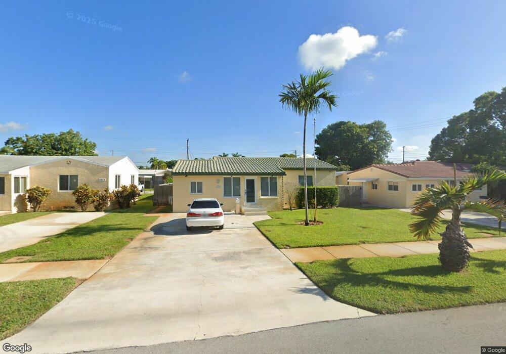
1911 Wilson St Hollywood, FL 33020
Royal Poinciana NeighborhoodEstimated Value: $360,000 - $453,000
2
Beds
1
Bath
1,292
Sq Ft
$322/Sq Ft
Est. Value
About This Home
This home is located at 1911 Wilson St, Hollywood, FL 33020 and is currently estimated at $415,683, approximately $321 per square foot. 1911 Wilson St is a home located in Broward County with nearby schools including Dania Elementary School, Olsen Middle School, and South Broward High School.
Ownership History
Date
Name
Owned For
Owner Type
Purchase Details
Closed on
Aug 29, 2024
Sold by
Cote Derick
Bought by
Cote Derick and Cote Mario
Current Estimated Value
Purchase Details
Closed on
Oct 12, 2011
Sold by
Sutton James and Gurdak Scott
Bought by
Cote Derick and Cote Kevin
Purchase Details
Closed on
Apr 3, 2002
Sold by
Nealy Charlotte P
Bought by
Sutton James and Gurdak Scott
Home Financials for this Owner
Home Financials are based on the most recent Mortgage that was taken out on this home.
Original Mortgage
$85,400
Interest Rate
6.68%
Create a Home Valuation Report for This Property
The Home Valuation Report is an in-depth analysis detailing your home's value as well as a comparison with similar homes in the area
Home Values in the Area
Average Home Value in this Area
Purchase History
| Date | Buyer | Sale Price | Title Company |
|---|---|---|---|
| Cote Derick | -- | Butler Title | |
| Cote Derick | $115,000 | Attorney | |
| Sutton James | $89,900 | Atlantis Title Company Of Pa |
Source: Public Records
Mortgage History
| Date | Status | Borrower | Loan Amount |
|---|---|---|---|
| Previous Owner | Sutton James | $85,400 |
Source: Public Records
Tax History Compared to Growth
Tax History
| Year | Tax Paid | Tax Assessment Tax Assessment Total Assessment is a certain percentage of the fair market value that is determined by local assessors to be the total taxable value of land and additions on the property. | Land | Improvement |
|---|---|---|---|---|
| 2025 | $8,009 | $365,930 | $48,200 | $317,730 |
| 2024 | $1,576 | $365,930 | $48,200 | $317,730 |
| 2023 | $1,576 | $101,870 | $0 | $0 |
| 2022 | $1,474 | $98,910 | $0 | $0 |
| 2021 | $1,423 | $96,030 | $0 | $0 |
| 2020 | $1,386 | $94,710 | $0 | $0 |
| 2019 | $1,359 | $92,590 | $0 | $0 |
| 2018 | $1,292 | $90,870 | $0 | $0 |
| 2017 | $1,200 | $89,010 | $0 | $0 |
| 2016 | $1,187 | $87,180 | $0 | $0 |
| 2015 | $1,189 | $86,580 | $0 | $0 |
| 2014 | $1,557 | $102,670 | $0 | $0 |
| 2013 | -- | $101,160 | $16,070 | $85,090 |
Source: Public Records
Map
Nearby Homes
- 1918 Taft St
- 1853 Taft St
- 1917 Harding St
- 1913 Harding St
- 1923 Roosevelt St
- 1820 Coolidge St
- 1812 Coolidge St
- 1812 Roosevelt St
- 1708 N Dixie Hwy
- 1777 N 17th Ct
- 1830 Cleveland St Unit 3
- 1830 Cleveland St Unit 2
- 1939 Arthur St
- 1954 Thomas St
- 1611 N 22nd Ave
- 1219 N 20th Ave
- 1850 Arthur St Unit 2
- 1807 N 17th Ave
- 2001 N 22nd Ave
- 1670 Harding St
- 1916 Wilson St
- 1917 Wilson St
- 1905 Wilson St
- 1923 Wilson St
- 1910 Harding St
- 1910 Harding St Unit REAR
- 1904 Harding St
- 1918 Harding St
- 1847 Wilson St
- 1929 Wilson St
- 1910 Wilson St
- 1904 Wilson St
- 1811 N 19th Ave Unit 2
- 1811 N 19th Ave Unit A
- 1811 N 19th Ave
- 1922 Wilson St
- 1843 Wilson St
- 1815 N 19th Ave
- 1928 Wilson St Unit 1
- 1928 Wilson St Unit 2