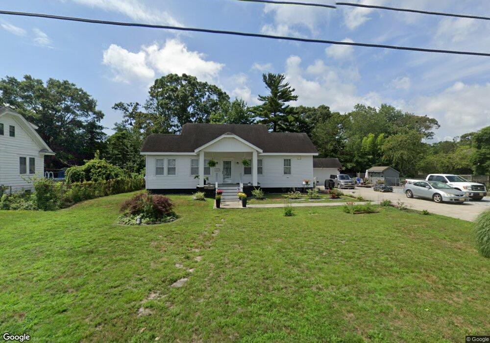
1912 Cedarbridge Rd Northfield, NJ 08225
Estimated Value: $289,000 - $387,000
Studio
--
Bath
1,084
Sq Ft
$318/Sq Ft
Est. Value
About This Home
This home is located at 1912 Cedarbridge Rd, Northfield, NJ 08225 and is currently estimated at $344,579, approximately $317 per square foot. 1912 Cedarbridge Rd is a home located in Atlantic County with nearby schools including Northfield Community Elementary School, Northfield Community Middle School, and Mainland Regional High School.
Ownership History
Date
Name
Owned For
Owner Type
Purchase Details
Closed on
Jul 31, 1998
Sold by
Mooney Gloria and Mooney James P
Bought by
Hubert Michael P
Current Estimated Value
Home Financials for this Owner
Home Financials are based on the most recent Mortgage that was taken out on this home.
Original Mortgage
$98,800
Outstanding Balance
$18,460
Interest Rate
6.92%
Estimated Equity
$326,119
Purchase Details
Closed on
Dec 30, 1996
Sold by
Hirst Robert R and Hirst Ruth A
Bought by
Mooney James P and Ramos Margarita
Home Financials for this Owner
Home Financials are based on the most recent Mortgage that was taken out on this home.
Original Mortgage
$90,848
Interest Rate
7.46%
Mortgage Type
FHA
Create a Home Valuation Report for This Property
The Home Valuation Report is an in-depth analysis detailing your home's value as well as a comparison with similar homes in the area
Home Values in the Area
Average Home Value in this Area
Purchase History
| Date | Buyer | Sale Price | Title Company |
|---|---|---|---|
| Hubert Michael P | $104,000 | The Title Company | |
| Mooney James P | $90,500 | Congress Title Corp |
Source: Public Records
Mortgage History
| Date | Status | Borrower | Loan Amount |
|---|---|---|---|
| Open | Hubert Michael P | $98,800 | |
| Previous Owner | Mooney James P | $90,848 |
Source: Public Records
Tax History
| Year | Tax Paid | Tax Assessment Tax Assessment Total Assessment is a certain percentage of the fair market value that is determined by local assessors to be the total taxable value of land and additions on the property. | Land | Improvement |
|---|---|---|---|---|
| 2025 | $7,881 | $219,400 | $82,500 | $136,900 |
| 2024 | $7,778 | $219,400 | $82,500 | $136,900 |
Source: Public Records
Map
Nearby Homes
- 4 E Mill Rd
- 19 Locust Dr
- 1607 Wells Ave
- 219 Northfield Ave
- 221 Northfield Ave
- 1805 Zion Rd
- 403 Park Ln
- 1205 Zion Rd
- 110 E Oakcrest Ave
- 41 E Vernon Ave
- 133 E Vernon Ave
- 2514 Helen Dr W
- 112 E Vernon Ave
- 10 Joseph Ct
- 410 W Vernon Ave
- 11 Roosevelt Ave
- 110 Northwood Ct
- 3 Meredith Ct
- 910 2nd St
- 320 Jackson Ave
- 1908 Cedarbridge Rd
- 2115 Merritt Dr
- 1921 Cedar Bridge Rd
- 2117 Merritt Dr
- 1921 Cedarbridge Rd
- 96 W Mill Rd
- 1905 Cedarbridge Rd
- 1924 Cedarbridge Rd
- 1904 Cedarbridge Rd
- 2113 Merritt Dr
- 2119 Merritt Dr
- 2006 Wabash Ave
- 2004 Wabash Ave
- 2121 Merritt Dr
- 1915 Merritt Dr
- 1900 Cedarbridge Rd
- 2110 Merritt Dr
- 2112 Merritt Dr
- 31 W Mill Rd
- 2114 Merritt Dr
Your Personal Tour Guide
Ask me questions while you tour the home.