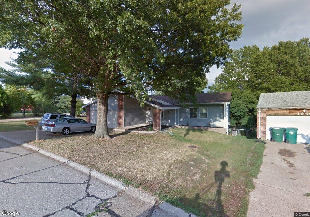
1912 Donnell Dr Barnhart, MO 63012
Estimated Value: $235,421 - $272,000
3
Beds
2
Baths
1,361
Sq Ft
$188/Sq Ft
Est. Value
About This Home
This home is located at 1912 Donnell Dr, Barnhart, MO 63012 and is currently estimated at $255,855, approximately $187 per square foot. 1912 Donnell Dr is a home located in Jefferson County with nearby schools including Windsor High School and St. Joseph Catholic School.
Ownership History
Date
Name
Owned For
Owner Type
Purchase Details
Closed on
Mar 8, 2013
Sold by
Sumski Matthew D and Sumski Laura Ann
Bought by
Kwiatowski Michael L and Kwiatowski Debbie R
Current Estimated Value
Home Financials for this Owner
Home Financials are based on the most recent Mortgage that was taken out on this home.
Original Mortgage
$112,142
Outstanding Balance
$79,315
Interest Rate
3.59%
Mortgage Type
New Conventional
Estimated Equity
$176,540
Purchase Details
Closed on
Aug 20, 2004
Sold by
Adams Christopher J and Adams Elaine C
Bought by
Sumski Matthew D
Home Financials for this Owner
Home Financials are based on the most recent Mortgage that was taken out on this home.
Original Mortgage
$105,600
Interest Rate
6%
Mortgage Type
Purchase Money Mortgage
Purchase Details
Closed on
Jan 17, 1997
Sold by
Lorenz Darrel D and Lorenz Donna S
Bought by
Adams Christopher J and Adams Elaine C
Home Financials for this Owner
Home Financials are based on the most recent Mortgage that was taken out on this home.
Original Mortgage
$86,547
Interest Rate
7.64%
Mortgage Type
FHA
Create a Home Valuation Report for This Property
The Home Valuation Report is an in-depth analysis detailing your home's value as well as a comparison with similar homes in the area
Home Values in the Area
Average Home Value in this Area
Purchase History
| Date | Buyer | Sale Price | Title Company |
|---|---|---|---|
| Kwiatowski Michael L | -- | None Available | |
| Sumski Matthew D | -- | Capital Title | |
| Adams Christopher J | -- | Commonwealth Title |
Source: Public Records
Mortgage History
| Date | Status | Borrower | Loan Amount |
|---|---|---|---|
| Open | Kwiatowski Michael L | $112,142 | |
| Previous Owner | Sumski Matthew D | $105,600 | |
| Previous Owner | Adams Christopher J | $86,547 |
Source: Public Records
Tax History
| Year | Tax Paid | Tax Assessment Tax Assessment Total Assessment is a certain percentage of the fair market value that is determined by local assessors to be the total taxable value of land and additions on the property. | Land | Improvement |
|---|---|---|---|---|
| 2025 | $1,678 | $24,700 | $4,800 | $19,900 |
| 2024 | $1,678 | $22,900 | $4,800 | $18,100 |
| 2023 | $1,678 | $22,900 | $4,800 | $18,100 |
| 2022 | $1,492 | $20,400 | $2,300 | $18,100 |
| 2021 | $1,493 | $20,400 | $2,300 | $18,100 |
| 2020 | $1,388 | $18,400 | $1,900 | $16,500 |
| 2019 | $1,386 | $18,400 | $1,900 | $16,500 |
| 2018 | $1,352 | $18,200 | $1,900 | $16,300 |
| 2017 | $1,301 | $18,200 | $1,900 | $16,300 |
| 2016 | $1,184 | $16,500 | $1,900 | $14,600 |
Source: Public Records
Map
Nearby Homes
- 0 Hwy Mm Unit MAR24032005
- 1660 Old State Road M
- 1675 Old State Road M
- 0 New Highway M Unit MAR25024234
- 2149 Meadow Dr
- 7255 Meriwether Ct
- 36 Huntleigh Woods
- 1433 Hoover Dr
- 7406 Avondale Park
- 7511 Hillcress Ct
- 2110 Devonshire Dr
- 1702 Springbrook Dr
- 6759 Sycamore Landing
- 2338 Windsor Castle Dr
- 2712 Kings Crossing Dr
- 6027 Kensington Way
- 2790 Kings Crossing Dr
- 5863 Mayberry Dr
- 8147 Murphy Ln
- 5827 Barberry Dr
- 1916 Donnell Dr
- 1909 Parkton Way
- 1920 Donnell Dr
- 1915 Parkton Way
- 1901 Parkton Way
- 1919 Parkton Way
- 1915 Donnell Dr
- 1919 Donnell Dr
- 73 Donnell Lot Dr
- 1926 Donnell Dr
- 1925 Parkton Way
- 1923 Parkton Way
- 1909 Parkton West Dr
- 1927 Donnell Dr
- 090 +/- Acres West of Parkton
- 1913 Parkton Dr W
- 1913 Parkton West Dr
- 1932 Donnell Dr
- 1922 Parkton West Dr
- 1918 Parkton Way
Your Personal Tour Guide
Ask me questions while you tour the home.