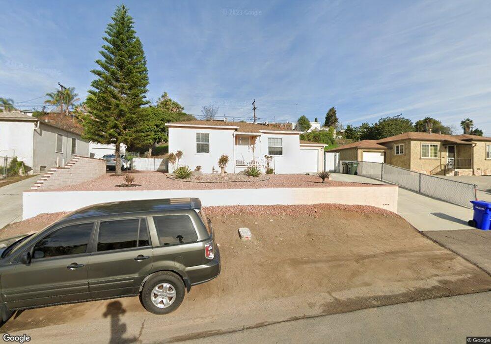
1912 Ensenada St Lemon Grove, CA 91945
Estimated Value: $545,000 - $718,000
2
Beds
1
Bath
738
Sq Ft
$826/Sq Ft
Est. Value
About This Home
This home is located at 1912 Ensenada St, Lemon Grove, CA 91945 and is currently estimated at $609,935, approximately $826 per square foot. 1912 Ensenada St is a home located in San Diego County with nearby schools including Monterey Heights Elementary, Mount Miguel High School, and Keiller Leadership Academy.
Ownership History
Date
Name
Owned For
Owner Type
Purchase Details
Closed on
Mar 21, 2012
Sold by
Bruder Robert M and Bruder Charlotte A
Bought by
Bruder Robert M and Brude Charlotte Ann
Current Estimated Value
Purchase Details
Closed on
Dec 6, 2011
Sold by
Bruder Charlotte A
Bought by
Bruder Charlotte A
Purchase Details
Closed on
May 15, 2001
Sold by
Keller Charles V
Bought by
Keller Charles
Create a Home Valuation Report for This Property
The Home Valuation Report is an in-depth analysis detailing your home's value as well as a comparison with similar homes in the area
Home Values in the Area
Average Home Value in this Area
Purchase History
| Date | Buyer | Sale Price | Title Company |
|---|---|---|---|
| Bruder Robert M | -- | None Available | |
| Bruder Charlotte A | -- | None Available | |
| Bruder Charlotte A | -- | None Available | |
| Keller Charles | -- | -- |
Source: Public Records
Tax History
| Year | Tax Paid | Tax Assessment Tax Assessment Total Assessment is a certain percentage of the fair market value that is determined by local assessors to be the total taxable value of land and additions on the property. | Land | Improvement |
|---|---|---|---|---|
| 2025 | $1,152 | $45,443 | $22,144 | $23,299 |
| 2024 | $1,152 | $44,553 | $21,710 | $22,843 |
| 2023 | $1,136 | $43,681 | $21,285 | $22,396 |
| 2022 | $1,131 | $42,825 | $20,868 | $21,957 |
| 2021 | $1,123 | $41,986 | $20,459 | $21,527 |
| 2020 | $1,100 | $41,557 | $20,250 | $21,307 |
| 2019 | $1,074 | $40,743 | $19,853 | $20,890 |
| 2018 | $1,046 | $39,945 | $19,464 | $20,481 |
| 2017 | $150 | $39,163 | $19,083 | $20,080 |
| 2016 | $974 | $38,396 | $18,709 | $19,687 |
| 2015 | $970 | $37,820 | $18,428 | $19,392 |
| 2014 | $944 | $37,081 | $18,068 | $19,013 |
Source: Public Records
Map
Nearby Homes
- 1905 El Dora St
- 1495 Shipley Ct
- 1607 Watwood Rd
- 2352 Cypress Ave
- 2317 Sherwood Dr
- 2049 Madera St
- 7978 Canton Dr
- 7936-38 Lansing Dr
- 2330 Di Foss St
- 2217 Lyndine St
- 2610 Sheri Ln
- 1062 Armacost Rd
- 1654 Walbollen St
- 7864 Palm St
- 7083 Berry Park Ln
- 2038 Siegle Dr
- 2222 Debco Dr
- 1628 La Corta St
- 7065 Berry Park Ln
- 2315 Berry St
- 1908 Ensenada St
- 1920 Ensenada St
- 1926 Ensenada St
- 1902 Ensenada St
- 1911 Eldora St
- 1905 Eldora St
- 1919 Eldora St
- 1909 Ensenada St
- 1930 Ensenada St
- 1915-17 Ensenada St
- 1896 Ensenada St
- 1901 Eldora St
- 1915 Ensenada St
- 1923 Eldora St Unit 25
- 1909 Ensenada St Unit 11
- 1921 Ensenada St Unit 23
- 1923 Eldora St
- 1903 Ensenada St
- 1927 Ensenada St Unit 29
- 1895 Eldora St
Your Personal Tour Guide
Ask me questions while you tour the home.