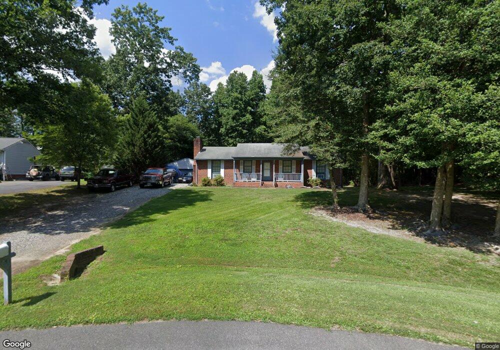
1912 Graves Rd Sandston, VA 23150
Estimated Value: $294,000 - $314,000
3
Beds
2
Baths
1,325
Sq Ft
$231/Sq Ft
Est. Value
About This Home
This home is located at 1912 Graves Rd, Sandston, VA 23150 and is currently estimated at $306,603, approximately $231 per square foot. 1912 Graves Rd is a home located in Henrico County with nearby schools including Donahoe Elementary School, Elko Middle School, and Highland Springs High School.
Ownership History
Date
Name
Owned For
Owner Type
Purchase Details
Closed on
May 30, 2007
Sold by
Harvey Teresa W
Bought by
Kelly Timothy T
Current Estimated Value
Home Financials for this Owner
Home Financials are based on the most recent Mortgage that was taken out on this home.
Original Mortgage
$161,500
Outstanding Balance
$98,714
Interest Rate
6.17%
Mortgage Type
New Conventional
Estimated Equity
$207,889
Purchase Details
Closed on
Nov 25, 2002
Sold by
Robertson William E
Bought by
Arthur Teresa W
Home Financials for this Owner
Home Financials are based on the most recent Mortgage that was taken out on this home.
Original Mortgage
$126,000
Interest Rate
6.07%
Mortgage Type
New Conventional
Create a Home Valuation Report for This Property
The Home Valuation Report is an in-depth analysis detailing your home's value as well as a comparison with similar homes in the area
Home Values in the Area
Average Home Value in this Area
Purchase History
| Date | Buyer | Sale Price | Title Company |
|---|---|---|---|
| Kelly Timothy T | $190,000 | -- | |
| Arthur Teresa W | $126,000 | -- |
Source: Public Records
Mortgage History
| Date | Status | Borrower | Loan Amount |
|---|---|---|---|
| Open | Kelly Timothy T | $161,500 | |
| Previous Owner | Arthur Teresa W | $126,000 |
Source: Public Records
Tax History Compared to Growth
Tax History
| Year | Tax Paid | Tax Assessment Tax Assessment Total Assessment is a certain percentage of the fair market value that is determined by local assessors to be the total taxable value of land and additions on the property. | Land | Improvement |
|---|---|---|---|---|
| 2025 | $2,405 | $268,300 | $47,000 | $221,300 |
| 2024 | $2,405 | $268,300 | $47,000 | $221,300 |
| 2023 | $2,281 | $268,300 | $47,000 | $221,300 |
| 2022 | $2,124 | $249,900 | $45,000 | $204,900 |
| 2021 | $1,703 | $184,400 | $40,000 | $144,400 |
| 2020 | $1,604 | $184,400 | $40,000 | $144,400 |
| 2019 | $1,543 | $177,400 | $40,000 | $137,400 |
| 2018 | $1,421 | $163,300 | $40,000 | $123,300 |
| 2017 | $1,384 | $159,100 | $40,000 | $119,100 |
| 2016 | $1,335 | $153,500 | $40,000 | $113,500 |
| 2015 | $1,298 | $153,500 | $40,000 | $113,500 |
| 2014 | $1,298 | $149,200 | $40,000 | $109,200 |
Source: Public Records
Map
Nearby Homes
- 1920 Meadow Rd
- 149 York River Rd
- 1290 Grapevine Rd
- 1649 Meadow Rd
- 2500 Meadow Rd
- 1712 N Airport Dr
- 670 N Airport Dr
- 300 Carlstone Dr
- 621 N Airport Dr
- 203 Meadow Rd
- 219 Defense Ave
- 428 Roxana Rd
- 1928 Repp Cir
- 405 Roxana Rd
- 204 Cornett St
- 5501 Whiteside Rd
- 206 Naglee Ave
- 121 E Magruder St
- 305 E Union St
- 119 Whiteside Rd
- 1908 Graves Rd
- 1913 Evanrude Ct
- 1904 Graves Rd
- 1917 Evanrude Ct
- 1909 Graves Rd
- 1909 Evanrude Ct
- 1905 Graves Rd
- 1900 Graves Rd
- 1905 Evanrude Ct
- 405 Evanrude Ln
- 430 Taylor Rd
- 1311 Boxwood Dr
- 409 Evanrude Ln
- 406 Boxwood Dr
- 1920 Evanrude Ct
- 420 Taylor Rd
- 413 Evanrude Ln
- 1901 Graves Rd
- 407 Boxwood Dr
- 400 Boxwood Dr