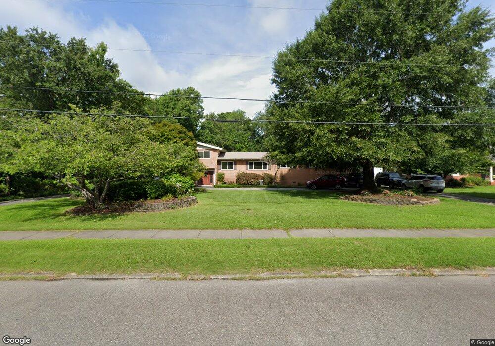
1912 Hawthorne Rd Wilmington, NC 28403
Glen Meade NeighborhoodEstimated Value: $902,136 - $1,137,000
3
Beds
4
Baths
3,464
Sq Ft
$297/Sq Ft
Est. Value
About This Home
This home is located at 1912 Hawthorne Rd, Wilmington, NC 28403 and is currently estimated at $1,027,284, approximately $296 per square foot. 1912 Hawthorne Rd is a home located in New Hanover County with nearby schools including Edwin A. Alderman Elementary School, Williston Middle School, and New Hanover High School.
Ownership History
Date
Name
Owned For
Owner Type
Purchase Details
Closed on
Jun 27, 2002
Sold by
Barker Darryl R Sara E
Bought by
Wilmington City Of
Current Estimated Value
Purchase Details
Closed on
Jul 31, 1997
Sold by
Perry George W Marilyn B
Bought by
Barker Darryl R Sara E
Purchase Details
Closed on
Sep 28, 1989
Sold by
Mclean Jan Hinkle
Bought by
Perry George W Marilyn B
Purchase Details
Closed on
Aug 1, 1987
Sold by
Hinkle Rubye L
Bought by
Mclean Jan Hinkle
Purchase Details
Closed on
Jan 1, 1974
Bought by
Hinkle Rubye L
Create a Home Valuation Report for This Property
The Home Valuation Report is an in-depth analysis detailing your home's value as well as a comparison with similar homes in the area
Home Values in the Area
Average Home Value in this Area
Purchase History
| Date | Buyer | Sale Price | Title Company |
|---|---|---|---|
| Wilmington City Of | $1,000 | -- | |
| Barker Darryl R Sara E | $225,000 | -- | |
| Perry George W Marilyn B | $145,000 | -- | |
| Mclean Jan Hinkle | -- | -- | |
| Hinkle Rubye L | $75,000 | -- |
Source: Public Records
Tax History Compared to Growth
Tax History
| Year | Tax Paid | Tax Assessment Tax Assessment Total Assessment is a certain percentage of the fair market value that is determined by local assessors to be the total taxable value of land and additions on the property. | Land | Improvement |
|---|---|---|---|---|
| 2023 | $3,725 | $428,200 | $199,600 | $228,600 |
| 2022 | $3,640 | $428,200 | $199,600 | $228,600 |
| 2021 | $3,665 | $428,200 | $199,600 | $228,600 |
| 2020 | $3,765 | $357,400 | $142,200 | $215,200 |
| 2019 | $3,765 | $357,400 | $142,200 | $215,200 |
| 2018 | $3,765 | $357,400 | $142,200 | $215,200 |
| 2017 | $3,765 | $357,400 | $142,200 | $215,200 |
| 2016 | $3,752 | $338,600 | $142,200 | $196,400 |
| 2015 | $3,586 | $338,600 | $142,200 | $196,400 |
| 2014 | $3,433 | $338,600 | $142,200 | $196,400 |
Source: Public Records
Map
Nearby Homes
- 2010 Independence Blvd Unit 2010
- 1802 Fordham Rd
- 2302 Gillette Dr
- 3801 Gillette Dr
- 3817 Canterbury Rd
- 1709 Hawthorne Rd
- 1701 S Live Oak Pkwy
- 2225 S Live Oak Pkwy
- 2118 Gloucester Place
- 2940 Oleander Dr Unit F11
- 2940 Oleander Dr Unit C9
- 2940 Oleander Dr Unit C11
- 2940 Oleander Dr Unit F5
- 2940 Oleander Dr Unit D13
- 2940 Oleander Dr Unit F7
- 2940 Oleander Dr Unit D16
- 1914 Colleton Ct Unit 8B
- 1901 Brewton Ct
- 3854 Sylvan Dr
- 1929 Glen Meade Rd
- 1908 Hawthorne Rd
- 1916 Hawthorne Rd
- 1904 Hawthorne Rd
- 1905 S Live Oak Pkwy
- 1920 Hawthorne Rd
- 1907 Hawthorne Rd
- 1919 S Live Oak Pkwy
- 1915 Hawthorne Rd
- 1901 S Live Oak Pkwy
- 1901 Hawthorne Rd
- 1924 Hawthorne Rd
- 1921 Hawthorne Rd
- 1840 Hawthorne Rd
- 1925 S Live Oak Pkwy
- 1837 S Live Oak Pkwy
- 1928 Hawthorne Rd
- 1925 Hawthorne Rd
- 1843 Hawthorne Rd
- 1705 S Live Oak Pkwy
- 1929 Hawthorne Rd