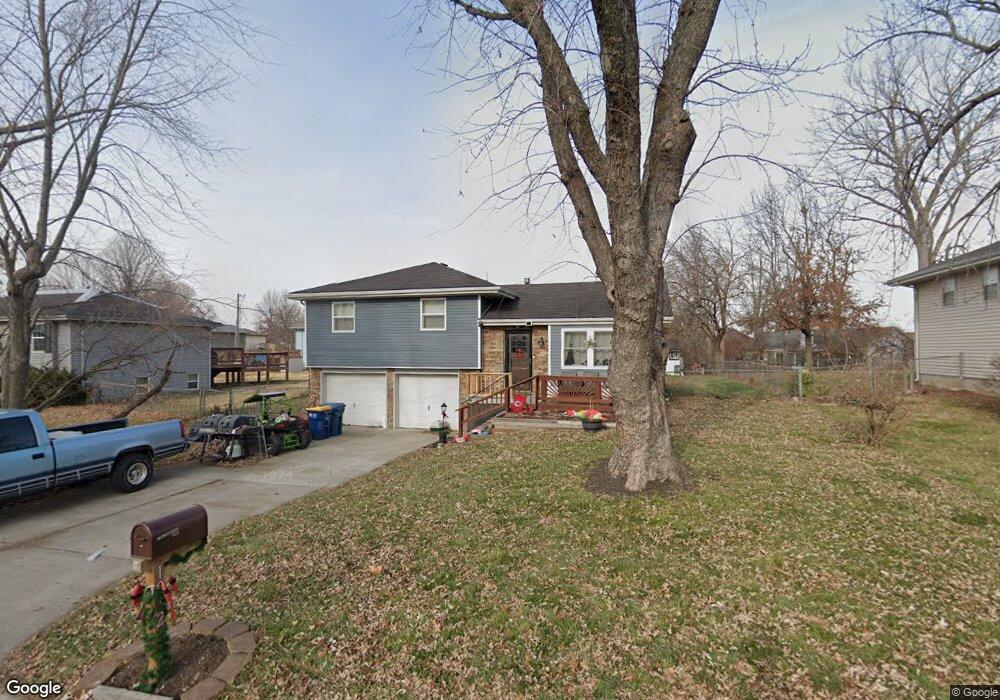
1912 Karlton Way Excelsior Springs, MO 64024
Estimated Value: $213,773 - $236,000
3
Beds
2
Baths
962
Sq Ft
$237/Sq Ft
Est. Value
About This Home
This home is located at 1912 Karlton Way, Excelsior Springs, MO 64024 and is currently estimated at $228,443, approximately $237 per square foot. 1912 Karlton Way is a home located in Clay County with nearby schools including Excelsior Springs High School.
Ownership History
Date
Name
Owned For
Owner Type
Purchase Details
Closed on
Jan 11, 2023
Sold by
Gallaway Kristen N
Bought by
Gallaway Matthew R
Current Estimated Value
Purchase Details
Closed on
Feb 25, 2022
Sold by
Guth Clara G and Guth Tina
Bought by
Gallaway Matthew R and Gallaway Nicole Kristen
Home Financials for this Owner
Home Financials are based on the most recent Mortgage that was taken out on this home.
Original Mortgage
$110,025
Interest Rate
3.69%
Mortgage Type
New Conventional
Purchase Details
Closed on
Jun 14, 2011
Sold by
Guth James D and Guth Clara G
Bought by
Guth James D and Guth Clara G
Create a Home Valuation Report for This Property
The Home Valuation Report is an in-depth analysis detailing your home's value as well as a comparison with similar homes in the area
Home Values in the Area
Average Home Value in this Area
Purchase History
| Date | Buyer | Sale Price | Title Company |
|---|---|---|---|
| Gallaway Matthew R | -- | None Listed On Document | |
| Gallaway Matthew R | -- | None Listed On Document | |
| Guth James D | -- | None Available |
Source: Public Records
Mortgage History
| Date | Status | Borrower | Loan Amount |
|---|---|---|---|
| Previous Owner | Gallaway Matthew R | $110,025 |
Source: Public Records
Tax History Compared to Growth
Tax History
| Year | Tax Paid | Tax Assessment Tax Assessment Total Assessment is a certain percentage of the fair market value that is determined by local assessors to be the total taxable value of land and additions on the property. | Land | Improvement |
|---|---|---|---|---|
| 2025 | $1,791 | $28,750 | -- | -- |
| 2024 | $1,791 | $25,540 | -- | -- |
| 2023 | $1,780 | $25,540 | $0 | $0 |
| 2022 | $1,618 | $22,840 | $0 | $0 |
| 2021 | $1,624 | $22,838 | $3,800 | $19,038 |
| 2020 | $1,384 | $18,920 | $0 | $0 |
| 2019 | $1,383 | $18,924 | $3,420 | $15,504 |
| 2018 | $1,252 | $17,080 | $0 | $0 |
| 2017 | $1,222 | $17,080 | $3,420 | $13,660 |
| 2016 | $1,222 | $17,080 | $3,420 | $13,660 |
| 2015 | $1,233 | $17,080 | $3,420 | $13,660 |
| 2014 | $1,195 | $16,400 | $3,420 | $12,980 |
Source: Public Records
Map
Nearby Homes
- 1908 Lesa Place
- 1904 Karlton Way
- 609 Kimberly Dr
- 617 Lodwick Ln
- 2017 Karlton Way
- 402 Leslie Ln
- 2017 Wornall Rd
- Lot 2 Wornall Rd
- 2081 Rock Bridge Pkwy
- 240 Rock Bridge Pkwy
- 402 Greenspire St
- 00000 NE 144th St
- 2021 Riverstone Dr
- 125 Crown Hill Rd
- 2207 Ashford St
- 1318 Kristie Cir
- 106 Helen St
- 2210 Piedmont Place
- 2305 Arbor Ln
- 304 Waller Ave
- 1910 Karlton Way
- 1914 Karlton Way
- 603 Kimberly Dr
- 1908 Karlton Way
- 605 Kimberly Dr
- 1913 Karlton Way
- 1911 Karlton Way
- 1915 Karlton Way
- 1909 Lesa Place
- 1906 Karlton Way
- 2000 Karlton Way
- 1909 Karlton Way
- 1906 Lesa Place
- 607 Kimberly Dr
- 2001 Kary Ln
- 1907 Lesa Place
- 1907 Karlton Way
- 2001 Karlton Way
- 2002 Karlton Way
- 1912 Wornall Rd