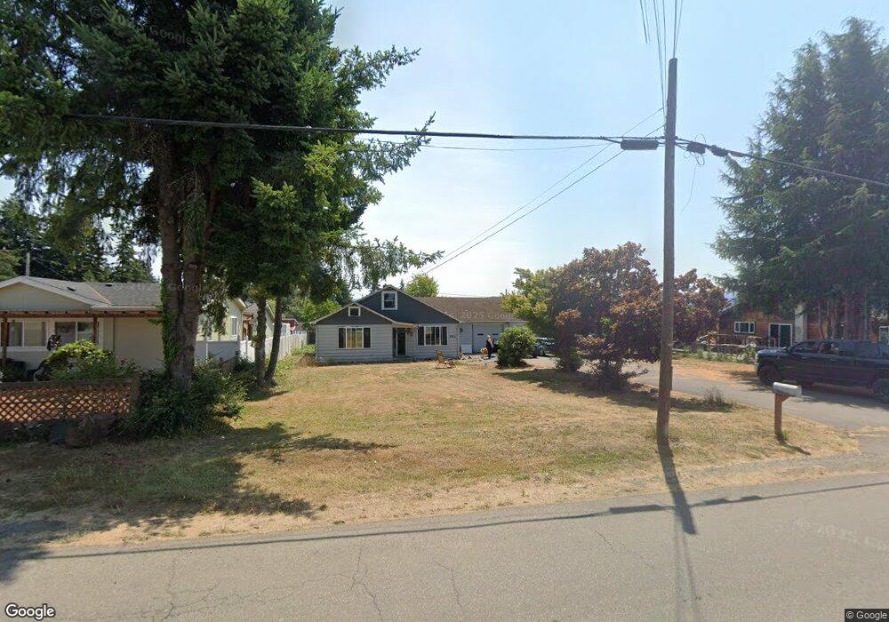
1912 Maple St Myrtle Point, OR 97458
Estimated Value: $304,709 - $322,000
3
Beds
2
Baths
1,424
Sq Ft
$220/Sq Ft
Est. Value
About This Home
This home is located at 1912 Maple St, Myrtle Point, OR 97458 and is currently estimated at $313,355, approximately $220 per square foot. 1912 Maple St is a home located in Coos County with nearby schools including Myrtle Crest School and Myrtle Point High School.
Ownership History
Date
Name
Owned For
Owner Type
Purchase Details
Closed on
Feb 9, 2023
Sold by
Desoto John A
Bought by
Desoto John A and Brelage Jenna M
Current Estimated Value
Home Financials for this Owner
Home Financials are based on the most recent Mortgage that was taken out on this home.
Original Mortgage
$162,000
Outstanding Balance
$156,705
Interest Rate
6.48%
Mortgage Type
New Conventional
Estimated Equity
$156,650
Purchase Details
Closed on
Jul 16, 2009
Sold by
Ashbaugh Philip and Ashbaugh Jennifer A
Bought by
Desoto John A and Pearce Ashley D
Home Financials for this Owner
Home Financials are based on the most recent Mortgage that was taken out on this home.
Original Mortgage
$142,857
Interest Rate
5.25%
Mortgage Type
Purchase Money Mortgage
Purchase Details
Closed on
Aug 6, 2004
Sold by
Meyer Richard David and Meyer Pamela Alice
Bought by
Ashbaugh Philip and Ashbaugh Jennifer A
Home Financials for this Owner
Home Financials are based on the most recent Mortgage that was taken out on this home.
Original Mortgage
$101,600
Interest Rate
4.13%
Mortgage Type
Purchase Money Mortgage
Create a Home Valuation Report for This Property
The Home Valuation Report is an in-depth analysis detailing your home's value as well as a comparison with similar homes in the area
Home Values in the Area
Average Home Value in this Area
Purchase History
| Date | Buyer | Sale Price | Title Company |
|---|---|---|---|
| Desoto John A | $50,000 | Ticor Title | |
| Desoto John A | $140,000 | Fidelity National Title Co | |
| Ashbaugh Philip | $127,000 | Fidelity National Title Co |
Source: Public Records
Mortgage History
| Date | Status | Borrower | Loan Amount |
|---|---|---|---|
| Open | Desoto John A | $162,000 | |
| Previous Owner | Desoto John A | $142,857 | |
| Previous Owner | Ashbaugh Philip | $101,600 | |
| Closed | Ashbaugh Philip | $12,700 |
Source: Public Records
Tax History
| Year | Tax Paid | Tax Assessment Tax Assessment Total Assessment is a certain percentage of the fair market value that is determined by local assessors to be the total taxable value of land and additions on the property. | Land | Improvement |
|---|---|---|---|---|
| 2025 | $2,785 | $168,030 | -- | -- |
| 2024 | $2,739 | $163,140 | -- | -- |
| 2023 | $2,613 | $158,390 | $0 | $0 |
| 2022 | $2,572 | $153,780 | $0 | $0 |
| 2021 | $2,506 | $149,310 | $0 | $0 |
| 2020 | $2,437 | $149,310 | $0 | $0 |
| 2019 | $2,330 | $140,750 | $0 | $0 |
| 2018 | $2,266 | $136,660 | $0 | $0 |
| 2017 | $2,207 | $132,680 | $0 | $0 |
| 2016 | $2,144 | $128,820 | $0 | $0 |
| 2015 | $1,991 | $125,070 | $0 | $0 |
| 2014 | $1,991 | $121,430 | $0 | $0 |
Source: Public Records
Map
Nearby Homes
- 1829 E Willow St
- 1932 Willow St
- 536 18th St
- 1404 Harris St
- 227 Border St
- 618/620 Spruce St
- 1211 Fairview St
- 0 Sitkum Ln Unit 300
- 1005 Maple St
- 805 C St
- 1783 View St
- 0 Roseburg Rd Unit 601
- 1715 20th St
- 1753 20th St
- 2031 Kincheloe Ln
- 1985 Roseburg Rd
- 54124 Old Broadbent Rd
- 0 Pleasant Valley Rd Unit 22531177
- 94263 Matheny Creek Ln
- 94104 Pleasant Valley Ln
Your Personal Tour Guide
Ask me questions while you tour the home.