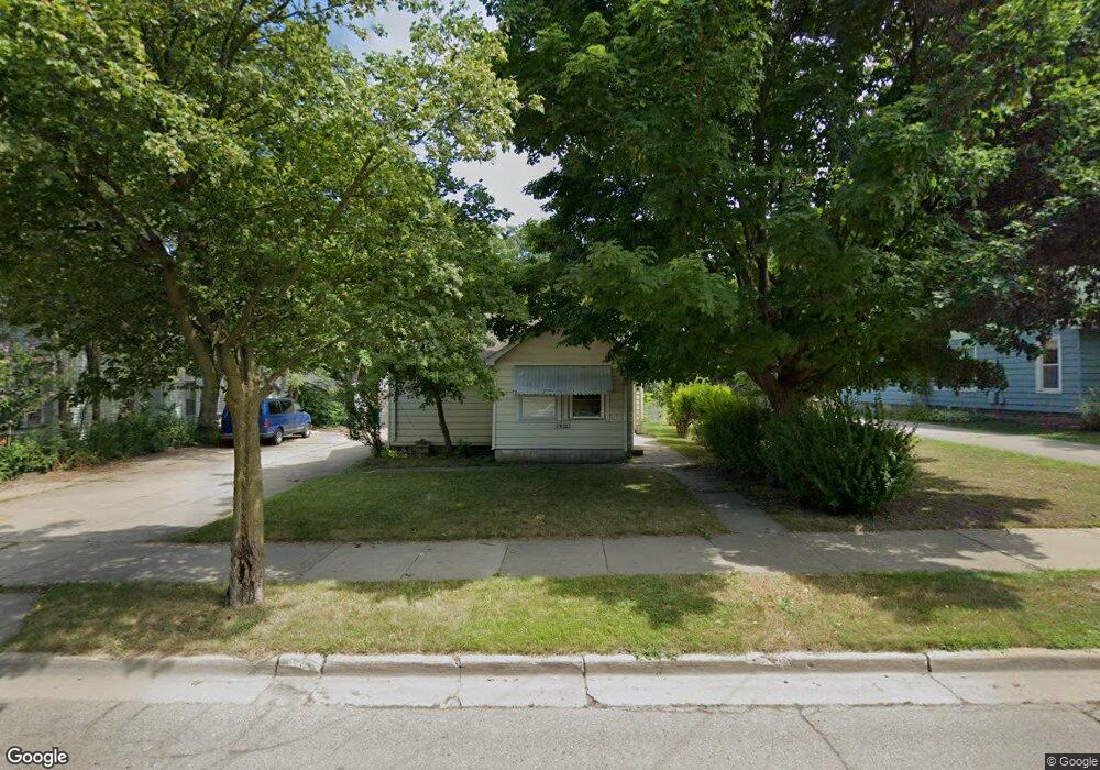
1912 N High St Lansing, MI 48906
Northtown NeighborhoodEstimated Value: $94,000 - $149,000
2
Beds
2
Baths
1,220
Sq Ft
$96/Sq Ft
Est. Value
About This Home
This home is located at 1912 N High St, Lansing, MI 48906 and is currently estimated at $117,303, approximately $96 per square foot. 1912 N High St is a home located in Ingham County with nearby schools including Gier Park School, Pattengill Academy, and Eastern High School.
Ownership History
Date
Name
Owned For
Owner Type
Purchase Details
Closed on
Jul 31, 2013
Sold by
Yerke Lawrence
Bought by
Brown Timothy
Current Estimated Value
Purchase Details
Closed on
Nov 27, 2009
Sold by
Yerke Lawrence
Bought by
Brown Timothy
Home Financials for this Owner
Home Financials are based on the most recent Mortgage that was taken out on this home.
Original Mortgage
$6,452
Interest Rate
8%
Mortgage Type
Seller Take Back
Purchase Details
Closed on
Nov 24, 2008
Sold by
Brown Timothy
Bought by
Yerke Lawrence H
Purchase Details
Closed on
Sep 24, 2007
Sold by
Norwest Mortgage Inc
Bought by
Hud
Purchase Details
Closed on
Mar 15, 2007
Sold by
Mccullem Alberta L and Mccullem Matthew D
Bought by
Norwest Mortgage Inc
Purchase Details
Closed on
Nov 1, 1994
Create a Home Valuation Report for This Property
The Home Valuation Report is an in-depth analysis detailing your home's value as well as a comparison with similar homes in the area
Home Values in the Area
Average Home Value in this Area
Purchase History
| Date | Buyer | Sale Price | Title Company |
|---|---|---|---|
| Brown Timothy | -- | None Available | |
| Brown Timothy | $6,452 | None Available | |
| Yerke Lawrence H | -- | None Available | |
| Brown Timothy | $1,500 | None Available | |
| Hud | -- | None Available | |
| Norwest Mortgage Inc | $37,264 | None Available | |
| -- | $35,000 | -- |
Source: Public Records
Mortgage History
| Date | Status | Borrower | Loan Amount |
|---|---|---|---|
| Previous Owner | Brown Timothy | $6,452 |
Source: Public Records
Tax History Compared to Growth
Tax History
| Year | Tax Paid | Tax Assessment Tax Assessment Total Assessment is a certain percentage of the fair market value that is determined by local assessors to be the total taxable value of land and additions on the property. | Land | Improvement |
|---|---|---|---|---|
| 2025 | $2,164 | $54,200 | $5,700 | $48,500 |
| 2024 | $17 | $46,100 | $5,700 | $40,400 |
| 2023 | $2,030 | $38,200 | $5,700 | $32,500 |
| 2022 | $1,833 | $34,500 | $5,900 | $28,600 |
| 2021 | $1,795 | $31,700 | $7,300 | $24,400 |
| 2020 | $1,784 | $32,300 | $7,300 | $25,000 |
| 2019 | $1,708 | $29,400 | $7,300 | $22,100 |
| 2018 | $1,603 | $28,100 | $7,300 | $20,800 |
| 2017 | $1,534 | $28,100 | $7,300 | $20,800 |
| 2016 | $1,478 | $26,300 | $7,300 | $19,000 |
| 2015 | $1,478 | $25,900 | $14,661 | $11,239 |
| 2014 | $1,478 | $25,700 | $14,661 | $11,039 |
Source: Public Records
Map
Nearby Homes
- 1016 Lake Lansing Rd
- 1810 N High St
- 1017 Whyte St
- 1624 N High St
- 0 Lake Lansing Rd Unit 289258
- 1811 Vermont Ave
- 2318 N High St
- 1613 Massachusetts Ave
- 1919 N East St
- 1530 New York Ave
- 1527 Massachusetts Ave
- 801 Banghart St
- 1415 New York Ave
- V/L (1036) N Larch St
- 1317 Illinois Ave
- 430 Pearl St
- 1141 Farrand St
- 1102 Persons Ct
- 417 Liberty St
- 2508 Gary Ave
- 1920 N High St
- 1906 N High St
- 1904 N High St
- 1900 N High St
- 1002 Lake
- 1913 New York Ave
- 1002 Lake Lansing Rd
- 1820 N High St
- 1907 New York Ave
- 1907 N High St
- 1925 New York Ave
- 1903 N High St
- 1010 Lake Lansing Rd
- 1821 N High St
- 1814 N High St
- 1923 New York Ave
- 1921 N High St
- 1913 N High St
- 1901 New York Ave
- 2003 New York Ave