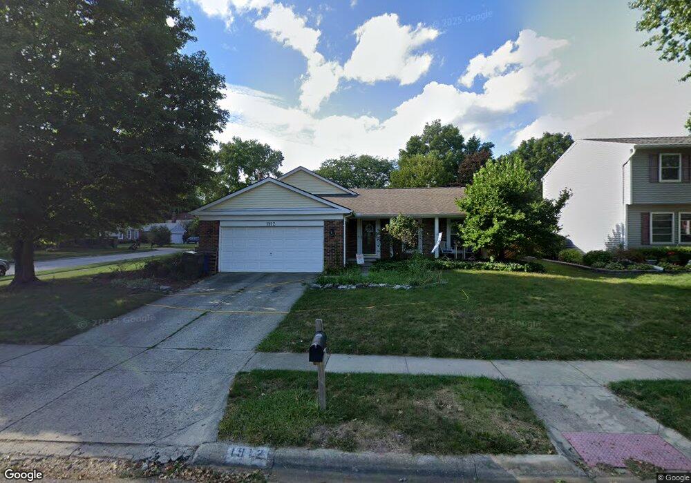
1912 Plains Blvd Powell, OH 43065
Western Hills NeighborhoodEstimated Value: $367,000 - $402,000
4
Beds
3
Baths
1,295
Sq Ft
$302/Sq Ft
Est. Value
About This Home
This home is located at 1912 Plains Blvd, Powell, OH 43065 and is currently estimated at $390,568, approximately $301 per square foot. 1912 Plains Blvd is a home located in Franklin County with nearby schools including Liberty Elementary School, McCord Middle School, and Worthington Kilbourne High School.
Ownership History
Date
Name
Owned For
Owner Type
Purchase Details
Closed on
Jun 3, 1996
Sold by
Richardson Richard D
Bought by
Seymour Green and Seymour Glenn T Seymour
Current Estimated Value
Home Financials for this Owner
Home Financials are based on the most recent Mortgage that was taken out on this home.
Original Mortgage
$116,850
Outstanding Balance
$7,459
Interest Rate
7.99%
Mortgage Type
New Conventional
Estimated Equity
$383,109
Purchase Details
Closed on
Nov 5, 1990
Purchase Details
Closed on
Oct 1, 1980
Create a Home Valuation Report for This Property
The Home Valuation Report is an in-depth analysis detailing your home's value as well as a comparison with similar homes in the area
Home Values in the Area
Average Home Value in this Area
Purchase History
| Date | Buyer | Sale Price | Title Company |
|---|---|---|---|
| Seymour Green | $123,000 | -- | |
| -- | -- | -- | |
| -- | $71,400 | -- |
Source: Public Records
Mortgage History
| Date | Status | Borrower | Loan Amount |
|---|---|---|---|
| Open | Seymour Green | $116,850 |
Source: Public Records
Tax History Compared to Growth
Tax History
| Year | Tax Paid | Tax Assessment Tax Assessment Total Assessment is a certain percentage of the fair market value that is determined by local assessors to be the total taxable value of land and additions on the property. | Land | Improvement |
|---|---|---|---|---|
| 2024 | $7,590 | $123,630 | $36,790 | $86,840 |
| 2023 | $7,258 | $123,630 | $36,790 | $86,840 |
| 2022 | $6,601 | $89,220 | $25,060 | $64,160 |
| 2021 | $6,090 | $89,220 | $25,060 | $64,160 |
| 2020 | $5,866 | $89,220 | $25,060 | $64,160 |
| 2019 | $5,387 | $73,930 | $20,900 | $53,030 |
| 2018 | $4,821 | $73,930 | $20,900 | $53,030 |
| 2017 | $4,827 | $73,930 | $20,900 | $53,030 |
| 2016 | $4,424 | $62,310 | $16,700 | $45,610 |
| 2015 | $4,425 | $62,310 | $16,700 | $45,610 |
| 2014 | $4,423 | $62,310 | $16,700 | $45,610 |
| 2013 | $2,201 | $62,300 | $16,695 | $45,605 |
Source: Public Records
Map
Nearby Homes
- 1908 Lost Valley Rd
- 8345 Smoky Row Rd Unit 8345
- 8351 Smoky Row Rd Unit 48351
- 8205 Longhorn Rd
- 7898 Sarahurst Dr
- 8266 Waco Ln
- 1949 Hamrock Dr
- 2053 Stancrest Rd
- 8594 Broadacre Dr
- 2280 Saberly Ct
- 1486 Clubview Blvd S
- 2013 Summit Row Blvd
- 2228 Gnarled Pine Dr
- 8741 Jamey Ct
- 2074 Hard Rd
- 2168 Summit Row Blvd
- 2120 Sharwood Ct
- 8796 Yates Point Ct
- 8803 Yates Point Ct
- 1399 Briarmeadow Dr
- 1904 Plains Blvd
- 8287 Highridge Dr
- 1896 Plains Blvd
- 1921 High Ridge Place
- 1913 High Ridge Place
- 1928 Plains Blvd
- 1909 Plains Blvd
- 8295 High Ridge Dr
- 1905 High Ridge Place
- 1888 Plains Blvd
- 1885 Plains Blvd
- 1930 Lost Valley Rd
- 8257 Big Horn Ct
- 1940 Plains Blvd
- 1897 High Ridge Place
- 1880 Plains Blvd
- 8264 Big Horn Ct
- 8311 Highridge Dr
- 1926 Lost Valley Rd
- 8326 Highridge Dr