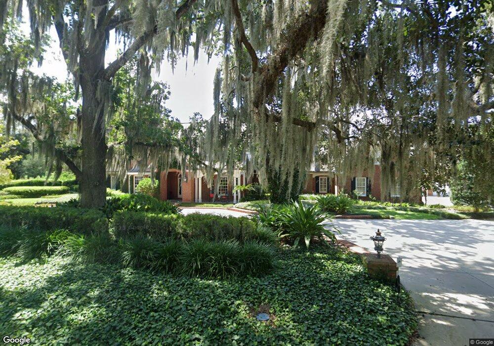
1912 SE 7th St Ocala, FL 34471
Southeast Ocala NeighborhoodEstimated Value: $1,878,000 - $4,699,000
5
Beds
8
Baths
5,983
Sq Ft
$554/Sq Ft
Est. Value
About This Home
This home is located at 1912 SE 7th St, Ocala, FL 34471 and is currently estimated at $3,312,001, approximately $553 per square foot. 1912 SE 7th St is a home located in Marion County with nearby schools including Eighth Street Elementary School, Osceola Middle School, and Forest High School.
Ownership History
Date
Name
Owned For
Owner Type
Purchase Details
Closed on
Jan 12, 2026
Sold by
Schmidt James A
Bought by
Schmidt James A and Schmidt Richard A
Current Estimated Value
Purchase Details
Closed on
Feb 22, 2011
Sold by
Boyd Roy T and Boyd Julie F
Bought by
Schmidt James A
Purchase Details
Closed on
Feb 23, 2001
Sold by
Brill Robert J and Brill Lauren L
Bought by
Boyd Roy T and Boyd Julie F
Home Financials for this Owner
Home Financials are based on the most recent Mortgage that was taken out on this home.
Original Mortgage
$1,190,000
Interest Rate
7.75%
Create a Home Valuation Report for This Property
The Home Valuation Report is an in-depth analysis detailing your home's value as well as a comparison with similar homes in the area
Home Values in the Area
Average Home Value in this Area
Purchase History
| Date | Buyer | Sale Price | Title Company |
|---|---|---|---|
| Schmidt James A | $100 | None Listed On Document | |
| Schmidt James A | $1,800,000 | Attorney | |
| Boyd Roy T | $1,700,000 | -- |
Source: Public Records
Mortgage History
| Date | Status | Borrower | Loan Amount |
|---|---|---|---|
| Previous Owner | Boyd Roy T | $1,190,000 | |
| Closed | Boyd Roy T | $250,000 |
Source: Public Records
Tax History
| Year | Tax Paid | Tax Assessment Tax Assessment Total Assessment is a certain percentage of the fair market value that is determined by local assessors to be the total taxable value of land and additions on the property. | Land | Improvement |
|---|---|---|---|---|
| 2025 | $30,035 | $1,741,017 | -- | -- |
| 2024 | $29,651 | $1,691,950 | -- | -- |
| 2023 | $28,980 | $1,642,670 | $0 | $0 |
| 2022 | $27,871 | $1,594,825 | $0 | $0 |
| 2021 | $27,893 | $1,548,374 | $0 | $0 |
| 2020 | $27,181 | $1,526,996 | $0 | $0 |
| 2019 | $26,816 | $1,492,665 | $0 | $0 |
| 2018 | $25,895 | $1,464,833 | $0 | $0 |
| 2017 | $25,765 | $1,434,704 | $0 | $0 |
| 2016 | $25,537 | $1,405,195 | $0 | $0 |
| 2015 | $25,757 | $1,395,427 | $0 | $0 |
| 2014 | $24,119 | $1,404,018 | $0 | $0 |
Source: Public Records
Map
Nearby Homes
- 2041 SE 5th St
- 1738 SE 5th St
- 1747 SE 5th St
- 1807 E Fort King St
- 0000 SE 20th Ave
- 1631 SE 17th St
- 1621 SE 17th St
- 1014 SE 13th Ave
- 1621 NE 2nd St Unit 302
- 1621 NE 2nd St Unit 101
- 1918 SE 17th St
- 2416 SE 15th St
- 1214 SE 7th St
- 2021 Twin Bridge Cir
- 2418 SE 15th St
- 1218 SE 11th St
- 1547 NE 2nd St Unit F
- 1962 Twin Bridge Cir
- 1151 SE 10th St
- 2420 SE 15th St
Your Personal Tour Guide
Ask me questions while you tour the home.