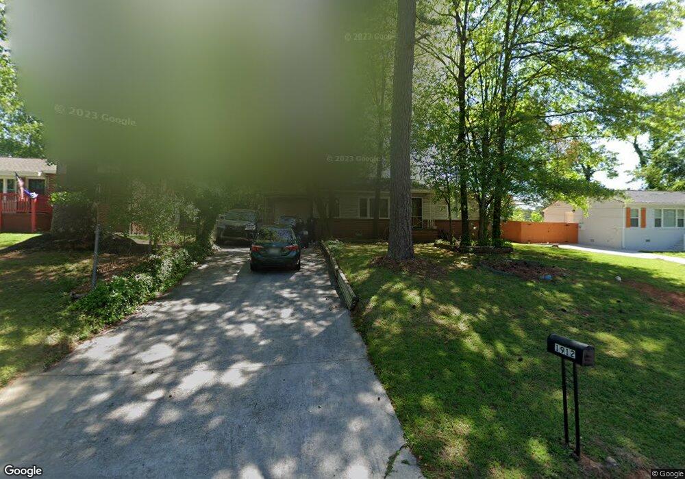
1912 Selwyn Dr Decatur, GA 30035
Southwest DeKalb NeighborhoodEstimated Value: $145,000 - $191,000
2
Beds
1
Bath
950
Sq Ft
$174/Sq Ft
Est. Value
About This Home
This home is located at 1912 Selwyn Dr, Decatur, GA 30035 and is currently estimated at $164,897, approximately $173 per square foot. 1912 Selwyn Dr is a home located in DeKalb County with nearby schools including Canby Lane Elementary School, Mary McLeod Bethune Middle School, and Towers High School.
Ownership History
Date
Name
Owned For
Owner Type
Purchase Details
Closed on
Aug 26, 1994
Sold by
Toney J Wade
Bought by
Lewis Bobby
Current Estimated Value
Home Financials for this Owner
Home Financials are based on the most recent Mortgage that was taken out on this home.
Original Mortgage
$48,318
Interest Rate
9.5%
Mortgage Type
FHA
Create a Home Valuation Report for This Property
The Home Valuation Report is an in-depth analysis detailing your home's value as well as a comparison with similar homes in the area
Home Values in the Area
Average Home Value in this Area
Purchase History
| Date | Buyer | Sale Price | Title Company |
|---|---|---|---|
| Lewis Bobby | $7,000 | -- |
Source: Public Records
Mortgage History
| Date | Status | Borrower | Loan Amount |
|---|---|---|---|
| Closed | Lewis Bobby | $48,318 |
Source: Public Records
Tax History Compared to Growth
Tax History
| Year | Tax Paid | Tax Assessment Tax Assessment Total Assessment is a certain percentage of the fair market value that is determined by local assessors to be the total taxable value of land and additions on the property. | Land | Improvement |
|---|---|---|---|---|
| 2025 | $1,878 | $66,840 | $14,000 | $52,840 |
| 2024 | $1,895 | $66,400 | $14,000 | $52,400 |
| 2023 | $1,895 | $61,440 | $14,000 | $47,440 |
| 2022 | $1,280 | $43,640 | $4,840 | $38,800 |
| 2021 | $1,033 | $32,920 | $4,840 | $28,080 |
| 2020 | $927 | $28,360 | $4,840 | $23,520 |
| 2019 | $725 | $22,640 | $4,840 | $17,800 |
| 2018 | $577 | $22,480 | $4,840 | $17,640 |
| 2017 | $678 | $20,880 | $2,360 | $18,520 |
| 2016 | $509 | $16,360 | $2,360 | $14,000 |
| 2014 | $467 | $14,880 | $2,360 | $12,520 |
Source: Public Records
Map
Nearby Homes
- 1918 Selwyn Dr
- 1906 Selwyn Dr
- 1926 Selwyn Dr
- 1900 Selwyn Dr
- 1913 Clarke Ln
- 1913 Selwyn Dr
- 1919 Selwyn Dr
- 1907 Selwyn Dr
- 1934 Selwyn Dr
- 1894 Selwyn Dr
- 1925 Selwyn Dr
- 1901 Selwyn Dr
- 1895 Clarke Ln
- 1888 Selwyn Dr Unit 2
- 1931 Selwyn Dr
- 1895 Selwyn Dr
- 4209 Sherwood Ave
- 4203 Sherwood Ave
- 1889 Clarke Ln
- 4197 Sherwood Ave