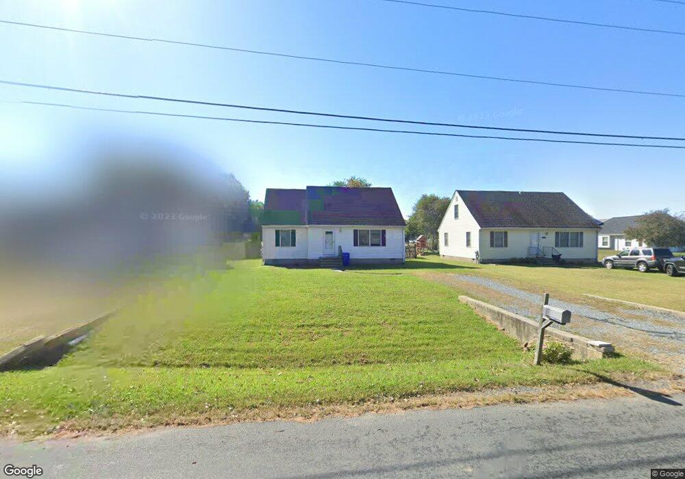
1912 Sherman Dr Chester, MD 21619
Estimated Value: $351,035 - $386,000
3
Beds
1
Bath
1,560
Sq Ft
$234/Sq Ft
Est. Value
About This Home
This home is located at 1912 Sherman Dr, Chester, MD 21619 and is currently estimated at $365,759, approximately $234 per square foot. 1912 Sherman Dr is a home located in Queen Anne's County with nearby schools including Kent Island Elementary School, Bayside Elementary School, and Matapeake Middle School.
Ownership History
Date
Name
Owned For
Owner Type
Purchase Details
Closed on
May 31, 2018
Sold by
Hill Mary Ann
Bought by
Joyner Barbara Hill
Current Estimated Value
Purchase Details
Closed on
Aug 12, 2008
Sold by
Matteau Paul T
Bought by
Hill Mary Ann
Purchase Details
Closed on
Jul 25, 2008
Sold by
Matteau Paul T
Bought by
Hill Mary Ann
Purchase Details
Closed on
Mar 21, 2006
Sold by
Hall Ronald L and Hall Mary Elizabeth
Bought by
Matteau Paul T
Home Financials for this Owner
Home Financials are based on the most recent Mortgage that was taken out on this home.
Original Mortgage
$263,400
Interest Rate
6.39%
Mortgage Type
VA
Purchase Details
Closed on
Dec 16, 2005
Sold by
Hall Ronald L and Hall Mary Elizabeth
Bought by
Matteau Paul T
Home Financials for this Owner
Home Financials are based on the most recent Mortgage that was taken out on this home.
Original Mortgage
$263,400
Interest Rate
6.39%
Mortgage Type
VA
Create a Home Valuation Report for This Property
The Home Valuation Report is an in-depth analysis detailing your home's value as well as a comparison with similar homes in the area
Home Values in the Area
Average Home Value in this Area
Purchase History
| Date | Buyer | Sale Price | Title Company |
|---|---|---|---|
| Joyner Barbara Hill | -- | None Available | |
| Hill Mary Ann | $270,000 | -- | |
| Hill Mary Ann | $270,000 | -- | |
| Matteau Paul T | $255,000 | -- | |
| Matteau Paul T | $255,000 | -- |
Source: Public Records
Mortgage History
| Date | Status | Borrower | Loan Amount |
|---|---|---|---|
| Previous Owner | Matteau Paul T | $263,400 | |
| Previous Owner | Matteau Paul T | $263,400 |
Source: Public Records
Tax History Compared to Growth
Tax History
| Year | Tax Paid | Tax Assessment Tax Assessment Total Assessment is a certain percentage of the fair market value that is determined by local assessors to be the total taxable value of land and additions on the property. | Land | Improvement |
|---|---|---|---|---|
| 2025 | $2,726 | $289,433 | $0 | $0 |
| 2024 | $2,528 | $268,367 | $0 | $0 |
| 2023 | $2,188 | $247,300 | $143,100 | $104,200 |
| 2022 | $2,165 | $244,867 | $0 | $0 |
| 2021 | $2,091 | $242,433 | $0 | $0 |
| 2020 | $2,091 | $240,000 | $140,600 | $99,400 |
| 2019 | $2,000 | $222,500 | $0 | $0 |
| 2018 | $1,897 | $205,000 | $0 | $0 |
| 2017 | $1,798 | $187,500 | $0 | $0 |
| 2016 | -- | $187,500 | $0 | $0 |
| 2015 | $1,837 | $187,500 | $0 | $0 |
| 2014 | $1,837 | $188,700 | $0 | $0 |
Source: Public Records
Map
Nearby Homes
- 1906 Harbor Dr
- 1872 Harbor Dr
- 1870 Harbor Dr
- 1903 Churchhill Ln
- 2723 Cox Neck Rd
- 1839 Harbor Dr
- 2653 Cox Neck Rd
- 7014 Bridgepointe Dr
- 224 Bayberry Dr
- 558 Cross Creek Ct
- 1757 Harbor Dr
- 204 Skipper Ln
- 326 Hanna Ct
- 124 Nauset Ln
- 306 Hanna Ct
- 135 Nauset Ln
- 306 Skipper Ln
- 419 Creeks End Ln
- 1000 Herons Nest Way Unit 32
- 1000 Herons Nest Way Unit 22
- 1914 Sherman Dr
- 1910 Sherman Dr
- 1916 Sherman Dr
- 1918 Sherman Dr
- 1911 Anchorage Dr
- 1913 Anchorage Dr
- 1915 Anchorage Dr
- 1920 Sherman Dr
- 1917 Anchorage Dr
- 1922 Sherman Dr
- 1919 Anchorage Dr
- 1921 Anchorage Dr
- 1924 Sherman Dr
- 1923 Anchorage Dr
- 1245 Shopping Center Rd
- 1912 Anchorage Dr
- 1910 Anchorage Dr
- 1 Sherman Way
- 1925 Anchorage Dr
- 1914 Anchorage Dr