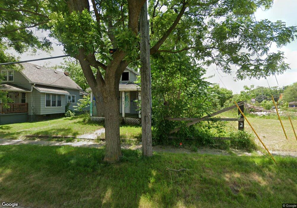
1912 Thom St Flint, MI 48506
Eastside NeighborhoodEstimated Value: $23,000 - $41,000
2
Beds
1
Bath
660
Sq Ft
$54/Sq Ft
Est. Value
About This Home
This home is located at 1912 Thom St, Flint, MI 48506 and is currently estimated at $35,797, approximately $54 per square foot. 1912 Thom St is a home located in Genesee County with nearby schools including Brownell STEM Academy, Richfield Public School Academy, and Flint Cultural Center Academy.
Ownership History
Date
Name
Owned For
Owner Type
Purchase Details
Closed on
Aug 18, 2023
Sold by
Faa Samoa Llc
Bought by
Chapman Marvin
Current Estimated Value
Purchase Details
Closed on
Nov 17, 2022
Sold by
Faa Samoa Llc
Bought by
Faa Samoa Llc
Purchase Details
Closed on
Apr 26, 2022
Sold by
Gordon Michaelle N
Bought by
Genesee County Treasurer
Purchase Details
Closed on
Oct 6, 2018
Sold by
Perkins Daniel E and Perkins Louise S
Bought by
Gordon Michaelle N
Purchase Details
Closed on
Oct 2, 2012
Sold by
Parker William J and William J Parker Trust
Bought by
Perkins Daniel E and Perkins Louise S
Purchase Details
Closed on
Feb 9, 2010
Sold by
Parker William J and William J Parker Trust
Bought by
Casselman Thomas and Casselman Carmen Cecilia Ramirez
Home Financials for this Owner
Home Financials are based on the most recent Mortgage that was taken out on this home.
Original Mortgage
$4,000
Interest Rate
8%
Mortgage Type
Seller Take Back
Create a Home Valuation Report for This Property
The Home Valuation Report is an in-depth analysis detailing your home's value as well as a comparison with similar homes in the area
Home Values in the Area
Average Home Value in this Area
Purchase History
| Date | Buyer | Sale Price | Title Company |
|---|---|---|---|
| Chapman Marvin | $5,500 | None Listed On Document | |
| Faa Samoa Llc | $600 | None Listed On Document | |
| Genesee County Treasurer | -- | -- | |
| Gordon Michaelle N | -- | None Available | |
| Perkins Daniel E | -- | None Available | |
| Perkins Daniel E | -- | None Available | |
| Casselman Thomas | $4,000 | None Available |
Source: Public Records
Mortgage History
| Date | Status | Borrower | Loan Amount |
|---|---|---|---|
| Previous Owner | Casselman Thomas | $4,000 |
Source: Public Records
Tax History
| Year | Tax Paid | Tax Assessment Tax Assessment Total Assessment is a certain percentage of the fair market value that is determined by local assessors to be the total taxable value of land and additions on the property. | Land | Improvement |
|---|---|---|---|---|
| 2025 | $694 | $6,800 | $0 | $0 |
| 2024 | $652 | $6,000 | $0 | $0 |
| 2023 | $645 | $5,700 | $0 | $0 |
| 2022 | $0 | $4,500 | $0 | $0 |
| 2021 | $470 | $4,300 | $0 | $0 |
| 2020 | $441 | $3,700 | $0 | $0 |
| 2019 | $441 | $3,600 | $0 | $0 |
| 2018 | $435 | $3,100 | $0 | $0 |
| 2017 | $428 | $0 | $0 | $0 |
| 2016 | $442 | $0 | $0 | $0 |
| 2015 | -- | $0 | $0 | $0 |
| 2014 | -- | $0 | $0 | $0 |
| 2012 | -- | $4,400 | $0 | $0 |
Source: Public Records
Map
Nearby Homes
- 1805 Montana Ave
- 1733 Oklahoma Ave
- 1730 Oklahoma Ave
- 1826 Dakota Ave
- 2217 Maryland Ave
- 1623 Montana Ave
- 1721 New York Ave
- 2506 Arlington Ave
- 1526 Montana Ave
- 1629 New York Ave
- 1518 Leith St
- 1526 Arizona Ave
- 1510 Utah Ave
- 1422 Leith St
- 1445 Maryland Ave
- 2321 Levern St
- 1805 Bennett Ave
- 1454 Delaware Ave
- 2426 Hoff St
- 2908 Douglas Ave
Your Personal Tour Guide
Ask me questions while you tour the home.