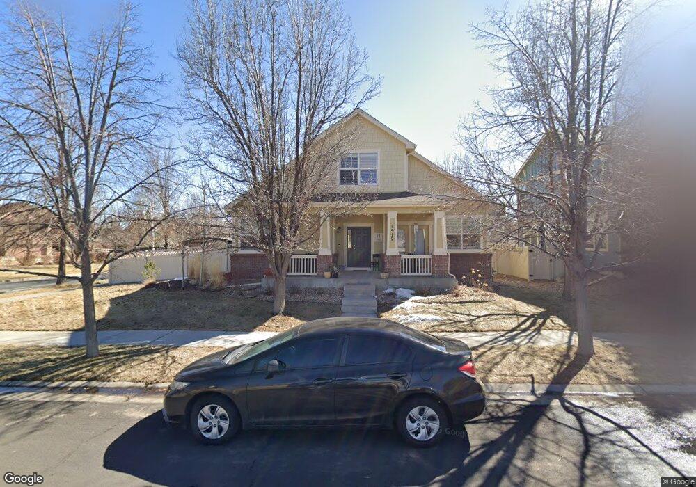
1912 W 130th Dr Denver, CO 80234
Harmony Park NeighborhoodEstimated Value: $665,874 - $787,000
4
Beds
3
Baths
2,290
Sq Ft
$320/Sq Ft
Est. Value
About This Home
This home is located at 1912 W 130th Dr, Denver, CO 80234 and is currently estimated at $733,219, approximately $320 per square foot. 1912 W 130th Dr is a home located in Adams County with nearby schools including Arapahoe Ridge Elementary School, Silver Hills Middle School, and Legacy High School.
Ownership History
Date
Name
Owned For
Owner Type
Purchase Details
Closed on
Apr 21, 2006
Sold by
Hardy David N and Hardy Elizabeth D
Bought by
Hardy David N and Hardy Elizabeth
Current Estimated Value
Home Financials for this Owner
Home Financials are based on the most recent Mortgage that was taken out on this home.
Original Mortgage
$277,600
Outstanding Balance
$159,251
Interest Rate
6.33%
Mortgage Type
Fannie Mae Freddie Mac
Estimated Equity
$573,968
Purchase Details
Closed on
Aug 15, 2003
Sold by
Lawrence Tamara and Lawrence David
Bought by
Lawrence David K and Lawrence Tamara K
Home Financials for this Owner
Home Financials are based on the most recent Mortgage that was taken out on this home.
Original Mortgage
$230,565
Interest Rate
5.35%
Mortgage Type
Unknown
Create a Home Valuation Report for This Property
The Home Valuation Report is an in-depth analysis detailing your home's value as well as a comparison with similar homes in the area
Home Values in the Area
Average Home Value in this Area
Purchase History
| Date | Buyer | Sale Price | Title Company |
|---|---|---|---|
| Hardy David N | -- | Security Title | |
| Hardy David N | $347,000 | Security Title | |
| Lawrence David K | -- | -- | |
| Lawrence Tamara | $288,207 | Land Title Guarantee Company |
Source: Public Records
Mortgage History
| Date | Status | Borrower | Loan Amount |
|---|---|---|---|
| Open | Hardy David N | $277,600 | |
| Previous Owner | Lawrence Tamara | $230,565 | |
| Closed | Lawrence Tamara | $230,565 |
Source: Public Records
Tax History Compared to Growth
Tax History
| Year | Tax Paid | Tax Assessment Tax Assessment Total Assessment is a certain percentage of the fair market value that is determined by local assessors to be the total taxable value of land and additions on the property. | Land | Improvement |
|---|---|---|---|---|
| 2024 | $4,044 | $41,630 | $9,380 | $32,250 |
| 2023 | $3,998 | $47,010 | $8,790 | $38,220 |
| 2022 | $3,509 | $35,100 | $8,690 | $26,410 |
| 2021 | $3,625 | $35,100 | $8,690 | $26,410 |
| 2020 | $3,549 | $35,020 | $8,940 | $26,080 |
| 2019 | $3,556 | $35,020 | $8,940 | $26,080 |
| 2018 | $3,293 | $31,410 | $6,550 | $24,860 |
| 2017 | $2,965 | $31,410 | $6,550 | $24,860 |
| 2016 | $2,648 | $27,230 | $5,810 | $21,420 |
| 2015 | $2,644 | $27,230 | $5,810 | $21,420 |
| 2014 | $2,392 | $23,880 | $5,090 | $18,790 |
Source: Public Records
Map
Nearby Homes
- 1872 W 130th Dr
- 12902 Harmony Pkwy
- 12920 Vallejo Cir
- 12955 Vallejo Cir
- 1813 W 131st Dr
- 1814 W 131st Dr
- 2373 Harmony Park Dr
- 13146 Raritan Ct
- 1741 W 131st Ct
- 13169 Umatilla Ct
- 13168 Wyandot St
- 13191 Umatilla St
- 13136 Alcott Place
- 860 W 132nd Ave Unit 146
- 860 W 132nd Ave Unit 44
- 860 W 132nd Ave Unit 42
- 860 W 132nd Ave Unit 229
- 2885 E Midway Blvd Unit 1309
- 2885 E Midway Blvd Unit 188
- 2885 E Midway Blvd Unit 204
- 1922 W 130th Dr
- 12991 Harmony Pkwy
- 1932 W 130th Dr
- 12981 Harmony Pkwy
- 1942 W 130th Dr
- 12980 Vallejo Cir
- 1892 W 130th Dr
- 12971 Harmony Pkwy
- 12996 Harmony Pkwy
- 12986 Harmony Pkwy
- 12961 Harmony Pkwy
- 1954 W 131st Dr
- 1934 W 131st Dr
- 1974 W 131st Dr
- 1952 W 130th Dr
- 12976 Vallejo Cir
- 1882 W 130th Dr
- 1994 W 131st Dr
- 1914 W 131st Dr
- 12976 Harmony Pkwy