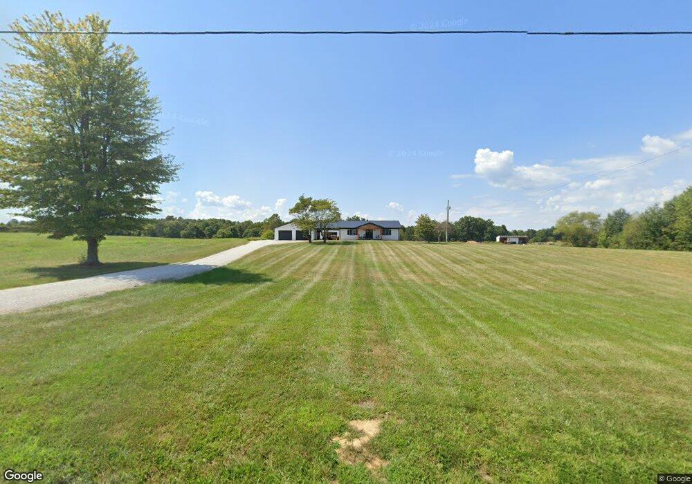
19127 E Highway 144 Union Star, KY 40171
Estimated Value: $163,000 - $455,394
3
Beds
1
Bath
1,232
Sq Ft
$271/Sq Ft
Est. Value
About This Home
This home is located at 19127 E Highway 144, Union Star, KY 40171 and is currently estimated at $334,465, approximately $271 per square foot. 19127 E Highway 144 is a home located in Breckinridge County with nearby schools including Irvington Elementary School, Breckinridge County Middle School, and Breckinridge County High School.
Ownership History
Date
Name
Owned For
Owner Type
Purchase Details
Closed on
Oct 20, 2021
Sold by
Hesler Phillip W and Hesler Deborah E
Bought by
Mccoy Christopher and Mccoy Katrina
Current Estimated Value
Home Financials for this Owner
Home Financials are based on the most recent Mortgage that was taken out on this home.
Original Mortgage
$146,269
Interest Rate
2.8%
Mortgage Type
Commercial
Purchase Details
Closed on
Jan 24, 2018
Sold by
Hesler Phillip W and Hesler Deborah E
Bought by
Hesler Phillip W and Hesler Deborah E
Home Financials for this Owner
Home Financials are based on the most recent Mortgage that was taken out on this home.
Original Mortgage
$125,000
Interest Rate
4.6%
Mortgage Type
Future Advance Clause Open End Mortgage
Create a Home Valuation Report for This Property
The Home Valuation Report is an in-depth analysis detailing your home's value as well as a comparison with similar homes in the area
Home Values in the Area
Average Home Value in this Area
Purchase History
| Date | Buyer | Sale Price | Title Company |
|---|---|---|---|
| Mccoy Christopher | $145,000 | None Available | |
| Hesler Phillip W | $127,500 | Collier Title Company Llc |
Source: Public Records
Mortgage History
| Date | Status | Borrower | Loan Amount |
|---|---|---|---|
| Closed | Mccoy Christopher | $146,269 | |
| Previous Owner | Hesler Phillip W | $125,000 |
Source: Public Records
Tax History Compared to Growth
Tax History
| Year | Tax Paid | Tax Assessment Tax Assessment Total Assessment is a certain percentage of the fair market value that is determined by local assessors to be the total taxable value of land and additions on the property. | Land | Improvement |
|---|---|---|---|---|
| 2024 | $2,182 | $238,750 | $12,750 | $226,000 |
| 2023 | $1,062 | $112,750 | $12,750 | $100,000 |
| 2022 | $814 | $84,750 | $12,750 | $72,000 |
| 2021 | $850 | $84,750 | $12,750 | $72,000 |
| 2020 | $856 | $84,750 | $12,750 | $72,000 |
| 2019 | $855 | $84,750 | $12,750 | $72,000 |
| 2018 | $472 | $83,150 | $0 | $0 |
| 2017 | $467 | $83,150 | $0 | $0 |
| 2016 | $474 | $81,150 | $11,150 | $70,000 |
| 2015 | $479 | $81,150 | $11,150 | $70,000 |
| 2013 | $412 | $75,150 | $11,150 | $64,000 |
Source: Public Records
Map
Nearby Homes
- 129 Henry Hathorne Ln
- 195 New State Rd
- 627 New State Rd
- 613 New State Rd
- 257 New State Rd
- 14792 E Highway 144
- 14792 E Hwy 144
- 1250 Arnold School Rd
- 310 Alvie Rd
- 2780 Hardesty Raymond Rd
- 150 Morgan Rd
- 0 Rhodelia Rd
- 2071 Hardesty Raymond Rd
- 3408 Rhodelia Rd
- 187 Silver Stone Ln
- 901 Williams Ln
- 660 Concordia Rd
- 225 Richardson Landing Rd
- 3015 Liberty Rd
- Lot 5 Green Valley Ranch Rd
- 19067 E Highway 144
- 19057 E Highway 144
- 19192 E Highway 144
- 19313 E Highway 144
- 2667 Popham Rd
- 2667 Popham Rd
- 18900 E Highway 144
- 19356 E Highway 144
- 19429 E Highway 144
- 2440 Popham Rd
- 18793 E Highway 144
- 19430 E Highway 144
- 19547 E Highway 144
- 2381 Popham Rd
- 19569 E Highway 144
- 19550 E Highway 144
- 19611 E Highway 144
- 15 Pat Barr Ln
- 2140 Popham Rd
- 19803 E Highway 144