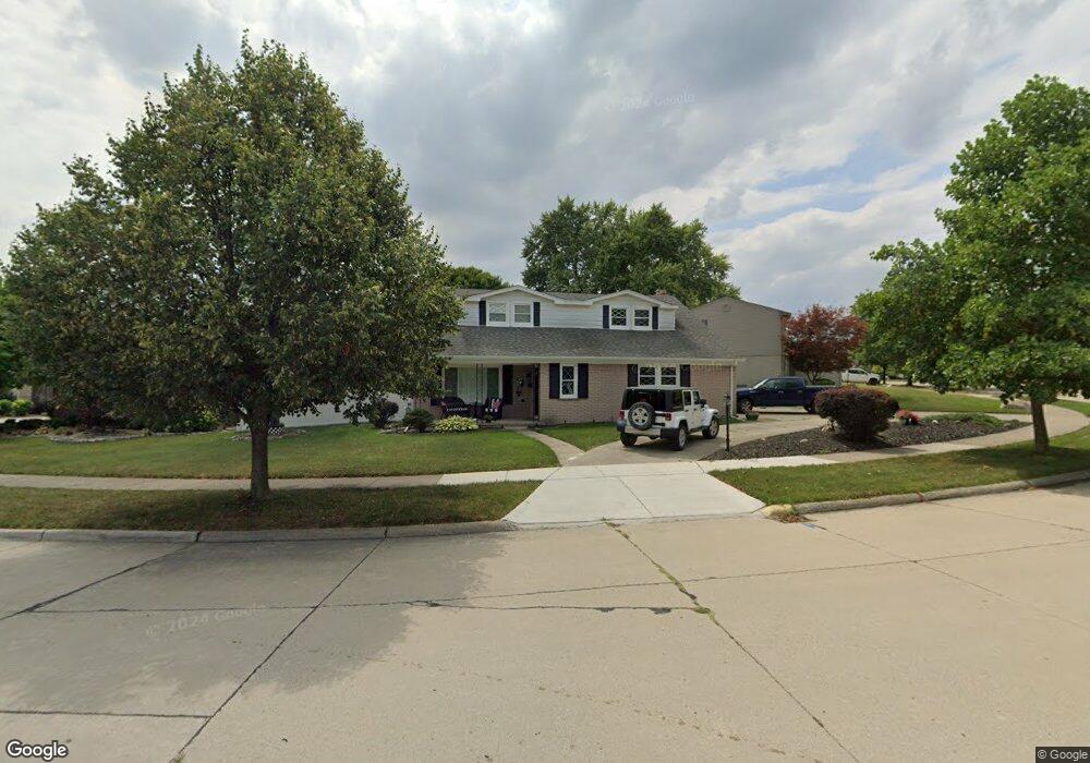
1913 Ardmore St Trenton, MI 48183
Estimated Value: $316,000 - $356,000
4
Beds
3
Baths
2,067
Sq Ft
$163/Sq Ft
Est. Value
About This Home
This home is located at 1913 Ardmore St, Trenton, MI 48183 and is currently estimated at $337,272, approximately $163 per square foot. 1913 Ardmore St is a home located in Wayne County with nearby schools including Jesse L. Anderson Elementary School, Boyd W. Arthurs Middle School, and Trenton High School.
Ownership History
Date
Name
Owned For
Owner Type
Purchase Details
Closed on
Nov 22, 2022
Sold by
Covington Karol A
Bought by
Olds Julie
Current Estimated Value
Purchase Details
Closed on
Feb 26, 2008
Sold by
Raboy Ernest and Raboy Mary
Bought by
Covington Vernon C
Create a Home Valuation Report for This Property
The Home Valuation Report is an in-depth analysis detailing your home's value as well as a comparison with similar homes in the area
Home Values in the Area
Average Home Value in this Area
Purchase History
| Date | Buyer | Sale Price | Title Company |
|---|---|---|---|
| Olds Julie | $200,000 | First American Title | |
| Covington Vernon C | $154,000 | Lawyers Title |
Source: Public Records
Tax History Compared to Growth
Tax History
| Year | Tax Paid | Tax Assessment Tax Assessment Total Assessment is a certain percentage of the fair market value that is determined by local assessors to be the total taxable value of land and additions on the property. | Land | Improvement |
|---|---|---|---|---|
| 2025 | $5,721 | $158,000 | $0 | $0 |
| 2024 | $5,721 | $144,900 | $0 | $0 |
| 2023 | $5,365 | $131,400 | $0 | $0 |
| 2022 | $5,290 | $130,300 | $0 | $0 |
| 2021 | $5,115 | $119,600 | $0 | $0 |
| 2020 | $5,171 | $118,400 | $0 | $0 |
| 2019 | $5,094 | $110,800 | $0 | $0 |
| 2018 | $3,368 | $100,600 | $0 | $0 |
| 2017 | $2,913 | $98,600 | $0 | $0 |
| 2016 | $4,544 | $96,500 | $0 | $0 |
| 2015 | $8,044 | $89,900 | $0 | $0 |
| 2013 | $7,793 | $82,500 | $0 | $0 |
| 2012 | $4,137 | $77,200 | $21,800 | $55,400 |
Source: Public Records
Map
Nearby Homes
- 2100 Fort St
- 1870 Fort St Unit 1
- 1900 Fort St Unit 3
- 2205 Glenwood St
- 2330 Cambridge St
- 2211 Parkside St
- 1590 Vernon St
- 1225 Harbour Dr Unit 28
- 2486 Edgemont St
- 2610 Gorno St
- 2387 Ashby St
- 20617 Somerset Ct
- 2330 Ashby St
- 2501 King Rd
- 2577 Edsel St
- 2657 Chelsea St
- 1659 Boxford St
- 1723 N Trenton Dr
- 2430 Middlefield Rd
- 2161 3rd St
- 1933 Ardmore St
- 1893 Ardmore St
- 1943 Ardmore St
- 2111 Gorno Ct
- 1892 Ardmore St
- 1800 Monticello St
- 1912 Ardmore St
- 1872 Ardmore St
- 1852 Ardmore St
- 1922 Ardmore St
- 2100 Gorno Ct
- 1953 Ardmore St
- 2121 Gorno Ct
- 1853 Ardmore St
- 1932 Ardmore St
- 1942 Ardmore St
- 1842 Ardmore St
- 1950 Baldwin Dr
- 1963 Ardmore St
- 1843 Ardmore St