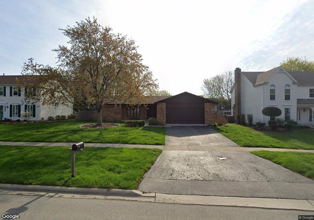
1913 Buckingham Dr Wheaton, IL 60189
Stonehedge NeighborhoodEstimated Value: $509,927 - $714,000
3
Beds
2
Baths
2,019
Sq Ft
$303/Sq Ft
Est. Value
About This Home
This home is located at 1913 Buckingham Dr, Wheaton, IL 60189 and is currently estimated at $611,482, approximately $302 per square foot. 1913 Buckingham Dr is a home located in DuPage County with nearby schools including Whittier Elementary School, Edison Middle School, and Wheaton Warrenville South High School.
Ownership History
Date
Name
Owned For
Owner Type
Purchase Details
Closed on
Jan 11, 2023
Sold by
Vandyke Darla N
Bought by
Darla N Van Dyke Trust
Current Estimated Value
Purchase Details
Closed on
Dec 6, 2004
Sold by
Vandyke Roger W and Roger W Vandyke Trust
Bought by
Vandyke Roger W and Vandyke Darla N
Purchase Details
Closed on
Jul 30, 1997
Sold by
Vandyke Roger W and Vandyke Darla N
Bought by
Vandyke Roger W and Vandyke Darla N
Purchase Details
Closed on
Mar 29, 1996
Sold by
Kay Randall Alan I and Kay Randall Sandra
Bought by
Vandyke Roger W and Vandyke Darla N
Create a Home Valuation Report for This Property
The Home Valuation Report is an in-depth analysis detailing your home's value as well as a comparison with similar homes in the area
Home Values in the Area
Average Home Value in this Area
Purchase History
| Date | Buyer | Sale Price | Title Company |
|---|---|---|---|
| Darla N Van Dyke Trust | -- | -- | |
| Vandyke Roger W | -- | -- | |
| Vandyke Roger W | -- | -- | |
| Vandyke Roger W | $224,000 | Law Title |
Source: Public Records
Tax History
| Year | Tax Paid | Tax Assessment Tax Assessment Total Assessment is a certain percentage of the fair market value that is determined by local assessors to be the total taxable value of land and additions on the property. | Land | Improvement |
|---|---|---|---|---|
| 2024 | $9,089 | $157,018 | $51,778 | $105,240 |
| 2023 | $8,686 | $144,530 | $47,660 | $96,870 |
| 2022 | $8,697 | $136,580 | $45,040 | $91,540 |
| 2021 | $8,659 | $133,340 | $43,970 | $89,370 |
| 2020 | $8,628 | $132,100 | $43,560 | $88,540 |
| 2019 | $8,420 | $128,610 | $42,410 | $86,200 |
| 2018 | $8,980 | $134,990 | $39,960 | $95,030 |
| 2017 | $8,833 | $130,010 | $38,490 | $91,520 |
| 2016 | $8,699 | $124,810 | $36,950 | $87,860 |
| 2015 | $8,613 | $119,070 | $35,250 | $83,820 |
| 2014 | $7,850 | $107,810 | $34,740 | $73,070 |
| 2013 | $7,649 | $108,130 | $34,840 | $73,290 |
Source: Public Records
Map
Nearby Homes
- 141 Loretto Ct
- 76 Somerset Cir
- 24 Winners Cup Cir Unit 3
- 30 Danada Dr
- 121 Brighton Dr
- 26W055 Cree Ln
- 1605 Burning Trail
- 1S538 Bayberry Ln
- 1601 W Wiesbrook Rd
- 1519 Foothill Dr
- Lot 1 Foothill Dr
- 1127 Hibbard Rd
- 1028 Lodalia Ct
- 2552 Weatherbee Ln
- 110 E Farnham Ln
- 1219 Golf Ln
- 1612 Stonebridge Trail
- 3S700 Delles Rd
- 1542 Castlewood Dr
- 1021 Greenwood Dr
- 1919 Buckingham Dr
- 1907 Buckingham Dr
- 1925 Buckingham Dr
- 1920 Cromwell Dr Unit 5
- 1914 Cromwell Dr
- 1908 Cromwell Dr
- 1914 Buckingham Dr
- 1920 Buckingham Dr
- 754 Brighton Dr
- 1926 Cromwell Dr
- 1908 Buckingham Dr Unit 5
- 1931 Buckingham Dr
- 1926 Buckingham Dr
- 818 Brighton Dr
- 1932 Cromwell Dr
- 1937 Buckingham Dr
- 1913 Somerset Ln
- 1913 Cromwell Dr
- 1938 Cromwell Dr
- 1907 Cromwell Dr
Your Personal Tour Guide
Ask me questions while you tour the home.