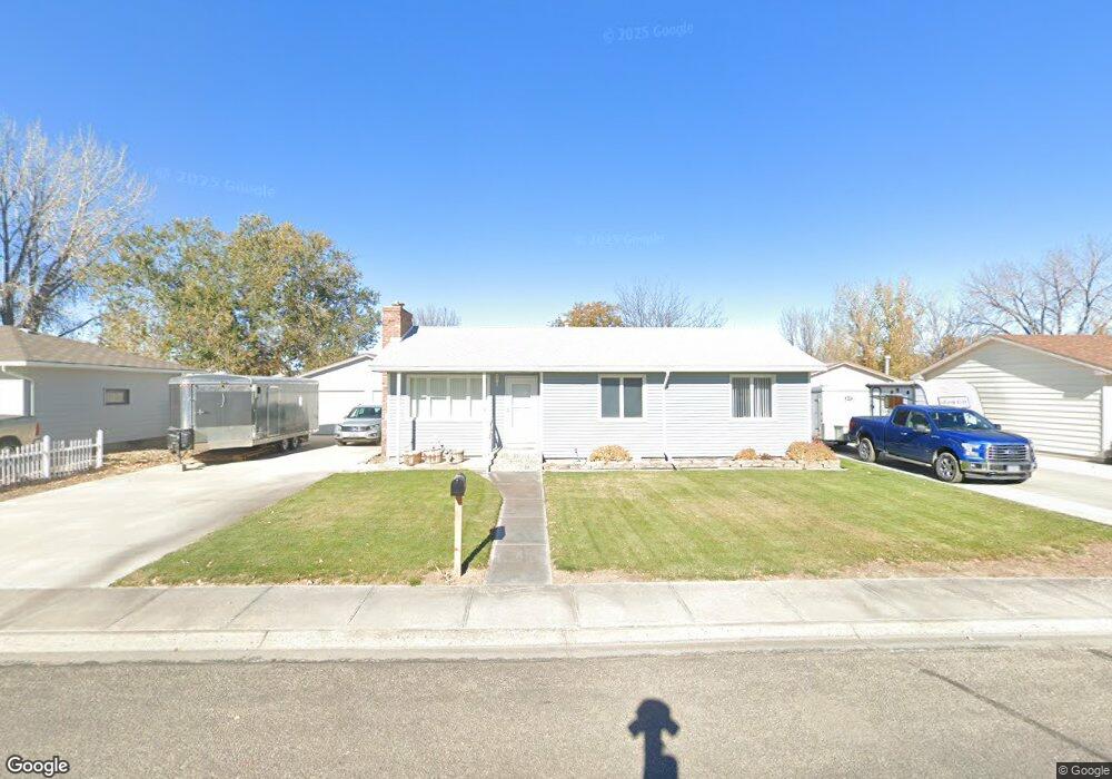
1913 Cloud Peak Dr Worland, WY 82401
Estimated Value: $201,000 - $229,000
3
Beds
1
Bath
1,146
Sq Ft
$189/Sq Ft
Est. Value
About This Home
This home is located at 1913 Cloud Peak Dr, Worland, WY 82401 and is currently estimated at $216,823, approximately $189 per square foot. 1913 Cloud Peak Dr is a home located in Washakie County with nearby schools including East Side Elementary School, South Side Elementary School, and West Side Elementary School.
Ownership History
Date
Name
Owned For
Owner Type
Purchase Details
Closed on
Apr 30, 2024
Sold by
Simonson Gregory D and Simonson Jamie
Bought by
Ben H Wight And Patricia A Wight Living Trust and Wight
Current Estimated Value
Purchase Details
Closed on
May 5, 2022
Sold by
Simonson Joe Marcus and Simonson Donna G
Bought by
Simonson Joe Marcus and Simonson Donna G
Create a Home Valuation Report for This Property
The Home Valuation Report is an in-depth analysis detailing your home's value as well as a comparison with similar homes in the area
Home Values in the Area
Average Home Value in this Area
Purchase History
| Date | Buyer | Sale Price | Title Company |
|---|---|---|---|
| Ben H Wight And Patricia A Wight Living Trust | -- | None Listed On Document | |
| Simonson Joe Marcus | -- | None Listed On Document |
Source: Public Records
Tax History Compared to Growth
Tax History
| Year | Tax Paid | Tax Assessment Tax Assessment Total Assessment is a certain percentage of the fair market value that is determined by local assessors to be the total taxable value of land and additions on the property. | Land | Improvement |
|---|---|---|---|---|
| 2025 | $1,093 | $14,353 | $2,158 | $12,195 |
| 2024 | $1,407 | $18,471 | $2,837 | $15,634 |
| 2023 | $1,296 | $20,025 | $3,421 | $16,604 |
| 2022 | $1,025 | $16,466 | $3,421 | $13,045 |
| 2021 | $944 | $15,400 | $3,421 | $11,979 |
| 2020 | $820 | $13,765 | $3,421 | $10,344 |
| 2019 | $1,228 | $16,128 | $3,421 | $12,707 |
| 2018 | $841 | $14,048 | $3,421 | $10,627 |
| 2017 | $804 | $13,564 | $3,610 | $9,954 |
| 2016 | $744 | $12,776 | $3,373 | $9,403 |
| 2015 | -- | $10,418 | $3,373 | $7,045 |
| 2014 | -- | $13,950 | $3,168 | $10,782 |
Source: Public Records
Map
Nearby Homes
- 1542 Cloud Peak Dr
- 2007 Harkins Ave
- 1701 Coburn Ave
- 225 S 22nd St
- 1301 Pulliam Ave
- 1221 Pulliam Ave
- 0 U S 16
- 408 S 16th St
- 1300 Coburn Ave
- 1205 Coburn Ave
- 2916 Columbine Ln
- 1012 Pulliam Ave
- 1015 Robertson Ave
- 107 Country Dr
- 2396 U S 20
- 2386 U S 20
- 2366 U S 20
- TBD S 23rd St
- 3017 Canyon Ridge Way
- 3017 Canyon Ridge Way
- 1907 Cloud Peak Dr
- 2001 Cloud Peak Dr
- 400 Meadowlark Ln
- 1901 Cloud Peak Dr
- 2009 Cloud Peak Dr
- 2002 Cloud Peak Dr
- 1902 Cloud Peak Dr
- 406 Meadowlark Ln
- 1900 Cloud Peak Dr
- 2017 Cloud Peak Dr
- 1845 Cloud Peak Dr
- 2000 Circle Rd
- 2008 Circle Rd
- 401 Meadowlark Ln
- 1908 Circle Rd
- 2022 Cloud Peak Dr
- 2016 Circle Rd
- 1829 Cloud Peak Dr
- 1900 Circle Rd
- 2101 Cloud Peak Dr