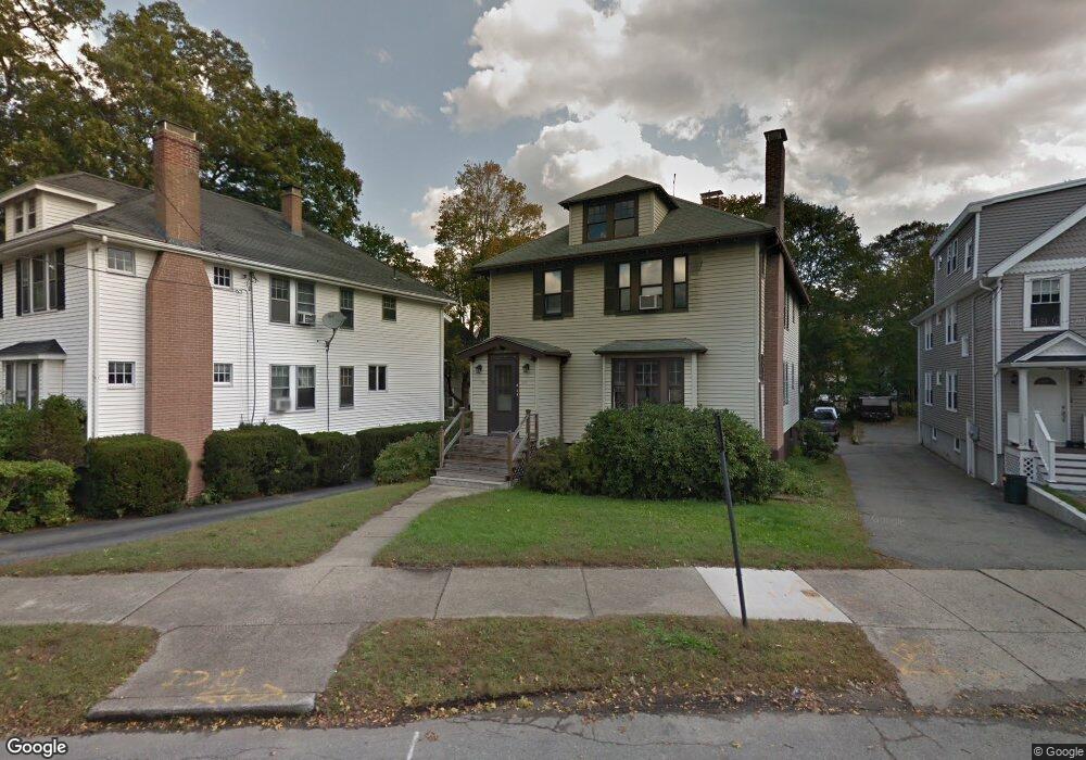
1913 Commonwealth Ave Unit 1915 Auburndale, MA 02466
Auburndale NeighborhoodEstimated Value: $1,235,000 - $1,537,602
4
Beds
2
Baths
2,464
Sq Ft
$556/Sq Ft
Est. Value
About This Home
This home is located at 1913 Commonwealth Ave Unit 1915, Auburndale, MA 02466 and is currently estimated at $1,370,401, approximately $556 per square foot. 1913 Commonwealth Ave Unit 1915 is a home located in Middlesex County with nearby schools including Williams Elementary School, Charles E Brown Middle School, and Newton South High School.
Ownership History
Date
Name
Owned For
Owner Type
Purchase Details
Closed on
Jan 21, 1997
Sold by
Glovsky Ellen R
Bought by
Skinner Paul A
Current Estimated Value
Home Financials for this Owner
Home Financials are based on the most recent Mortgage that was taken out on this home.
Original Mortgage
$223,200
Interest Rate
7.36%
Mortgage Type
Purchase Money Mortgage
Create a Home Valuation Report for This Property
The Home Valuation Report is an in-depth analysis detailing your home's value as well as a comparison with similar homes in the area
Home Values in the Area
Average Home Value in this Area
Purchase History
| Date | Buyer | Sale Price | Title Company |
|---|---|---|---|
| Skinner Paul A | $279,000 | -- |
Source: Public Records
Mortgage History
| Date | Status | Borrower | Loan Amount |
|---|---|---|---|
| Open | Skinner Paul A | $240,000 | |
| Closed | Skinner Paul A | $223,200 |
Source: Public Records
Tax History Compared to Growth
Tax History
| Year | Tax Paid | Tax Assessment Tax Assessment Total Assessment is a certain percentage of the fair market value that is determined by local assessors to be the total taxable value of land and additions on the property. | Land | Improvement |
|---|---|---|---|---|
| 2025 | $10,606 | $1,082,200 | $720,300 | $361,900 |
| 2024 | $10,255 | $1,050,700 | $699,300 | $351,400 |
| 2023 | $9,829 | $965,500 | $561,200 | $404,300 |
| 2022 | $9,405 | $894,000 | $519,600 | $374,400 |
| 2021 | $8,825 | $820,200 | $476,700 | $343,500 |
| 2020 | $8,563 | $820,200 | $476,700 | $343,500 |
| 2019 | $8,010 | $766,500 | $445,500 | $321,000 |
| 2018 | $7,898 | $729,900 | $421,000 | $308,900 |
| 2017 | $7,446 | $669,600 | $386,200 | $283,400 |
| 2016 | $6,991 | $614,300 | $354,300 | $260,000 |
| 2015 | $6,665 | $574,100 | $331,100 | $243,000 |
Source: Public Records
Map
Nearby Homes
- 13 Weir St
- 51 Bourne St
- 17 Gilbert St
- 1639 Washington St
- 62-64 Rowe St Unit B
- 226 Auburn St Unit 226
- 224 Auburn St Unit 224
- 224 Auburn St Unit A
- 0 Duncan Rd Unit 72925240
- 17 Crescent St
- 10 Crescent St Unit 1
- 10 Crescent St Unit 2
- 283 Woodland Rd
- 1754 Washington St
- 1488 Washington St Unit 1488
- 160 Pine St Unit 12
- 283 Melrose St
- 17 Lasell St
- 90 Auburndale Ave
- 2202 Commonwealth Ave Unit 2
- 1909 Commonwealth Ave Unit 1911
- 1917 Commonwealth Ave Unit 1919
- 1917 Commonwealth Ave Unit 1917
- 1917 Commonwealth Ave Unit 1
- 1919 Commonwealth Ave Unit 1919
- 1905 Commonwealth Ave
- 1905 Commonwealth Ave Unit 2
- 1905 Commonwealth Ave Unit 2
- 1903 Commonwealth Ave Unit Ave
- 1903 Commonwealth Ave
- 1903 Commonwealth Ave Unit 2
- 1903 Commonwealth Ave Unit 1
- 25 Normandy Rd Unit 27
- 10 Auburn Terrace
- 27 Normandy Rd
- 1921 Commonwealth Ave
- 26-28 Normandy Rd Unit 2
- 26 Normandy Rd Unit 28
- 26 Normandy Rd Unit 2
- 26 Normandy Rd Unit 1