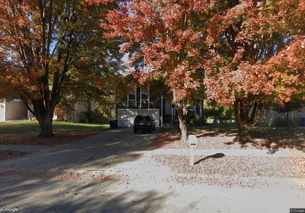
1913 Current St Liberty, MO 64068
Estimated Value: $287,000 - $302,000
3
Beds
2
Baths
1,248
Sq Ft
$236/Sq Ft
Est. Value
About This Home
This home is located at 1913 Current St, Liberty, MO 64068 and is currently estimated at $294,540, approximately $236 per square foot. 1913 Current St is a home located in Clay County with nearby schools including Lillian Schumacher Elementary School, Liberty Middle School, and Liberty High School.
Ownership History
Date
Name
Owned For
Owner Type
Purchase Details
Closed on
Jun 30, 2025
Sold by
Merrill Detlef J and Merrill Alisha
Bought by
Blunt Clayton and Blunt Miranda
Current Estimated Value
Home Financials for this Owner
Home Financials are based on the most recent Mortgage that was taken out on this home.
Original Mortgage
$321,772
Outstanding Balance
$321,223
Interest Rate
6.81%
Mortgage Type
VA
Estimated Equity
-$26,683
Purchase Details
Closed on
Dec 1, 2023
Sold by
Taylor Michael J and Taylor Leah G
Bought by
Merrill Detlef J and Merrill Alisha
Home Financials for this Owner
Home Financials are based on the most recent Mortgage that was taken out on this home.
Original Mortgage
$215,000
Interest Rate
7.63%
Mortgage Type
New Conventional
Purchase Details
Closed on
May 5, 1999
Sold by
Hudson Darrell
Bought by
Taylor Michael J and Taylor Leah G
Home Financials for this Owner
Home Financials are based on the most recent Mortgage that was taken out on this home.
Original Mortgage
$126,000
Interest Rate
6.99%
Mortgage Type
VA
Create a Home Valuation Report for This Property
The Home Valuation Report is an in-depth analysis detailing your home's value as well as a comparison with similar homes in the area
Purchase History
| Date | Buyer | Sale Price | Title Company |
|---|---|---|---|
| Blunt Clayton | -- | Alliance Title | |
| Merrill Detlef J | -- | Alliance Title | |
| Taylor Michael J | -- | United Title Company |
Source: Public Records
Mortgage History
| Date | Status | Borrower | Loan Amount |
|---|---|---|---|
| Open | Blunt Clayton | $321,772 | |
| Previous Owner | Merrill Detlef J | $215,000 | |
| Previous Owner | Taylor Michael J | $126,000 |
Source: Public Records
Tax History
| Year | Tax Paid | Tax Assessment Tax Assessment Total Assessment is a certain percentage of the fair market value that is determined by local assessors to be the total taxable value of land and additions on the property. | Land | Improvement |
|---|---|---|---|---|
| 2025 | $2,699 | $40,320 | -- | -- |
| 2024 | $2,699 | $35,090 | -- | -- |
| 2023 | $2,745 | $35,090 | $0 | $0 |
| 2022 | $2,375 | $29,980 | $0 | $0 |
| 2021 | $2,356 | $29,982 | $6,650 | $23,332 |
| 2020 | $2,140 | $25,570 | $0 | $0 |
| 2019 | $2,140 | $25,574 | $4,940 | $20,634 |
| 2018 | $1,988 | $23,330 | $0 | $0 |
| 2017 | $1,970 | $23,330 | $3,990 | $19,340 |
| 2016 | $1,970 | $23,330 | $3,990 | $19,340 |
| 2015 | $1,970 | $23,330 | $3,990 | $19,340 |
| 2014 | $1,901 | $22,330 | $3,990 | $18,340 |
Source: Public Records
Map
Nearby Homes
- 1877 Chickadee Dr
- 939 Goldfinch Ln
- 1846 Mallard Dr
- 900 Shiloh Ct
- 2218 Liberty Landing Rd
- 1628 Magnolia Ave
- 2600 Magnolia Ave
- 1200 Silverleaf Ct
- 1172 White Oak Ln
- 1059 Fir Ln
- 653 Butternut Ct
- 1026 Jasmine Dr
- 1022 Jasmine Dr
- 1015 Poplar Ln
- 1007 Poplar Ln
- 1955 Birmingham Rd
- 1027 Fir Ln
- 1020 Poplar Ln
- 988 Poplar Ln
- 1015 Fir Ln
- 1909 Current St
- 1917 Current St
- 1905 Current St
- 1921 Current St
- 1912 Current St
- 1908 Current St
- 1916 Current St
- 1901 Current St
- 1904 Current St
- 1925 Current St
- 1900 Current St
- 1897 Current St
- 1929 Current St
- 1106 Current Place
- 1930 Current St
- 1883 Mourning Dove Dr
- 1890 Current St
- 1907 Clay Dr
- 1893 Current St
- 1933 Current St