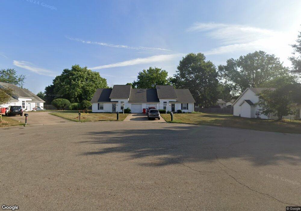
1913 Eastbranch Cir NE Canton, OH 44705
Plain Township NeighborhoodEstimated Value: $238,000 - $292,000
4
Beds
4
Baths
2,548
Sq Ft
$105/Sq Ft
Est. Value
About This Home
This home is located at 1913 Eastbranch Cir NE, Canton, OH 44705 and is currently estimated at $267,221, approximately $104 per square foot. 1913 Eastbranch Cir NE is a home located in Stark County with nearby schools including Ransom H. Barr Elementary School, Glenwood Intermediate School, and GlenOak High School.
Ownership History
Date
Name
Owned For
Owner Type
Purchase Details
Closed on
Nov 23, 2021
Sold by
Countryside Service Company Llc
Bought by
22 Degrees East Llc
Current Estimated Value
Home Financials for this Owner
Home Financials are based on the most recent Mortgage that was taken out on this home.
Original Mortgage
$392,000
Outstanding Balance
$359,697
Interest Rate
3.09%
Mortgage Type
Future Advance Clause Open End Mortgage
Estimated Equity
-$92,476
Purchase Details
Closed on
Jul 1, 2015
Sold by
Lazaroff Tommy and Lazaroff Eldora
Bought by
Country Service Company Llc
Purchase Details
Closed on
May 28, 2008
Sold by
Lazaroff Tommy
Bought by
Lazaroff Tommy and Lazaroff Eldora
Create a Home Valuation Report for This Property
The Home Valuation Report is an in-depth analysis detailing your home's value as well as a comparison with similar homes in the area
Home Values in the Area
Average Home Value in this Area
Purchase History
| Date | Buyer | Sale Price | Title Company |
|---|---|---|---|
| 22 Degrees East Llc | $392,000 | None Available | |
| Country Service Company Llc | $438,000 | Attorney | |
| Lazaroff Tommy | -- | Patriot Title Agency Inc |
Source: Public Records
Mortgage History
| Date | Status | Borrower | Loan Amount |
|---|---|---|---|
| Open | 22 Degrees East Llc | $392,000 |
Source: Public Records
Tax History Compared to Growth
Tax History
| Year | Tax Paid | Tax Assessment Tax Assessment Total Assessment is a certain percentage of the fair market value that is determined by local assessors to be the total taxable value of land and additions on the property. | Land | Improvement |
|---|---|---|---|---|
| 2025 | -- | $86,210 | $17,920 | $68,290 |
| 2024 | -- | $86,210 | $17,920 | $68,290 |
| 2023 | $2,835 | $59,500 | $10,990 | $48,510 |
| 2022 | $2,842 | $59,500 | $10,990 | $48,510 |
| 2021 | $2,855 | $59,500 | $10,990 | $48,510 |
| 2020 | $2,646 | $50,130 | $9,490 | $40,640 |
| 2019 | $2,626 | $50,130 | $9,490 | $40,640 |
| 2018 | $2,602 | $50,130 | $9,490 | $40,640 |
| 2017 | $2,679 | $47,500 | $11,060 | $36,440 |
| 2016 | $2,921 | $51,660 | $11,060 | $40,600 |
| 2015 | $2,826 | $51,660 | $11,060 | $40,600 |
| 2014 | $570 | $45,920 | $10,710 | $35,210 |
| 2013 | $1,251 | $45,920 | $10,710 | $35,210 |
Source: Public Records
Map
Nearby Homes
- 1912 40th St NE
- 4015 Pelham St NE Unit 3A
- 2333 Ivy Way St NE
- 1624 34th St NE
- 4402 Dalbury Ave NE Unit 9E
- 1227 33rd St NE
- 3022 Taft Ave NE
- 3321 Martindale Rd NE
- 3305 Regent Ave NE
- 2538 Ironstone St NE
- 1331 Spangler St NE
- 2823 Columbus Rd NE
- 815 44th St NE
- 1233 29th St NE
- 000 Rowland Ave NE
- 1638 Warrick Place NE
- 2806 33rd St NE
- 2216 49th St NE
- 1202 28th St NE
- 1321 Warrick Place NE
- 1915 Eastbranch Cir NE
- 1907 Eastbranch Cir NE
- 1923 Eastbranch Cir NE
- 1914 38th St NE
- 1925 Eastbranch Cir NE
- 1900 38th St NE
- 1918 38th St NE
- 1906 Eastbranch Cir NE
- 1904 Eastbranch Cir NE
- 1924 38th St NE
- 1918 Eastbranch Cir NE
- 1933 Eastbranch Cir NE
- 1933 1935 Eastbranch Cir NE
- 1920 Eastbranch Cir NE Unit 2
- 1912 Eastbranch Cir NE
- 1910 Eastbranch Cir NE
- 1930 38th St NE
- 1928 Eastbranch Cir NE
- 1926 Eastbranch Cir NE
- 1940 38th St NE