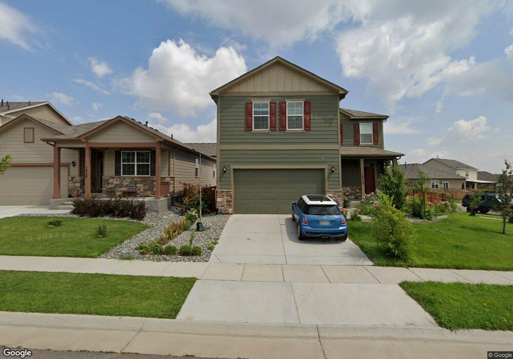
1913 Opal Ave Lochbuie, CO 80603
Estimated Value: $487,372 - $519,000
4
Beds
3
Baths
2,064
Sq Ft
$245/Sq Ft
Est. Value
About This Home
This home is located at 1913 Opal Ave, Lochbuie, CO 80603 and is currently estimated at $506,093, approximately $245 per square foot. 1913 Opal Ave is a home located in Weld County with nearby schools including Weld Central Senior High School, Bromley East Charter School, and Foundations Academy.
Ownership History
Date
Name
Owned For
Owner Type
Purchase Details
Closed on
Jul 7, 2022
Sold by
George Karaparambil
Bought by
Csh Property One Llc
Current Estimated Value
Purchase Details
Closed on
Dec 31, 2018
Sold by
Karaparambil George
Bought by
Princy Karaparambil George and Princy Elenjikkal Peter Alphonsa
Home Financials for this Owner
Home Financials are based on the most recent Mortgage that was taken out on this home.
Original Mortgage
$326,944
Interest Rate
4.8%
Mortgage Type
New Conventional
Create a Home Valuation Report for This Property
The Home Valuation Report is an in-depth analysis detailing your home's value as well as a comparison with similar homes in the area
Home Values in the Area
Average Home Value in this Area
Purchase History
| Date | Buyer | Sale Price | Title Company |
|---|---|---|---|
| Csh Property One Llc | $535,000 | None Listed On Document | |
| Princy Karaparambil George | -- | Heritage Title Co | |
| Karaparambil George | $346,944 | Heritage Title Co |
Source: Public Records
Mortgage History
| Date | Status | Borrower | Loan Amount |
|---|---|---|---|
| Previous Owner | Karaparambil George | $326,944 |
Source: Public Records
Tax History Compared to Growth
Tax History
| Year | Tax Paid | Tax Assessment Tax Assessment Total Assessment is a certain percentage of the fair market value that is determined by local assessors to be the total taxable value of land and additions on the property. | Land | Improvement |
|---|---|---|---|---|
| 2025 | $4,381 | $29,620 | $7,810 | $21,810 |
| 2024 | $4,381 | $29,620 | $7,810 | $21,810 |
| 2023 | $4,264 | $34,060 | $8,120 | $25,940 |
| 2022 | $3,406 | $25,500 | $4,520 | $20,980 |
| 2021 | $3,565 | $26,240 | $4,650 | $21,590 |
| 2020 | $3,105 | $23,610 | $3,220 | $20,390 |
| 2019 | $3,248 | $23,610 | $3,220 | $20,390 |
| 2018 | $6 | $10 | $10 | $0 |
| 2017 | $6 | $10 | $10 | $0 |
| 2016 | $6 | $10 | $10 | $0 |
| 2015 | $6 | $10 | $10 | $0 |
| 2014 | $6 | $10 | $10 | $0 |
Source: Public Records
Map
Nearby Homes
- 1977 Opal Ave
- 713 Indigo St
- 1032 Cable St
- 1790 Jade Ave
- 603 Jewel St
- 2328 Ruby Ave
- 412 Iron St
- 252 Firestone Cir
- 277 Jewel St
- 269 Jewel St
- 1688 Aquamarine Dr
- 1580 Plata St
- 1554 Plata St
- 982 Tallus St
- 1528 Plata St
- 972 Tallus St
- LARK Plan at Silver Peaks
- Edmon Plan at Silver Peaks
- Hennessy Plan at Silver Peaks
- Adair Plan at Silver Peaks