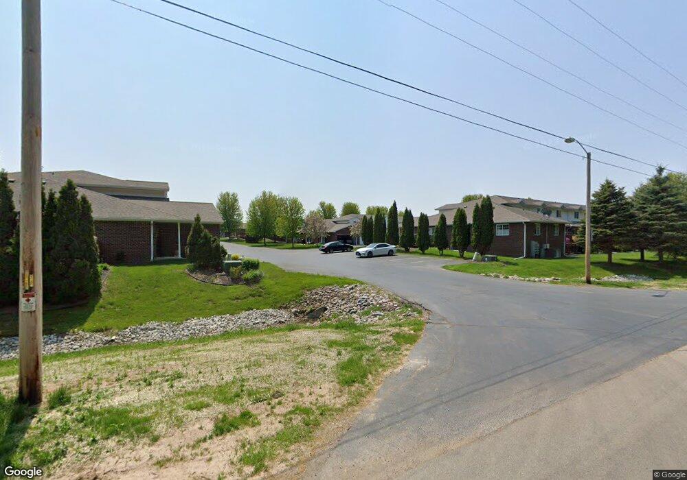
1913 Riverside Dr Unit H Suamico, WI 54313
Estimated Value: $237,000 - $285,000
2
Beds
2
Baths
1,320
Sq Ft
$200/Sq Ft
Est. Value
About This Home
This home is located at 1913 Riverside Dr Unit H, Suamico, WI 54313 and is currently estimated at $264,514, approximately $200 per square foot. 1913 Riverside Dr Unit H is a home located in Brown County with nearby schools including Suamico Elementary School, Lineville Intermediate School, and Bay View Middle School.
Ownership History
Date
Name
Owned For
Owner Type
Purchase Details
Closed on
Oct 8, 2020
Sold by
Plant Tim J La
Bought by
Bernklau Timothy M and Bernklau Danette S
Current Estimated Value
Home Financials for this Owner
Home Financials are based on the most recent Mortgage that was taken out on this home.
Original Mortgage
$60,000
Outstanding Balance
$41,269
Interest Rate
2.9%
Mortgage Type
New Conventional
Estimated Equity
$223,245
Purchase Details
Closed on
Feb 15, 2006
Sold by
Meyernik Esther M
Bought by
Tomalak Todd A and Tomalak Sarah M
Home Financials for this Owner
Home Financials are based on the most recent Mortgage that was taken out on this home.
Original Mortgage
$132,000
Interest Rate
6.22%
Mortgage Type
Fannie Mae Freddie Mac
Purchase Details
Closed on
Sep 2, 2005
Sold by
Whirtington Estates Inc
Bought by
Heling Daniel L
Home Financials for this Owner
Home Financials are based on the most recent Mortgage that was taken out on this home.
Original Mortgage
$106,875
Interest Rate
5.89%
Mortgage Type
Fannie Mae Freddie Mac
Purchase Details
Closed on
Aug 26, 2005
Sold by
Whirthington Estates Inc
Bought by
Griepentrog Chad E
Home Financials for this Owner
Home Financials are based on the most recent Mortgage that was taken out on this home.
Original Mortgage
$106,875
Interest Rate
5.89%
Mortgage Type
Fannie Mae Freddie Mac
Purchase Details
Closed on
May 27, 2005
Sold by
Whirthington Estates Inc
Bought by
Cleereman Tara M
Home Financials for this Owner
Home Financials are based on the most recent Mortgage that was taken out on this home.
Original Mortgage
$107,068
Interest Rate
5.91%
Mortgage Type
Fannie Mae Freddie Mac
Purchase Details
Closed on
Dec 3, 2004
Sold by
Whirthington Estates Inc
Bought by
Meyerink Esther M
Home Financials for this Owner
Home Financials are based on the most recent Mortgage that was taken out on this home.
Original Mortgage
$103,900
Interest Rate
5.71%
Mortgage Type
Unknown
Create a Home Valuation Report for This Property
The Home Valuation Report is an in-depth analysis detailing your home's value as well as a comparison with similar homes in the area
Home Values in the Area
Average Home Value in this Area
Purchase History
| Date | Buyer | Sale Price | Title Company |
|---|---|---|---|
| Bernklau Timothy M | $190,000 | Bay Title & Abstract Inc | |
| Tomalak Todd A | $142,000 | Liberty Title | |
| Heling Daniel L | $112,500 | Bay Title & Abstract Inc | |
| Griepentrog Chad E | $112,500 | Bay Title & Abstract Inc | |
| Cleereman Tara M | $110,400 | Bay Title & Abstract Inc | |
| Meyerink Esther M | $129,900 | Bay Title & Abstract Inc |
Source: Public Records
Mortgage History
| Date | Status | Borrower | Loan Amount |
|---|---|---|---|
| Open | Bernklau Timothy M | $60,000 | |
| Previous Owner | Tomalak Todd A | $132,000 | |
| Previous Owner | Heling Daniel L | $106,875 | |
| Previous Owner | Griepentrog Chad E | $99,000 | |
| Previous Owner | Cleereman Tara M | $107,068 | |
| Previous Owner | Meyerink Esther M | $103,900 |
Source: Public Records
Tax History
| Year | Tax Paid | Tax Assessment Tax Assessment Total Assessment is a certain percentage of the fair market value that is determined by local assessors to be the total taxable value of land and additions on the property. | Land | Improvement |
|---|---|---|---|---|
| 2025 | $3,319 | $274,200 | $27,000 | $247,200 |
| 2024 | $3,154 | $181,200 | $18,600 | $162,600 |
| 2023 | $3,088 | $181,200 | $18,600 | $162,600 |
| 2022 | $3,050 | $181,200 | $18,600 | $162,600 |
| 2021 | $2,880 | $181,200 | $18,600 | $162,600 |
| 2020 | $2,946 | $181,200 | $18,600 | $162,600 |
| 2019 | $2,541 | $129,100 | $15,500 | $113,600 |
| 2018 | $2,455 | $129,100 | $15,500 | $113,600 |
| 2017 | $2,425 | $129,100 | $15,500 | $113,600 |
| 2016 | $2,337 | $129,100 | $15,500 | $113,600 |
| 2015 | $2,398 | $129,100 | $15,500 | $113,600 |
| 2014 | $2,390 | $129,100 | $15,500 | $113,600 |
| 2013 | $2,390 | $129,100 | $15,500 | $113,600 |
Source: Public Records
Map
Nearby Homes
- 1926 River Hill Ct
- 1968 Trenton Ln
- 2055 S Tanager Ln
- 0 Harbor Cove Ln
- 3175 Lakeview Dr
- 0 Maple Grove Unit 50315677
- 0 Maple Grove Unit 50315674
- 0 Maple Grove Unit 50315676
- 2664 Chambers Crossing
- 1429 Harbor Lights Rd
- 2623 Chambers Crossing
- 1253 Riverside Dr
- 2503 Wilding Way
- 2801 Meadow Flower Ln
- 0 Sunset Beach Rd
- 2753 Summerset Cir
- 1980 Lost Trail
- 2150 Lost Trail
- 0 Lost Trail Unit 50313993
- 2192 E Deerfield Ave
- 1915 Riverside Dr Unit H
- 1915 Riverside Dr Unit G
- 1915 Riverside Dr Unit E
- 1915 Riverside Dr Unit D
- 1915 Riverside Dr Unit C
- 1915 Riverside Dr Unit B
- 1915 Riverside Dr Unit A
- 1913 Riverside Dr Unit G
- 1913 Riverside Dr Unit F
- 1913 Riverside Dr Unit E
- 1913 Riverside Dr Unit D
- 1913 Riverside Dr Unit C
- 1913 Riverside Dr Unit B
- 1913 Riverside Dr Unit A
- 1909 Riverside Dr Unit J
- 1909 Riverside Dr Unit I
- 1909 Riverside Dr Unit H
- 1909 Riverside Dr Unit G
- 1909 Riverside Dr Unit F
- 1909 Riverside Dr Unit E
Your Personal Tour Guide
Ask me questions while you tour the home.