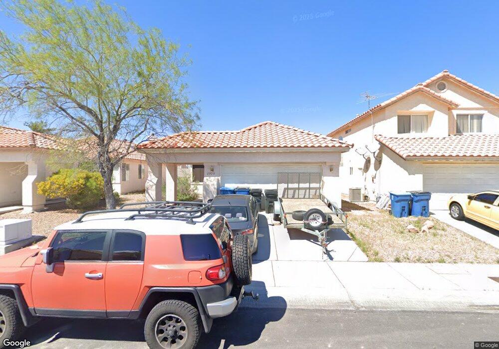
1913 Spangle Dr Las Vegas, NV 89108
Michael Way NeighborhoodEstimated Value: $375,205 - $406,000
3
Beds
2
Baths
1,468
Sq Ft
$266/Sq Ft
Est. Value
About This Home
This home is located at 1913 Spangle Dr, Las Vegas, NV 89108 and is currently estimated at $390,301, approximately $265 per square foot. 1913 Spangle Dr is a home located in Clark County with nearby schools including Lilly & Wing Fong Elementary School, J. Harold Brinley Middle School, and Western High School.
Ownership History
Date
Name
Owned For
Owner Type
Purchase Details
Closed on
Mar 8, 2006
Sold by
Shepard Jason and Boyer Charlene
Bought by
Shepard Jason L and Shepard Charlene M
Current Estimated Value
Home Financials for this Owner
Home Financials are based on the most recent Mortgage that was taken out on this home.
Original Mortgage
$181,000
Outstanding Balance
$7,694
Interest Rate
6.08%
Mortgage Type
New Conventional
Estimated Equity
$382,607
Purchase Details
Closed on
Oct 28, 1998
Sold by
Cortez Catherine M
Bought by
Shepard Jason and Boyer Charlene
Home Financials for this Owner
Home Financials are based on the most recent Mortgage that was taken out on this home.
Original Mortgage
$123,364
Interest Rate
6.61%
Mortgage Type
FHA
Create a Home Valuation Report for This Property
The Home Valuation Report is an in-depth analysis detailing your home's value as well as a comparison with similar homes in the area
Home Values in the Area
Average Home Value in this Area
Purchase History
| Date | Buyer | Sale Price | Title Company |
|---|---|---|---|
| Shepard Jason L | -- | Lawyers Title Of Nevada | |
| Shepard Jason | $125,000 | First American Title Co | |
| Cortez Catherine M | -- | First American Title Co |
Source: Public Records
Mortgage History
| Date | Status | Borrower | Loan Amount |
|---|---|---|---|
| Open | Shepard Jason L | $181,000 | |
| Closed | Cortez Catherine M | $123,364 |
Source: Public Records
Tax History Compared to Growth
Tax History
| Year | Tax Paid | Tax Assessment Tax Assessment Total Assessment is a certain percentage of the fair market value that is determined by local assessors to be the total taxable value of land and additions on the property. | Land | Improvement |
|---|---|---|---|---|
| 2025 | $998 | $73,228 | $26,250 | $46,978 |
| 2024 | $969 | $73,228 | $26,250 | $46,978 |
| 2023 | $781 | $71,802 | $26,950 | $44,852 |
| 2022 | $941 | $64,531 | $23,450 | $41,081 |
| 2021 | $914 | $60,637 | $21,350 | $39,287 |
| 2020 | $884 | $59,098 | $19,950 | $39,148 |
| 2019 | $873 | $54,917 | $16,100 | $38,817 |
| 2018 | $833 | $49,607 | $12,250 | $37,357 |
| 2017 | $1,643 | $50,132 | $12,250 | $37,882 |
| 2016 | $781 | $45,152 | $8,750 | $36,402 |
| 2015 | $779 | $33,294 | $5,950 | $27,344 |
| 2014 | $756 | $22,369 | $4,900 | $17,469 |
Source: Public Records
Map
Nearby Homes
- 6520 Lombard Dr
- 1814 Marathon Dr
- 6400 Starcrest Dr
- 1816 N Torrey Pines Dr
- 6633 Gazelle Dr
- 1900 N Torrey Pines Dr Unit 212
- 1900 N Torrey Pines Dr Unit 223
- 6380 Blue Twilight Ct
- 1713 Amboy Dr
- 2040 Willowbury Dr Unit C
- 2028 Bavington Dr Unit A
- 1704 Kismet Cir
- 2108 Willowbury Dr Unit B
- 1701 Goodrich Cir
- 1624 N Torrey Pines Dr Unit 104
- 1608 N Torrey Pines Dr Unit 103
- 1624 N Torrey Pines Dr Unit 101
- 2124 Willowbury Dr Unit D
- 1630 Harvest Pecan Ct
- 2121 Chertsey Dr Unit D
- 1909 Spangle Dr
- 1917 Spangle Dr
- 1905 Spangle Dr
- 1912 Betsy Ross Dr
- 1908 Betsy Ross Dr
- 1916 Betsy Ross Dr
- 1901 Spangle Dr
- 1904 Betsy Ross Dr
- 1912 Spangle Dr
- 1908 Spangle Dr
- 1916 Spangle Dr
- 1900 Betsy Ross Dr
- 6512 Lombard Dr
- 6516 Lombard Dr
- 1857 Spangle Dr
- 6508 Lombard Dr
- 1904 Spangle Dr
- 6504 Lombard Dr
- 6524 Lombard Dr
- 1856 Betsy Ross Dr