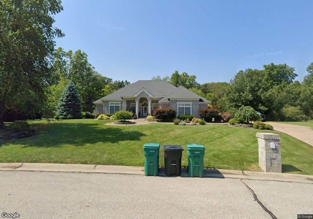
1913 Windcrest Dr O Fallon, IL 62269
Estimated Value: $796,433 - $944,000
4
Beds
4
Baths
2,740
Sq Ft
$313/Sq Ft
Est. Value
About This Home
This home is located at 1913 Windcrest Dr, O Fallon, IL 62269 and is currently estimated at $856,858, approximately $312 per square foot. 1913 Windcrest Dr is a home located in St. Clair County with nearby schools including Moye Elementary School, Fulton Junior High School, and O'Fallon Township High School.
Ownership History
Date
Name
Owned For
Owner Type
Purchase Details
Closed on
Jun 18, 2009
Sold by
Meise Brothers Construction Co Inc
Bought by
Sharp Tevis M
Current Estimated Value
Home Financials for this Owner
Home Financials are based on the most recent Mortgage that was taken out on this home.
Original Mortgage
$417,000
Outstanding Balance
$264,601
Interest Rate
4.85%
Mortgage Type
Purchase Money Mortgage
Estimated Equity
$592,257
Create a Home Valuation Report for This Property
The Home Valuation Report is an in-depth analysis detailing your home's value as well as a comparison with similar homes in the area
Home Values in the Area
Average Home Value in this Area
Purchase History
| Date | Buyer | Sale Price | Title Company |
|---|---|---|---|
| Sharp Tevis M | $629,000 | Professional Title Insurance |
Source: Public Records
Mortgage History
| Date | Status | Borrower | Loan Amount |
|---|---|---|---|
| Open | Sharp Tevis M | $417,000 |
Source: Public Records
Tax History
| Year | Tax Paid | Tax Assessment Tax Assessment Total Assessment is a certain percentage of the fair market value that is determined by local assessors to be the total taxable value of land and additions on the property. | Land | Improvement |
|---|---|---|---|---|
| 2024 | $17,597 | $257,097 | $44,754 | $212,343 |
| 2023 | $16,397 | $227,479 | $39,598 | $187,881 |
| 2022 | $15,122 | $207,145 | $38,809 | $168,336 |
| 2021 | $14,663 | $196,607 | $36,835 | $159,772 |
| 2020 | $14,541 | $186,237 | $34,892 | $151,345 |
| 2019 | $14,204 | $186,237 | $34,892 | $151,345 |
| 2018 | $13,314 | $173,936 | $38,426 | $135,510 |
| 2017 | $13,062 | $166,879 | $36,867 | $130,012 |
| 2016 | $12,947 | $163,112 | $36,035 | $127,077 |
| 2014 | $12,591 | $169,041 | $48,661 | $120,380 |
| 2013 | $12,604 | $172,157 | $49,558 | $122,599 |
Source: Public Records
Map
Nearby Homes
- 1821 Orr Ln
- 319 Bethel Meadows Rd
- 678 Prato Ct
- 7001 Lockmann Rd
- 1128 Pisa Dr
- 191 Belmont Rd
- 420 S Aurora St
- 1012 Crooked Stick Dr
- 1029 Summer Ln
- 1240 Pausch Rd Unit 6.65 ac
- 1240 Pausch Rd
- 718 Osborn Dr
- 910 Portland Ave
- 427 Valley Ln
- 121 S Seminary St
- 1202 State St
- 1309 Coleridge Ct
- 4 Cedar Point
- 700 Thoreau Dr
- 305 Forest Oaks Dr
- 1917 Windcrest Dr
- 508 Willow Bend Ln
- 1820 Orr Ln
- 1806 Orr Ln
- 1825 Orr Ln
- 1831 Orr Ln
- 1826 Orr Ln
- 1814 Orr Ln
- 1905 Windcrest Dr
- 1916 Windcrest Dr
- 1901 Windcrest Dr
- 1900 Windcrest Dr
- 404 Willow Bend Ln
- 1909 Birchfield Ct
- 505 Willow Bend Ln
- 1912 Birchfield Ct
- 409 Willow Bend Ln
- 405 Willow Bend Ln
- 512 Willow Bend Ln
- 400 Willow Bend Ln
Your Personal Tour Guide
Ask me questions while you tour the home.