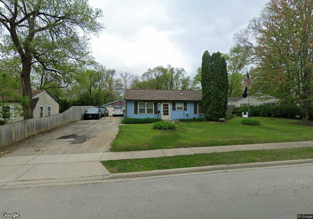
1914 Cowing Ln Crest Hill, IL 60403
Cunningham NeighborhoodEstimated Value: $183,275 - $245,000
--
Bed
--
Bath
--
Sq Ft
10,019
Sq Ft Lot
About This Home
This home is located at 1914 Cowing Ln, Crest Hill, IL 60403 and is currently estimated at $216,569. 1914 Cowing Ln is a home located in Will County with nearby schools including Chaney Elementary School, Lockport Township High School East, and Cathedral Of St Raymond School.
Ownership History
Date
Name
Owned For
Owner Type
Purchase Details
Closed on
Oct 22, 2025
Sold by
Hendricks Nicholas H and Hendricks Pam
Bought by
Hendricks Trust and Hendricks
Current Estimated Value
Purchase Details
Closed on
Apr 4, 1995
Sold by
Hud
Bought by
Hendricks Nicholas H and Hendricks Pam
Home Financials for this Owner
Home Financials are based on the most recent Mortgage that was taken out on this home.
Original Mortgage
$57,450
Interest Rate
8.43%
Purchase Details
Closed on
Jul 18, 1994
Sold by
Waszak Chester L
Bought by
Hud
Create a Home Valuation Report for This Property
The Home Valuation Report is an in-depth analysis detailing your home's value as well as a comparison with similar homes in the area
Home Values in the Area
Average Home Value in this Area
Purchase History
| Date | Buyer | Sale Price | Title Company |
|---|---|---|---|
| Hendricks Trust | -- | None Listed On Document | |
| Hendricks Nicholas H | -- | Greater Illinois Title Co | |
| Hud | -- | -- |
Source: Public Records
Mortgage History
| Date | Status | Borrower | Loan Amount |
|---|---|---|---|
| Previous Owner | Hendricks Nicholas H | $57,450 |
Source: Public Records
Tax History Compared to Growth
Tax History
| Year | Tax Paid | Tax Assessment Tax Assessment Total Assessment is a certain percentage of the fair market value that is determined by local assessors to be the total taxable value of land and additions on the property. | Land | Improvement |
|---|---|---|---|---|
| 2024 | $3,814 | $56,505 | $20,496 | $36,009 |
| 2023 | $3,814 | $50,727 | $18,400 | $32,327 |
| 2022 | $3,245 | $44,148 | $16,014 | $28,134 |
| 2021 | $3,061 | $41,488 | $15,049 | $26,439 |
| 2020 | $2,986 | $40,124 | $14,554 | $25,570 |
| 2019 | $2,813 | $38,032 | $13,795 | $24,237 |
| 2018 | $2,541 | $34,181 | $12,398 | $21,783 |
| 2017 | $2,433 | $32,268 | $11,704 | $20,564 |
| 2016 | $2,240 | $30,242 | $10,969 | $19,273 |
| 2015 | -- | $28,775 | $10,437 | $18,338 |
| 2014 | -- | $26,892 | $9,754 | $17,138 |
| 2013 | -- | $28,012 | $10,160 | $17,852 |
Source: Public Records
Map
Nearby Homes
- 1922 Cowing Ln
- 1905 Innercircle Dr
- 1817 Kelly Ave
- 1901 Wilcox St
- 1618 Innercircle Dr
- 1621 Innercircle Dr Unit 1
- 1609 Marlboro Ln
- 1514 Hosmer St
- 521 Chaney Ave
- 1310 Harvest Dr
- 513 Chaney Ave
- 1425 Frederick St
- Vacant Heiden Ave
- 1339 Harvest Dr
- 1616 Heiden Ave
- 1822 Barthelone Ave
- 1204 Boston Ave
- 901 Norley Ave
- 1429 Berta Dr Unit 2W
- 1400 Berta Dr
- 1912 Cowing Ln Unit 2
- 1916 Cowing Ln
- 1910 Cowing Ln
- 1918 Cowing Ln
- 1923 Cowing Ln
- 1908 Cowing Ln
- 1921 Cowing Ln
- 1925 Cowing Ln
- 1919 Cowing Ln
- 1927 Cowing Ln
- 1859 Waverly Ct
- 1906 Cowing Ln
- 1917 Cowing Ln
- 1920 Cowing Ln
- 1929 Cowing Ln
- 1860 Waverly Ct
- 1913 Cowing Ln
- 1857 Waverly Ct
- 1931 Cowing Ln
- 1904 Cowing Ln