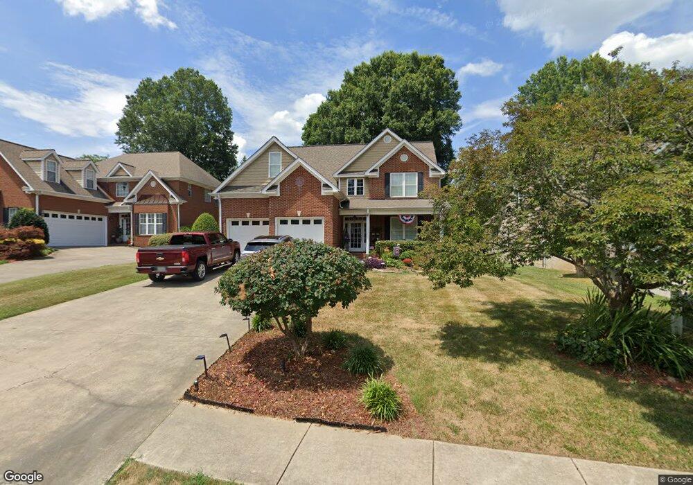
1914 Keystone Way Dalton, GA 30720
Estimated Value: $441,389 - $533,000
3
Beds
3
Baths
2,587
Sq Ft
$187/Sq Ft
Est. Value
About This Home
This home is located at 1914 Keystone Way, Dalton, GA 30720 and is currently estimated at $484,597, approximately $187 per square foot. 1914 Keystone Way is a home located in Whitfield County with nearby schools including Brookwood Elementary School, Dalton Middle School, and Dalton High School.
Ownership History
Date
Name
Owned For
Owner Type
Purchase Details
Closed on
Apr 6, 2009
Sold by
Mcentire Joseph
Bought by
Griffin Raymond C
Current Estimated Value
Purchase Details
Closed on
Aug 8, 2008
Sold by
Not Provided
Bought by
Griffin Raymond C
Purchase Details
Closed on
Jul 31, 2008
Sold by
Robert L Mcentire Fam L
Bought by
Mcentire Joseph Chadwick
Purchase Details
Closed on
May 10, 2007
Sold by
Parrott Deforest
Bought by
Robert L Mcentire Fam Lp
Purchase Details
Closed on
Jul 23, 2004
Sold by
Hollis & Hollis Development Co
Bought by
Parrott Deforest and Parrott Eugenia K
Purchase Details
Closed on
Sep 18, 2003
Sold by
Wilding Development Group Llc
Bought by
Hollis & Hollis Development Company Llc
Create a Home Valuation Report for This Property
The Home Valuation Report is an in-depth analysis detailing your home's value as well as a comparison with similar homes in the area
Home Values in the Area
Average Home Value in this Area
Purchase History
| Date | Buyer | Sale Price | Title Company |
|---|---|---|---|
| Griffin Raymond C | $305,000 | -- | |
| Griffin Raymond C | -- | -- | |
| Mcentire Joseph Chadwick | $304,853 | -- | |
| Robert L Mcentire Fam Lp | $305,500 | -- | |
| Parrott Deforest | $349,000 | -- | |
| Hollis & Hollis Development Company Llc | $55,000 | -- |
Source: Public Records
Tax History Compared to Growth
Tax History
| Year | Tax Paid | Tax Assessment Tax Assessment Total Assessment is a certain percentage of the fair market value that is determined by local assessors to be the total taxable value of land and additions on the property. | Land | Improvement |
|---|---|---|---|---|
| 2024 | $1,534 | $176,749 | $22,000 | $154,749 |
| 2023 | $1,534 | $130,403 | $21,200 | $109,203 |
| 2022 | $2,190 | $115,104 | $21,200 | $93,904 |
| 2021 | $2,193 | $115,104 | $21,200 | $93,904 |
| 2020 | $2,307 | $115,104 | $21,200 | $93,904 |
| 2019 | $2,388 | $115,104 | $21,200 | $93,904 |
| 2018 | $2,439 | $115,104 | $21,200 | $93,904 |
| 2017 | $3,861 | $115,104 | $21,200 | $93,904 |
| 2016 | $3,458 | $103,406 | $18,000 | $85,406 |
| 2014 | $3,184 | $103,406 | $18,000 | $85,406 |
| 2013 | -- | $103,406 | $18,000 | $85,406 |
Source: Public Records
Map
Nearby Homes
- 1709 Dug Gap Rd
- 1506 Summer Gate Way
- 1506 Summer Gate Way Unit 8
- 1922 Fairfield Dr
- 1704 Southmont Dr
- 1482 Mineral Springs Rd
- 1498 Mineral Springs Rd
- 1913 Tara Place
- 1934 Spring Chase Way
- 1608 Ryman Ridge Rd
- 0 Horizon Ct Unit 130497
- 0 Horizon Ct Unit 130499
- 0 Horizon Ct Unit 130479
- 0 Horizon Ct Unit 130477
- 0 Horizon Ct Unit 130478
- 0 Horizon Ct Unit 130496
- 0 Horizon Ct Unit 130498
- 00 Rio Vista Dr
- 1504 Belmont Dr
- 1123 Ridgeleigh Cir
- 1912 Keystone Way
- 1916 Keystone Way
- 1910 Keystone Way
- 1918 Keystone Way
- 1915 Keystone Way
- 1920 Keystone Way
- 1908 Keystone Way
- 1913 Keystone Way
- 1917 Keystone Way
- 0 Keystone Way
- 1911 Keystone Way
- LOT 18 Keystone Way
- LOT 2 Keystone Way
- LOT 11 Keystone Way
- 1919 Keystone Way
- 1906 Keystone Way
- 1907 Keystone Way
- 1904 Keystone Way
- 710 Hackney Dr
- 712 Hackney Dr