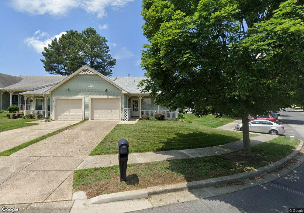
1914 Marconi Cir Annapolis, MD 21401
Parole NeighborhoodEstimated Value: $447,000 - $473,000
Studio
2
Baths
1,434
Sq Ft
$322/Sq Ft
Est. Value
About This Home
This home is located at 1914 Marconi Cir, Annapolis, MD 21401 and is currently estimated at $461,645, approximately $321 per square foot. 1914 Marconi Cir is a home located in Anne Arundel County with nearby schools including Rolling Knolls Elementary School, Wiley H. Bates Middle School, and Annapolis High School.
Ownership History
Date
Name
Owned For
Owner Type
Purchase Details
Closed on
Jan 27, 2005
Sold by
Mizell Esther
Bought by
Donahue Mary P
Current Estimated Value
Home Financials for this Owner
Home Financials are based on the most recent Mortgage that was taken out on this home.
Original Mortgage
$243,920
Outstanding Balance
$126,985
Interest Rate
6.12%
Mortgage Type
Adjustable Rate Mortgage/ARM
Estimated Equity
$334,660
Purchase Details
Closed on
Feb 3, 1995
Sold by
Hasson Joanne C
Bought by
Mizell Esther Trust
Purchase Details
Closed on
Aug 25, 1988
Sold by
U S Homes Corp
Bought by
Hasson Joanne C
Create a Home Valuation Report for This Property
The Home Valuation Report is an in-depth analysis detailing your home's value as well as a comparison with similar homes in the area
Home Values in the Area
Average Home Value in this Area
Purchase History
| Date | Buyer | Sale Price | Title Company |
|---|---|---|---|
| Donahue Mary P | $304,900 | -- | |
| Mizell Esther Trust | $142,500 | -- | |
| Hasson Joanne C | $125,000 | -- |
Source: Public Records
Mortgage History
| Date | Status | Borrower | Loan Amount |
|---|---|---|---|
| Open | Donahue Mary P | $243,920 | |
| Closed | Donahue Mary P | $60,980 |
Source: Public Records
Tax History
| Year | Tax Paid | Tax Assessment Tax Assessment Total Assessment is a certain percentage of the fair market value that is determined by local assessors to be the total taxable value of land and additions on the property. | Land | Improvement |
|---|---|---|---|---|
| 2025 | $3,579 | $356,667 | -- | -- |
| 2024 | $3,579 | $333,633 | $0 | $0 |
| 2023 | $3,465 | $310,600 | $160,000 | $150,600 |
| 2022 | $3,239 | $305,867 | $0 | $0 |
| 2020 | $3,090 | $296,400 | $140,000 | $156,400 |
| 2019 | $3,026 | $279,133 | $0 | $0 |
| 2018 | $2,655 | $261,867 | $0 | $0 |
| 2017 | $2,824 | $244,600 | $0 | $0 |
| 2016 | -- | $240,967 | $0 | $0 |
| 2015 | -- | $237,333 | $0 | $0 |
| 2014 | -- | $233,700 | $0 | $0 |
Source: Public Records
Map
Nearby Homes
- 926 Perry Landing Ct
- 1984 Marconi Cir
- 2510 Painter Ct
- 1943 Marconi Cir
- 1955 Marconi Cir
- 2568 Forest Knoll
- 1010 Mastline Dr
- 2568 Glen Cove
- 950 Heather Way
- 2731 Yeomans Lantern Ct
- 940 Astern Way Unit 309
- 930 Astern Way Unit 512
- 930 Astern Way Unit 405
- 932 Riversedge Cir
- 92 Clifford Blvd
- 2828 Berth Ct
- 905 Scupper Ct
- 810 Midship Ct
- 1907 Mackiebeth Ct
- 704 Roane Hollow Ln
- 1912 Marconi Cir
- 1910 Marconi Cir
- 1908 Marconi Cir
- 1916 Marconi Cir
- 1906 Marconi Cir
- 1918 Marconi Cir
- 2543 Painter Ct
- 1904 Marconi Cir
- 1920 Marconi Cir
- 2513 Tudo Ct
- 2515 Tudo Ct
- 2541 Painter Ct
- 1902 Marconi Cir
- 1922 Marconi Cir
- 2517 Tudo Ct
- 1907 Marconi Cir
- 1905 Marconi Cir
- 2519 Tudo Ct
- 1903 Marconi Cir
- 2539 Painter Ct
Your Personal Tour Guide
Ask me questions while you tour the home.