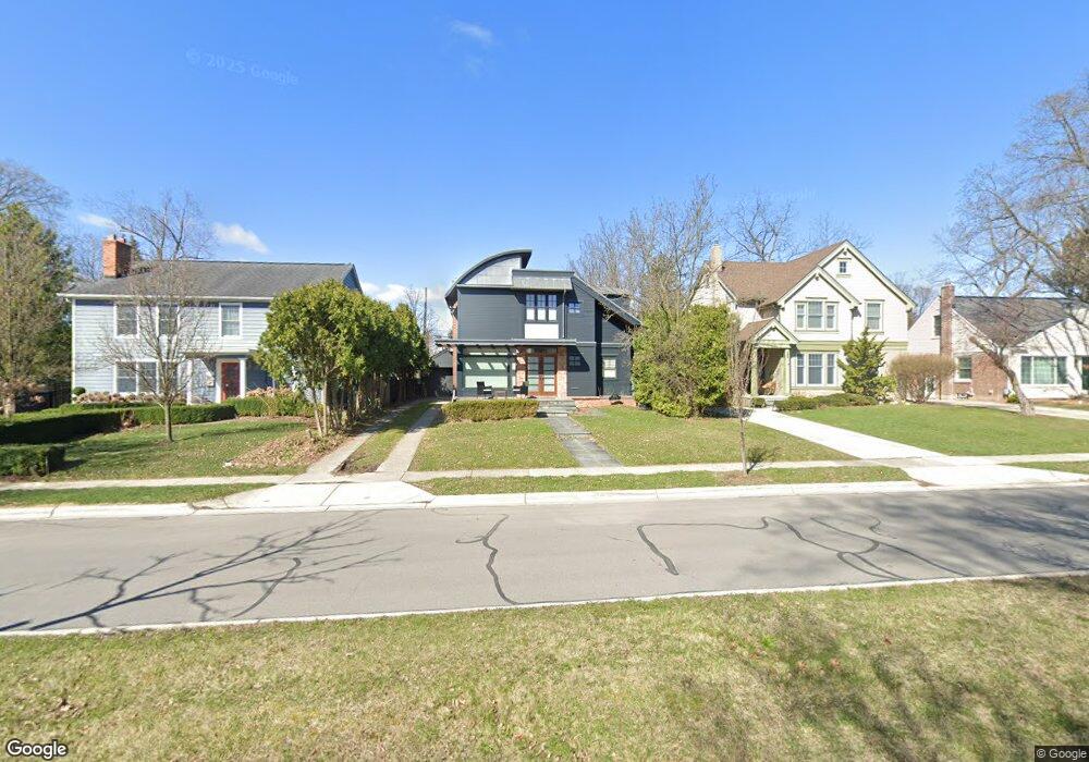
1914 Stanley Blvd Unit Bldg-Unit Birmingham, MI 48009
Estimated Value: $710,000 - $795,605
3
Beds
3
Baths
1,673
Sq Ft
$456/Sq Ft
Est. Value
About This Home
This home is located at 1914 Stanley Blvd Unit Bldg-Unit, Birmingham, MI 48009 and is currently estimated at $763,401, approximately $456 per square foot. 1914 Stanley Blvd Unit Bldg-Unit is a home located in Oakland County with nearby schools including Pierce Elementary School, Derby Middle School, and Ernest W. Seaholm High School.
Ownership History
Date
Name
Owned For
Owner Type
Purchase Details
Closed on
Oct 10, 2018
Sold by
Lago Dominick
Bought by
Lulaj Eddie
Current Estimated Value
Home Financials for this Owner
Home Financials are based on the most recent Mortgage that was taken out on this home.
Original Mortgage
$300,000
Outstanding Balance
$262,726
Interest Rate
4.7%
Mortgage Type
New Conventional
Estimated Equity
$500,675
Purchase Details
Closed on
May 20, 1999
Sold by
Helen Peterstr
Bought by
Lago Dominick
Create a Home Valuation Report for This Property
The Home Valuation Report is an in-depth analysis detailing your home's value as well as a comparison with similar homes in the area
Home Values in the Area
Average Home Value in this Area
Purchase History
| Date | Buyer | Sale Price | Title Company |
|---|---|---|---|
| Lulaj Eddie | $470,000 | Bbc Title Agency Llc | |
| Lago Dominick | $240,000 | -- |
Source: Public Records
Mortgage History
| Date | Status | Borrower | Loan Amount |
|---|---|---|---|
| Open | Lulaj Eddie | $300,000 |
Source: Public Records
Tax History Compared to Growth
Tax History
| Year | Tax Paid | Tax Assessment Tax Assessment Total Assessment is a certain percentage of the fair market value that is determined by local assessors to be the total taxable value of land and additions on the property. | Land | Improvement |
|---|---|---|---|---|
| 2024 | $10,398 | $323,930 | $0 | $0 |
| 2023 | $9,964 | $300,540 | $0 | $0 |
| 2022 | $10,683 | $287,150 | $0 | $0 |
| 2021 | $10,778 | $274,380 | $0 | $0 |
| 2020 | $9,603 | $266,390 | $0 | $0 |
| 2019 | $10,867 | $259,450 | $0 | $0 |
| 2018 | $8,099 | $254,820 | $0 | $0 |
| 2017 | $8,085 | $252,050 | $0 | $0 |
| 2016 | $8,100 | $249,760 | $0 | $0 |
| 2015 | -- | $234,860 | $0 | $0 |
| 2014 | -- | $210,800 | $0 | $0 |
| 2011 | -- | $170,450 | $0 | $0 |
Source: Public Records
Map
Nearby Homes
- 1748 Stanley Blvd
- 1723 Birmingham Blvd
- 1626 Maryland Blvd
- 1886 Henrietta St
- 1850 Shipman Blvd
- 1992 Shipman Blvd
- 16975 W Fourteen Mile Rd
- 1978 Henrietta St
- 16991 Kirkshire Ave
- 1541 Shipman Blvd
- 955 Wakefield St
- 150 Bird Ave Unit 20
- 251 E 14 Mile Rd
- 1323 Washington Blvd
- 1419 Henrietta St
- 16950 Kinross Ave
- 16281 Buckingham Ave
- 350 Catalpa Dr
- 1205 S Bates St
- 1897 Norfolk St
- 1914 Stanley Blvd
- 1896 Stanley Blvd
- 1930 Stanley Blvd
- 1884 Stanley Blvd
- 1905 Maryland Blvd
- 1927 Maryland Blvd
- 1893 Maryland Blvd
- 1878 Stanley Blvd
- 1968 Stanley Blvd
- 1949 Maryland Blvd Unit Bldg-Unit
- 1949 Maryland Blvd
- 1877 Maryland Blvd
- 1973 Maryland Blvd
- 1919 Stanley Blvd
- 1859 Maryland Blvd
- 1897 Stanley Blvd
- 1854 Stanley Blvd
- 1992 Stanley Blvd
- 1941 Stanley Blvd
- 1875 Stanley Blvd Unit Bldg-Unit