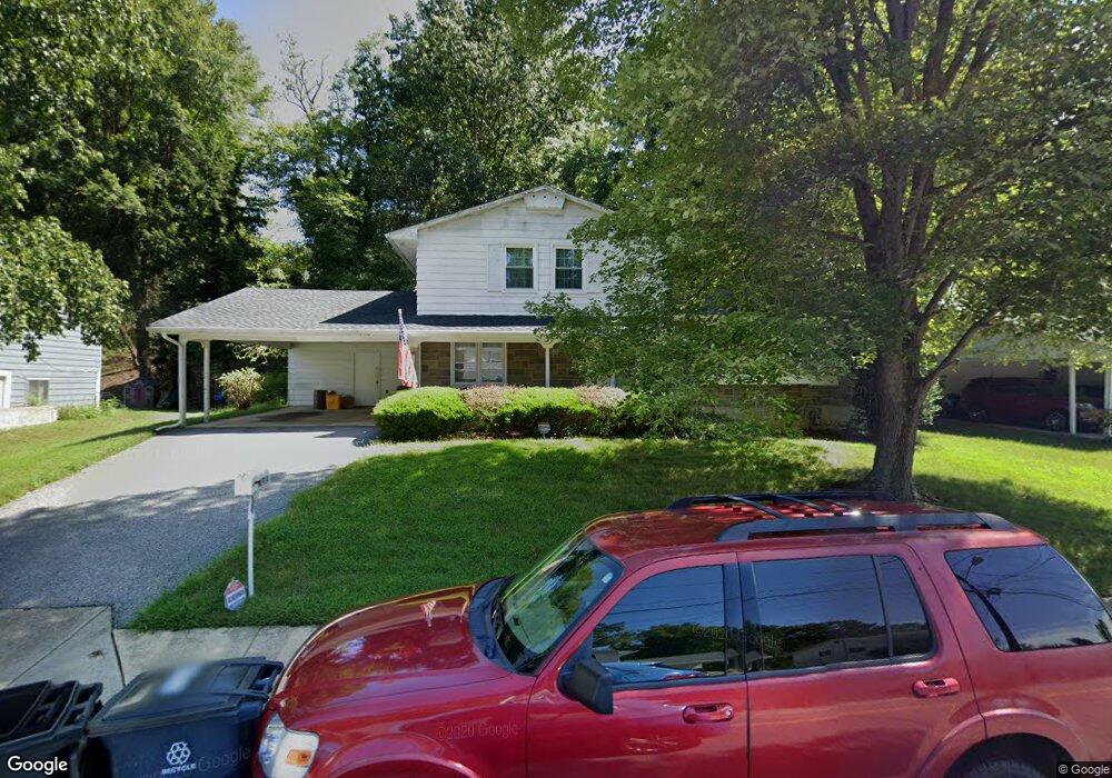
1914 Taylor Ave Fort Washington, MD 20744
Estimated Value: $375,768 - $492,000
--
Bed
3
Baths
1,810
Sq Ft
$245/Sq Ft
Est. Value
About This Home
This home is located at 1914 Taylor Ave, Fort Washington, MD 20744 and is currently estimated at $443,442, approximately $244 per square foot. 1914 Taylor Ave is a home located in Prince George's County with nearby schools including Fort Washington Forest Elementary School, Accokeek Academy, and Friendly High School.
Ownership History
Date
Name
Owned For
Owner Type
Purchase Details
Closed on
Nov 17, 2022
Sold by
Liggans Thornten Therrell and Liggans Irine C
Bought by
Liggans Thornten Therrell
Current Estimated Value
Purchase Details
Closed on
Feb 5, 1993
Sold by
Eaton Dexter M and Eaton Yvonne
Bought by
Liggans Thornten T and Liggans Irine C
Purchase Details
Closed on
Jun 4, 1986
Sold by
Tomassoni Fernando
Bought by
Eaton Dexter M and Eaton Yvonne
Create a Home Valuation Report for This Property
The Home Valuation Report is an in-depth analysis detailing your home's value as well as a comparison with similar homes in the area
Home Values in the Area
Average Home Value in this Area
Purchase History
| Date | Buyer | Sale Price | Title Company |
|---|---|---|---|
| Liggans Thornten Therrell | -- | Brennan Title | |
| Liggans Thornten T | $134,500 | -- | |
| Eaton Dexter M | $97,000 | -- |
Source: Public Records
Tax History Compared to Growth
Tax History
| Year | Tax Paid | Tax Assessment Tax Assessment Total Assessment is a certain percentage of the fair market value that is determined by local assessors to be the total taxable value of land and additions on the property. | Land | Improvement |
|---|---|---|---|---|
| 2025 | $4,546 | $366,767 | -- | -- |
| 2024 | $4,546 | $361,700 | $101,200 | $260,500 |
| 2023 | $4,358 | $337,500 | $0 | $0 |
| 2022 | $4,129 | $313,300 | $0 | $0 |
| 2021 | $3,907 | $289,100 | $100,600 | $188,500 |
| 2020 | $3,817 | $274,933 | $0 | $0 |
| 2019 | $3,707 | $260,767 | $0 | $0 |
| 2018 | $3,579 | $246,600 | $75,600 | $171,000 |
| 2017 | $3,499 | $238,133 | $0 | $0 |
| 2016 | -- | $229,667 | $0 | $0 |
| 2015 | $3,083 | $221,200 | $0 | $0 |
| 2014 | $3,083 | $221,200 | $0 | $0 |
Source: Public Records
Map
Nearby Homes
- 1916 Taylor Ave
- 13318 Chalfont Ave
- 12904 Chalfont Ave
- 1410 Fillmore Rd
- 13503 Harrison Ave
- 14005 Livingston Rd
- 12806 Monroe Ave
- 2421 Baileys Pond Rd
- 0 Joseph Dr
- 13102 Gerry Rd
- 2608 Saint Marys View Rd
- 2001 Medinah Ridge Rd
- 13803 Stroh Ct
- 2201 Herring Creek Dr
- 2504 Brandy Ln
- 14311 Livingston Rd
- 2509 Brandy Ln
- 804 Cascade Dr
- 2804 Saint Marys View Rd
- 802 Cornish St
- 1912 Taylor Ave
- 13307 Chalfont Ave
- 1910 Taylor Ave
- 13309 Chalfont Ave
- 13305 Chalfont Ave
- 1918 Taylor Ave
- 1913 Taylor Ave
- 1911 Taylor Ave
- 1915 Taylor Ave
- 13303 Chalfont Ave
- 13313 Chalfont Ave
- 1909 Taylor Ave
- 1908 Taylor Ave
- 1917 Taylor Ave
- 13301 Chalfont Ave
- 1920 Taylor Ave
- 1905 Taylor Ave
- 13211 Chalfont Ave
- 13308 Chalfont Ave
- 13306 Chalfont Ave