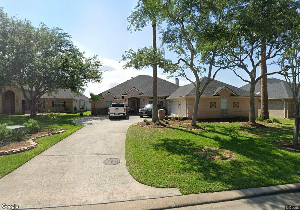
1914 Waters Edge Ln Seabrook, TX 77586
Estimated Value: $481,730 - $591,000
3
Beds
3
Baths
3,090
Sq Ft
$166/Sq Ft
Est. Value
About This Home
This home is located at 1914 Waters Edge Ln, Seabrook, TX 77586 and is currently estimated at $511,683, approximately $165 per square foot. 1914 Waters Edge Ln is a home located in Harris County with nearby schools including Bay Elementary School, Seabrook Intermediate School, and Clear Falls High School.
Ownership History
Date
Name
Owned For
Owner Type
Purchase Details
Closed on
Aug 3, 2023
Sold by
Paultz William
Bought by
Paultz Jordan and Paultz Emily
Current Estimated Value
Purchase Details
Closed on
Jun 11, 2014
Sold by
Paultz William E
Bought by
Paultz Diane R
Purchase Details
Closed on
Dec 31, 2001
Sold by
D R Horton Texas Ltd
Bought by
Carwile Joseph F and Camille Carwile A
Home Financials for this Owner
Home Financials are based on the most recent Mortgage that was taken out on this home.
Original Mortgage
$125,000
Interest Rate
6.73%
Purchase Details
Closed on
Aug 10, 2001
Sold by
Walsh Robert C and Walsh Dianne M
Bought by
D R Horton Texas Ltd
Purchase Details
Closed on
Jan 12, 2000
Sold by
Lake Mija Ltd
Bought by
Walsh Robert C and Walsh Dianne M
Create a Home Valuation Report for This Property
The Home Valuation Report is an in-depth analysis detailing your home's value as well as a comparison with similar homes in the area
Home Values in the Area
Average Home Value in this Area
Purchase History
| Date | Buyer | Sale Price | Title Company |
|---|---|---|---|
| Paultz Jordan | -- | None Listed On Document | |
| Paultz Diane R | -- | None Available | |
| Carwile Joseph F | -- | Stewart Title | |
| D R Horton Texas Ltd | -- | Stewart Title | |
| Walsh Robert C | -- | Stewart Title |
Source: Public Records
Mortgage History
| Date | Status | Borrower | Loan Amount |
|---|---|---|---|
| Previous Owner | Carwile Joseph F | $125,000 |
Source: Public Records
Tax History
| Year | Tax Paid | Tax Assessment Tax Assessment Total Assessment is a certain percentage of the fair market value that is determined by local assessors to be the total taxable value of land and additions on the property. | Land | Improvement |
|---|---|---|---|---|
| 2025 | $9,987 | $511,216 | $167,438 | $343,778 |
| 2024 | $9,987 | $491,298 | $167,438 | $323,860 |
| 2023 | $9,987 | $611,204 | $251,157 | $360,047 |
| 2022 | $11,696 | $561,077 | $251,157 | $309,920 |
| 2021 | $11,452 | $500,000 | $220,714 | $279,286 |
| 2020 | $11,277 | $454,972 | $205,492 | $249,480 |
| 2019 | $11,849 | $458,000 | $187,226 | $270,774 |
| 2018 | $2,888 | $425,640 | $187,226 | $238,414 |
| 2017 | $11,068 | $425,640 | $173,516 | $252,124 |
| 2016 | $10,449 | $401,820 | $147,673 | $254,147 |
| 2015 | $6,207 | $409,450 | $147,673 | $261,777 |
| 2014 | $6,207 | $370,000 | $147,673 | $222,327 |
Source: Public Records
Map
Nearby Homes
- 0 Oak Alley Ct Unit 61117265
- 806 Dawn Ridge Way
- 817 Dawn Ridge Way
- 1133 E Meyer Rd
- 1302 Lake Mija Ct
- 1210 Cambridge Ct
- 1018 E Meyer Rd
- 1221 Friendship Trail
- 1615 Friendship Trail
- 1439 Friendship Trail
- 1205 Cambridge Ct
- 1513 Mija Ln
- 1225 Friendship Trail
- 2317 Nassau Dr
- 1313 Plymouth Rock Ln
- 949 Autumn Brook St
- 945 Autumn Brook St
- 1013 Victorian Ct
- 929 Bay Sky Way
- 3309 Todville Rd
- 1918 Waters Edge Ln
- 1910 Waters Edge Ln
- 1922 Waters Edge Ln
- 1906 Waters Edge Ln
- 2014 Yorktown Ct
- 2013 Yorktown Ct
- 1926 Waters Edge Ln
- 1902 Waters Edge Ln
- 2009 Yorktown Ct
- 2010 Yorktown Ct
- 1638 Old Orchard Ln
- 1634 Old Orchard Ln
- 2005 Yorktown Ct
- 2006 Yorktown Ct
- 3613 N Meyer Rd
- 3613 N Meyer Rd
- 3613 N Meyer Rd
- 1630 Old Orchard Ln
- 1934 Waters Edge Ln
- 2002 Yorktown Ct
Your Personal Tour Guide
Ask me questions while you tour the home.