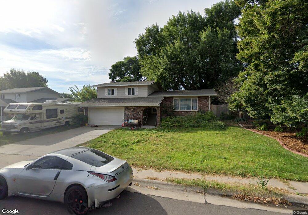
1914 William Ave North Platte, NE 69101
Estimated Value: $252,559 - $297,000
4
Beds
3
Baths
1,745
Sq Ft
$158/Sq Ft
Est. Value
About This Home
This home is located at 1914 William Ave, North Platte, NE 69101 and is currently estimated at $275,640, approximately $157 per square foot. 1914 William Ave is a home located in Lincoln County with nearby schools including North Platte High School and Our Redeemer Lutheran School.
Ownership History
Date
Name
Owned For
Owner Type
Purchase Details
Closed on
Jun 28, 2021
Sold by
Perrigo David Alan
Bought by
Odea Tyler J and Odea Cassandra C
Current Estimated Value
Home Financials for this Owner
Home Financials are based on the most recent Mortgage that was taken out on this home.
Original Mortgage
$152,000
Outstanding Balance
$137,916
Interest Rate
2.9%
Mortgage Type
New Conventional
Estimated Equity
$137,724
Create a Home Valuation Report for This Property
The Home Valuation Report is an in-depth analysis detailing your home's value as well as a comparison with similar homes in the area
Home Values in the Area
Average Home Value in this Area
Purchase History
| Date | Buyer | Sale Price | Title Company |
|---|---|---|---|
| Odea Tyler J | $190,000 | Scott Abstract |
Source: Public Records
Mortgage History
| Date | Status | Borrower | Loan Amount |
|---|---|---|---|
| Open | Odea Tyler J | $152,000 |
Source: Public Records
Tax History Compared to Growth
Tax History
| Year | Tax Paid | Tax Assessment Tax Assessment Total Assessment is a certain percentage of the fair market value that is determined by local assessors to be the total taxable value of land and additions on the property. | Land | Improvement |
|---|---|---|---|---|
| 2024 | $2,837 | $208,394 | $43,701 | $164,693 |
| 2023 | $3,516 | $192,821 | $16,721 | $176,100 |
| 2022 | $3,340 | $172,874 | $14,992 | $157,882 |
| 2021 | $3,224 | $166,225 | $14,415 | $151,810 |
| 2020 | $3,271 | $166,225 | $14,415 | $151,810 |
| 2019 | $3,285 | $166,225 | $14,415 | $151,810 |
| 2018 | $3,286 | $199,085 | $14,415 | $184,670 |
| 2017 | $3,333 | $168,000 | $14,415 | $153,585 |
| 2016 | $3,175 | $157,260 | $14,415 | $142,845 |
| 2014 | $3,112 | $142,435 | $18,280 | $124,155 |
Source: Public Records
Map
Nearby Homes
- 921 S Carr Ave
- 1910 W Philip Ave
- 1821 Cedarberry Rd
- 2020 Cedarberry Rd
- 1107 S Emory Ave
- 1501 W Leota St
- 2210 W Leota St
- 1401 S Buffalo Bill Ave
- 2307 W D St
- 1311 W E St
- 306 W Circle Dr
- 910 W Philip Ave
- 909 W Philip Ave
- 906 W Phillip St
- 102 S Buffalo Bill Ave
- 3001 Cedarberry Ln
- 3015 Birchwood Rd
- 420 S Reynolds Ave
- LOT 14 Crow Brothers Sub
- LOT 13 Crow Brothers Sub
- 1910 William Ave
- 1911 William Ave
- 1918 William Ave
- 1902 William Ave
- 1913 William Ave
- 1901 William Ave
- 1820 William Ave
- 1911 Sunset Dr
- 1001 S Carr Ave
- 1821 Sunset Dr
- 1901 Sunset Dr
- 1821 William Ave
- 1021 S Carr Ave
- 1811 Sunset Dr
- 1810 William Ave
- 1813 William Ave
- 1914 W Philip Ave
- 1918 W Philip Ave
- 1102 Miles Ct
- 1820 W Philip Ave