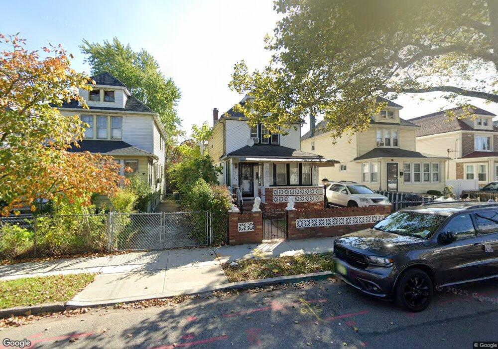
19144 113th Ave Saint Albans, NY 11412
Hollis NeighborhoodEstimated Value: $544,000 - $604,000
--
Bed
--
Bath
1,728
Sq Ft
$326/Sq Ft
Est. Value
About This Home
This home is located at 19144 113th Ave, Saint Albans, NY 11412 and is currently estimated at $562,835, approximately $325 per square foot. 19144 113th Ave is a home located in Queens County with nearby schools including P.S. 118 Lorraine Hansberry, I.S. 192 The Linden, and Riverton Street Charter School.
Ownership History
Date
Name
Owned For
Owner Type
Purchase Details
Closed on
Sep 25, 2025
Sold by
Fannie Mae and Federal National Mortgage Association
Bought by
Bayside Capital Corp
Current Estimated Value
Purchase Details
Closed on
Dec 7, 2023
Sold by
Borchert Helmut Esq
Bought by
Federal National Mortgage Association
Create a Home Valuation Report for This Property
The Home Valuation Report is an in-depth analysis detailing your home's value as well as a comparison with similar homes in the area
Home Values in the Area
Average Home Value in this Area
Purchase History
| Date | Buyer | Sale Price | Title Company |
|---|---|---|---|
| Bayside Capital Corp | $596,694 | -- | |
| Federal National Mortgage Association | $565,684 | -- | |
| Federal National Mortgage Association | $565,684 | -- |
Source: Public Records
Tax History Compared to Growth
Tax History
| Year | Tax Paid | Tax Assessment Tax Assessment Total Assessment is a certain percentage of the fair market value that is determined by local assessors to be the total taxable value of land and additions on the property. | Land | Improvement |
|---|---|---|---|---|
| 2025 | $5,563 | $27,946 | $8,177 | $19,769 |
| 2024 | $5,563 | $27,695 | $8,592 | $19,103 |
| 2023 | $4,490 | $26,154 | $6,863 | $19,291 |
| 2022 | $4,267 | $39,240 | $12,360 | $26,880 |
| 2021 | $4,242 | $36,600 | $12,360 | $24,240 |
| 2020 | $4,270 | $31,500 | $12,360 | $19,140 |
| 2019 | $4,169 | $32,760 | $12,360 | $20,400 |
| 2018 | $1,562 | $21,795 | $11,224 | $10,571 |
| 2017 | $1,451 | $20,571 | $10,701 | $9,870 |
| 2016 | $1,319 | $20,571 | $10,701 | $9,870 |
| 2015 | $731 | $19,407 | $11,425 | $7,982 |
| 2014 | $731 | $19,233 | $12,992 | $6,241 |
Source: Public Records
Map
Nearby Homes
- 191-40 112th Rd
- 194-16 112th Ave
- 190-63 112th Ave
- 190-59 112th Ave
- 19432 113th Rd
- 19427 Murdock Ave
- 194-29 112th Ave
- 194- 24 111th Rd
- 19445 Murdock Ave
- 19022 111th Rd
- 194-42 Murdock Ave
- 19431 114th Rd
- 191-34 114th Rd
- 194-56 Murdock Ave
- 191-16 114th Rd
- 191-47 114th Dr
- 18914 114th Rd
- 19404 110th Rd
- 18833 Keeseville Ave
- 114-22 197th St
- 19148 113th Ave
- 19140 113th Ave
- 19150 113th Ave
- 19136 113th Ave
- 19132 113th Ave
- 19132 113th Ave
- 19139 113th Rd
- 19141 113th Rd
- 19132 113th Ave
- 191-39 113th Rd
- 19135 113th Rd
- 19143 113th Rd
- 191-41 113th Rd
- 19143 113th Rd
- 19133 113th Rd
- 19145 113th Rd
- 19131 113th Rd
- 19130 113th Ave
- 19127 113th Rd
- 191-27 113th Rd