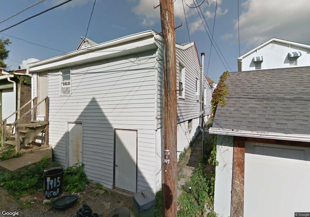
1915 Alcoa Dr New Kensington, PA 15068
Estimated Value: $17,000 - $115,000
--
Bed
--
Bath
--
Sq Ft
3,572
Sq Ft Lot
About This Home
This home is located at 1915 Alcoa Dr, New Kensington, PA 15068 and is currently estimated at $78,630. 1915 Alcoa Dr is a home with nearby schools including Mary Queen of Apostles School.
Ownership History
Date
Name
Owned For
Owner Type
Purchase Details
Closed on
Apr 4, 2007
Sold by
Thompson Dana H and Levish Jessica
Bought by
Thompson Dana H
Current Estimated Value
Home Financials for this Owner
Home Financials are based on the most recent Mortgage that was taken out on this home.
Original Mortgage
$40,000
Interest Rate
6.78%
Mortgage Type
Credit Line Revolving
Purchase Details
Closed on
Mar 2, 2005
Sold by
Bank One Na
Bought by
Thompson Dana H and Levish Jessica
Purchase Details
Closed on
Dec 8, 2004
Sold by
Beard Lawrence T and Beard Diana L
Bought by
Bank One Na and Residential Money Centers Inc
Create a Home Valuation Report for This Property
The Home Valuation Report is an in-depth analysis detailing your home's value as well as a comparison with similar homes in the area
Home Values in the Area
Average Home Value in this Area
Purchase History
| Date | Buyer | Sale Price | Title Company |
|---|---|---|---|
| Thompson Dana H | $25,000 | First American Title Ins Co | |
| Thompson Dana H | $7,100 | -- | |
| Bank One Na | -- | -- |
Source: Public Records
Mortgage History
| Date | Status | Borrower | Loan Amount |
|---|---|---|---|
| Previous Owner | Thompson Dana H | $40,000 |
Source: Public Records
Tax History Compared to Growth
Tax History
| Year | Tax Paid | Tax Assessment Tax Assessment Total Assessment is a certain percentage of the fair market value that is determined by local assessors to be the total taxable value of land and additions on the property. | Land | Improvement |
|---|---|---|---|---|
| 2025 | $960 | $5,610 | $2,100 | $3,510 |
| 2024 | $952 | $5,610 | $2,100 | $3,510 |
| 2023 | $904 | $5,610 | $2,100 | $3,510 |
| 2022 | $878 | $5,610 | $2,100 | $3,510 |
| 2021 | $860 | $5,610 | $2,100 | $3,510 |
| 2020 | $843 | $5,610 | $2,100 | $3,510 |
| 2019 | $840 | $5,610 | $2,100 | $3,510 |
| 2018 | $829 | $5,610 | $2,100 | $3,510 |
| 2017 | $829 | $5,610 | $2,100 | $3,510 |
| 2016 | $829 | $5,610 | $2,100 | $3,510 |
| 2015 | $829 | $5,610 | $2,100 | $3,510 |
| 2014 | $800 | $5,610 | $2,100 | $3,510 |
Source: Public Records
Map
Nearby Homes
- 1915 Woodmont Ave
- 1909 Woodmont Ave
- 2004 Woodmont Ave
- 2004 Victoria Ave
- 1802 Alcoa Dr
- 1820 Victoria Ave
- 1809 Kimball Ave
- 1407 Drey St Unit 29
- 2105 Victoria Ave
- 1735 Kimball Ave
- 1818 Kenneth Ave
- 2016 Kenneth Ave
- 1741 Freeport Rd Unit U
- 1717 Ridge Ave
- 344 Iroquois Dr
- 2015 Kenneth Ave
- 2014 Constitution Blvd
- 2110 Kenneth Ave
- 2112 Kenneth Ave
- 1719 Freeport Rd
- 1913 Alcoa Dr
- 1917 Alcoa Dr
- 1911 Alcoa Dr
- 1909 Alcoa Dr
- 1923 Alcoa Dr
- 1912 Woodmont Ave
- 1922 Woodmont Ave
- 1918 Woodmont Ave
- 1924 Woodmont Ave
- 1914 1/2 Woodmont Ave
- 1926 Woodmont Ave
- 1925 Alcoa Dr
- 1932 Woodmont Ave
- 1914 Woodmont Ave
- 1927 Alcoa Dr
- 1908 Alcoa Dr
- 1918 Alcoa Dr
- 1934 Woodmont Ave
- 1910 Alcoa Dr
- 1914 Alcoa Dr