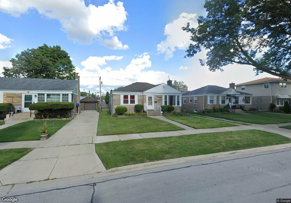
1915 Belleview Ave Westchester, IL 60154
Estimated Value: $273,000 - $325,800
2
Beds
2
Baths
1,000
Sq Ft
$307/Sq Ft
Est. Value
About This Home
This home is located at 1915 Belleview Ave, Westchester, IL 60154 and is currently estimated at $307,200, approximately $307 per square foot. 1915 Belleview Ave is a home located in Cook County with nearby schools including Westchester Primary School, Westchester Intermediate School, and Westchester Middle School.
Ownership History
Date
Name
Owned For
Owner Type
Purchase Details
Closed on
Oct 24, 2008
Sold by
Geyer Ryan R and Geyer Catrina N
Bought by
Stiggers Harold and Stiggers Shelly
Current Estimated Value
Home Financials for this Owner
Home Financials are based on the most recent Mortgage that was taken out on this home.
Original Mortgage
$169,759
Outstanding Balance
$111,599
Interest Rate
6.11%
Mortgage Type
FHA
Estimated Equity
$195,601
Purchase Details
Closed on
May 26, 2006
Sold by
Albano Carl and Albano Angelina
Bought by
Geyer Ryan R and Geyer Catrina N
Home Financials for this Owner
Home Financials are based on the most recent Mortgage that was taken out on this home.
Original Mortgage
$168,370
Interest Rate
8.37%
Mortgage Type
Balloon
Create a Home Valuation Report for This Property
The Home Valuation Report is an in-depth analysis detailing your home's value as well as a comparison with similar homes in the area
Home Values in the Area
Average Home Value in this Area
Purchase History
| Date | Buyer | Sale Price | Title Company |
|---|---|---|---|
| Stiggers Harold | $172,000 | Attorneys Title Guaranty Fun | |
| Geyer Ryan R | $224,500 | Chicago Title Insurance Co |
Source: Public Records
Mortgage History
| Date | Status | Borrower | Loan Amount |
|---|---|---|---|
| Open | Stiggers Harold | $169,759 | |
| Previous Owner | Geyer Ryan R | $168,370 |
Source: Public Records
Tax History Compared to Growth
Tax History
| Year | Tax Paid | Tax Assessment Tax Assessment Total Assessment is a certain percentage of the fair market value that is determined by local assessors to be the total taxable value of land and additions on the property. | Land | Improvement |
|---|---|---|---|---|
| 2024 | $6,216 | $27,000 | $4,515 | $22,485 |
| 2023 | $5,227 | $27,000 | $4,515 | $22,485 |
| 2022 | $5,227 | $20,553 | $3,870 | $16,683 |
| 2021 | $5,086 | $20,552 | $3,870 | $16,682 |
| 2020 | $5,035 | $20,552 | $3,870 | $16,682 |
| 2019 | $4,411 | $19,044 | $3,547 | $15,497 |
| 2018 | $4,352 | $19,044 | $3,547 | $15,497 |
| 2017 | $4,285 | $19,044 | $3,547 | $15,497 |
| 2016 | $4,051 | $16,386 | $3,225 | $13,161 |
| 2015 | $3,962 | $16,386 | $3,225 | $13,161 |
| 2014 | $3,886 | $16,386 | $3,225 | $13,161 |
| 2013 | $3,663 | $17,200 | $3,225 | $13,975 |
Source: Public Records
Map
Nearby Homes
- 1908 Belleview Ave
- 10461 Dorchester St
- 1921 Buckingham Ave
- 1860 Buckingham Ave
- 10324 Wight St
- 1811 Downing Ave
- 10630 W Cermak Rd Unit 2E
- 1803 Balmoral Ave
- 10567 Waterford Dr
- 2205 Mayfair Ave
- 2230 Kensington Ave
- 1847 Newcastle Ave
- 10531 Camelot St
- 10524 Camelot St
- 10610 Essex St
- 2337 Kensington Ave
- 1907 Suffolk Ave
- 2401 Mayfair Ave
- 10511 Preston St
- 1948 Boeger Ave
- 1909 Belleview Ave
- 1921 Belleview Ave
- 1905 Belleview Ave
- 1925 Belleview Ave
- 1922 S Mannheim Rd
- 1867 Belleview Ave
- 1929 Belleview Ave
- 1920 S Mannheim Rd
- 1863 Belleview Ave
- 1935 Belleview Ave
- 1912 Belleview Ave
- 1922 Belleview Ave
- 1874 Belleview Ave
- 1926 Belleview Ave
- 1870 Belleview Ave
- 1855 Belleview Ave
- 1855 Belleview Ave
- 1941 Belleview Ave
- 1938 S Mannheim Rd
- 1926 S Mannheim Rd