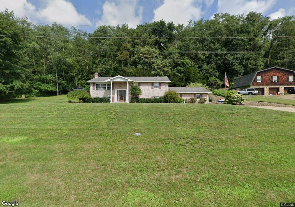
1915 Brandon Dr Wellsville, OH 43968
Estimated Value: $226,000 - $259,000
3
Beds
2
Baths
1,380
Sq Ft
$173/Sq Ft
Est. Value
About This Home
This home is located at 1915 Brandon Dr, Wellsville, OH 43968 and is currently estimated at $238,903, approximately $173 per square foot. 1915 Brandon Dr is a home located in Columbiana County with nearby schools including Garfield Elementary School, Daw Elementary School, and Wellsville Jr./Sr. High School.
Ownership History
Date
Name
Owned For
Owner Type
Purchase Details
Closed on
Apr 17, 2025
Sold by
Swearingen Linda K
Bought by
Swearingen William C
Current Estimated Value
Purchase Details
Closed on
Nov 26, 1999
Sold by
Curry George and Curry Evelyn
Bought by
Wyand Ronald L and Wyand Vickie L
Home Financials for this Owner
Home Financials are based on the most recent Mortgage that was taken out on this home.
Original Mortgage
$110,962
Interest Rate
7.9%
Create a Home Valuation Report for This Property
The Home Valuation Report is an in-depth analysis detailing your home's value as well as a comparison with similar homes in the area
Home Values in the Area
Average Home Value in this Area
Purchase History
| Date | Buyer | Sale Price | Title Company |
|---|---|---|---|
| Swearingen William C | -- | None Listed On Document | |
| Swearingen William C | -- | None Listed On Document | |
| Wyand Ronald L | $135,000 | -- |
Source: Public Records
Mortgage History
| Date | Status | Borrower | Loan Amount |
|---|---|---|---|
| Previous Owner | Wyand Ronald L | $110,962 |
Source: Public Records
Tax History Compared to Growth
Tax History
| Year | Tax Paid | Tax Assessment Tax Assessment Total Assessment is a certain percentage of the fair market value that is determined by local assessors to be the total taxable value of land and additions on the property. | Land | Improvement |
|---|---|---|---|---|
| 2024 | $1,914 | $66,820 | $5,670 | $61,150 |
| 2023 | $1,871 | $66,820 | $5,670 | $61,150 |
| 2022 | $1,884 | $66,820 | $5,670 | $61,150 |
| 2021 | $1,560 | $54,360 | $5,640 | $48,720 |
| 2020 | $1,559 | $54,360 | $5,640 | $48,720 |
| 2019 | $1,616 | $54,360 | $5,640 | $48,720 |
| 2018 | $1,515 | $49,390 | $5,110 | $44,280 |
| 2017 | $1,549 | $49,390 | $5,110 | $44,280 |
| 2016 | $1,607 | $50,130 | $5,500 | $44,630 |
| 2015 | $1,607 | $50,130 | $5,500 | $44,630 |
| 2014 | $1,502 | $50,130 | $5,500 | $44,630 |
Source: Public Records
Map
Nearby Homes
- 1715 Brandon Dr
- 1325 Boyce Ave
- 1751 Crawford Ave Unit 1753
- 612 15th St
- 1752 Chester Ave
- 511 Aten Ave
- 43818 Sherwood Rd
- 1514 Commerce St
- 923 Wood St
- 1019 Commerce St
- 1225 Center St
- 308 10th St
- 817 Broadway Ave
- 616 Washington Ave
- 928 Main St
- 909 Riverside Ave
- 738 Main St
- 1010 Hibbetts Mill Rd
- 602 Main St
- 0 Hibbetts-Mill Rd
- 1835 Brandon Dr
- 1324 Shontz Dr
- 1320 Shontz Dr
- 1825 Brandon Dr
- 1317 Shontz Dr
- 1316 Shontz Dr
- 1315 Shontz Dr
- 1312 Shontz Dr
- 1815 Brandon Dr
- 1313 Shontz Dr
- 1360 Parkview Dr
- 1340 Parkview Dr
- 1311 Shontz Dr
- 1308 Shontz Dr
- 1330 Parkview Dr
- 1821 Franklin Dr
- 1320 Parkview Dr
- 1355 Parkview Dr
- 1345 Parkview Dr
- 1310 Parkview Dr